 Old Cumbria Gazetteer
 |
 |
|
| Duddon Estuary | ||
| site name:- | Duddon, River | |
| county:- | Cumbria | |
| locality type:- | estuary | |
| locality type:- | river estuary | |
| locality type:- | National Nature Reserve | |
| locality type:- | Special Protection Area | |
| locality type:- | European Marine Site | |
| coordinates:- | SD20508090 (etc) | |
| 1Km square:- | SD2080 | |
| 10Km square:- | SD17 | |
| 10Km square:- | SD27 | |
| 10Km square:- | SD18 | |
| 10Km square:- | SD28 | |
| old boundary | ||
| locality:- | Cumberland boundary | |
| locality:- | Lancashire boundary | |
|
|
||
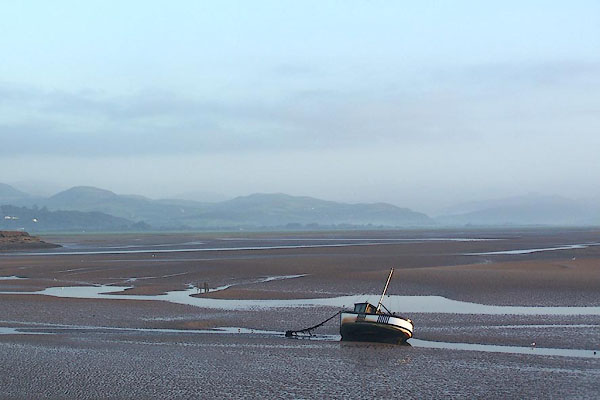 BMV15.jpg At Millom Pier. (taken 13.10.2006) 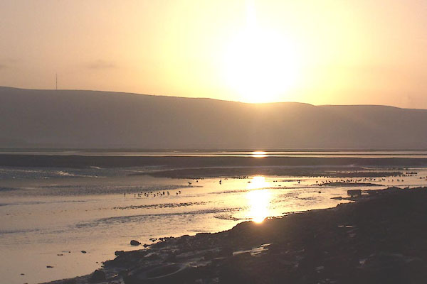 BMV13.jpg At Millom Pier. (taken 13.10.2006) |
||
|
|
||
| evidence:- | old map:- Saxton 1579 |
|
| source data:- | Map, hand coloured engraving, Westmorlandiae et Cumberlandiae Comitatus ie Westmorland
and Cumberland, scale about 5 miles to 1 inch, by Christopher Saxton, London, engraved
by Augustinus Ryther, 1576, published 1579-1645.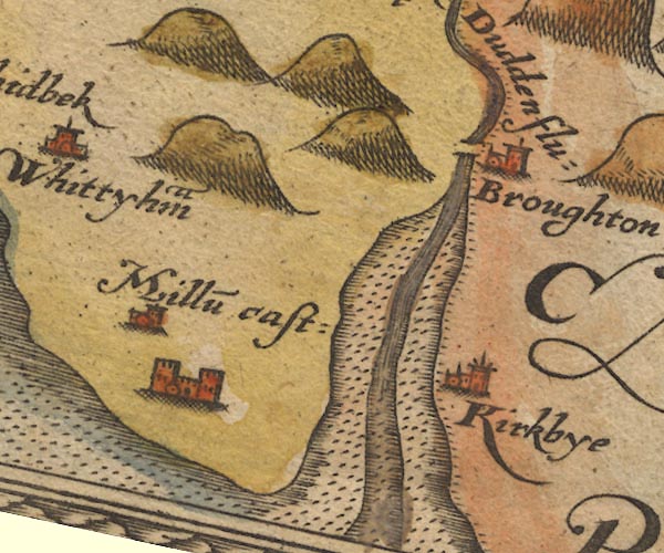 Sax9SD18.jpg item:- private collection : 2 Image © see bottom of page |
|
|
|
||
| evidence:- | old map:- Mercator 1595 (edn?) |
|
| source data:- | Map, hand coloured engraving, Westmorlandia, Lancastria, Cestria
etc, ie Westmorland, Lancashire, Cheshire etc, scale about 10.5
miles to 1 inch, by Gerard Mercator, Duisberg, Germany, 1595,
edition 1613-16.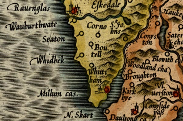 MER5CumG.jpg "" estuary item:- Armitt Library : 2008.14.3 Image © see bottom of page |
|
|
|
||
| evidence:- | old map:- Speed 1611 (Cmd) |
|
| source data:- | Map, hand coloured engraving, Cumberland and the Ancient Citie
Carlile Described, scale about 4 miles to 1 inch, by John Speed,
1610, published by J Sudbury and George Humble, Popes Head
Alley, London, 1611-12.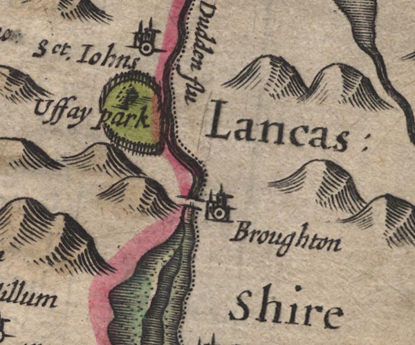 SP11SD28.jpg 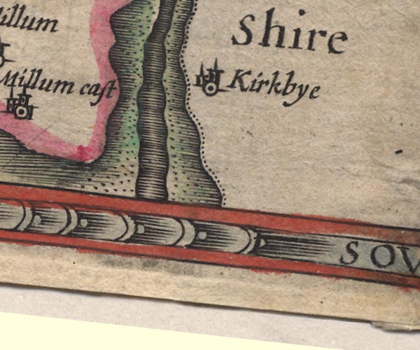 SP11SD27.jpg river channel, foreshore sands item:- private collection : 16 Image © see bottom of page |
|
|
|
||
| evidence:- | old map:- Jansson 1646 |
|
| source data:- | Map, hand coloured engraving, Cumbria and Westmoria, ie
Cumberland and Westmorland, scale about 3.5 miles to 1 inch, by
John Jansson, Amsterdam, Netherlands, 1646.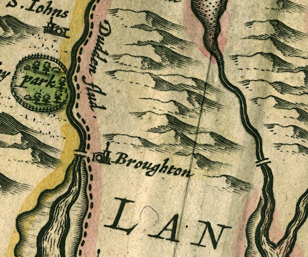 JAN3SD28.jpg 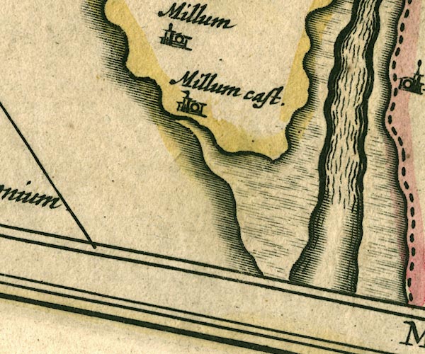 JAN3SD17.jpg item:- JandMN : 88 Image © see bottom of page |
|
|
|
||
| evidence:- | old map:- Sanson 1679 |
|
| source data:- | Map, hand coloured engraving, Ancien Royaume de Northumberland
aujourdhuy Provinces de Nort, ie the Ancient Kingdom of
Northumberland or the Northern Provinces, scale about 9.5 miles
to 1 inch, by Nicholas Sanson, Paris, France, 1679. click to enlarge click to enlargeSAN2Cm.jpg estuary item:- Dove Cottage : 2007.38.15 Image © see bottom of page |
|
|
|
||
| evidence:- | old map:- Seller 1694 (Cmd) |
|
| source data:- | Map, uncoloured engraving, Cumberland, scale about 12 miles to 1
inch, by John Seller, 1694. click to enlarge click to enlargeSEL9.jpg estuary, shown in Cumberland item:- Dove Cottage : 2007.38.89 Image © see bottom of page |
|
|
|
||
| evidence:- | old map:- Seller 1694 (Wmd) |
|
| source data:- | Map, hand coloured engraving, Westmorland, scale about 8 miles
to 1 inch, by John Seller, 1694. click to enlarge click to enlargeSEL7.jpg estuary, shown in Lancashire item:- Dove Cottage : 2007.38.87 Image © see bottom of page |
|
|
|
||
| evidence:- | old map:- Morden 1695 (Cmd) |
|
| source data:- | Map, uncoloured engraving, Cumberland, scale about 4 miles to 1
inch, by Robert Morden, 1695, published by Abel Swale, the
Unicorn, St Paul's Churchyard, Awnsham, and John Churchill, the
Black Swan, Paternoster Row, London, 1695-1715.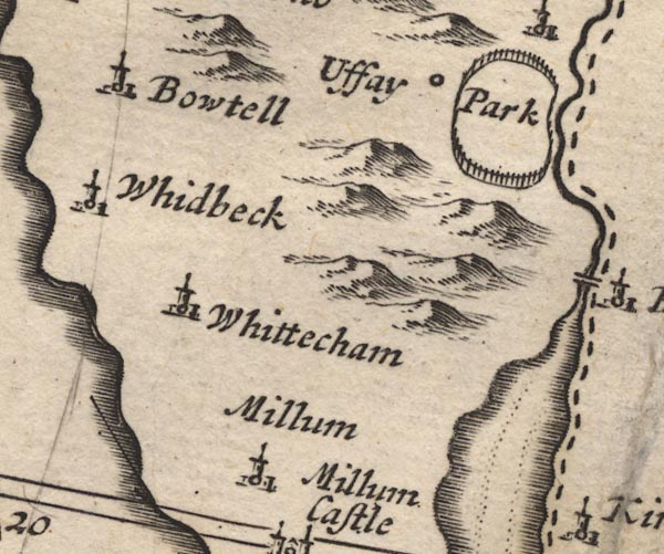 MD12SD18.jpg Foreshore sands outlined by dotted line. 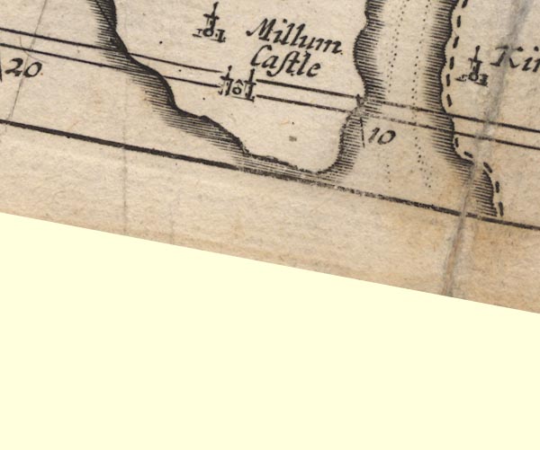 MD12SD17.jpg The county boundary drawn down the east shore. item:- JandMN : 90 Image © see bottom of page |
|
|
|
||
| evidence:- | old map:- Badeslade 1742 placename:- Duddon River |
|
| source data:- | Map, uncoloured engraving, A Map of Cumberland North from
London, scale about 11 miles to 1 inch, with descriptive text,
by Thomas Badeslade, London, engraved and published by William
Henry Toms, Union Court, Holborn, London, 1742. click to enlarge click to enlargeBD10.jpg "Duddon R" estuary item:- JandMN : 115 Image © see bottom of page |
|
|
|
||
| evidence:- | old map:- Simpson 1746 map (Wmd) |
|
| source data:- | Map, uncoloured engraving, Westmorland, scale about 8 miles to 1
inch, printed by R Walker, Fleet Lane, London, 1746. SMP2SDE.jpg Coast line with form lines. item:- Dove Cottage : 2007.38.59 Image © see bottom of page |
|
|
|
||
| evidence:- | old map:- Bowen and Kitchin 1760 |
|
| source data:- | Map, hand coloured engraving, A New Map of the Counties of
Cumberland and Westmoreland Divided into their Respective Wards,
scale about 4 miles to 1 inch, by Emanuel Bowen and Thomas
Kitchin et al, published by T Bowles, Robert Sayer, and John
Bowles, London, 1760. BO18SD17.jpg river mouth item:- Armitt Library : 2008.14.10 Image © see bottom of page |
|
|
|
||
| evidence:- | old map:- Donald 1774 (Cmd) placename:- Duddon Mouth |
|
| source data:- | Map, hand coloured engraving, 3x2 sheets, The County of Cumberland, scale about 1
inch to 1 mile, by Thomas Donald, engraved and published by Joseph Hodskinson, 29
Arundel Street, Strand, London, 1774.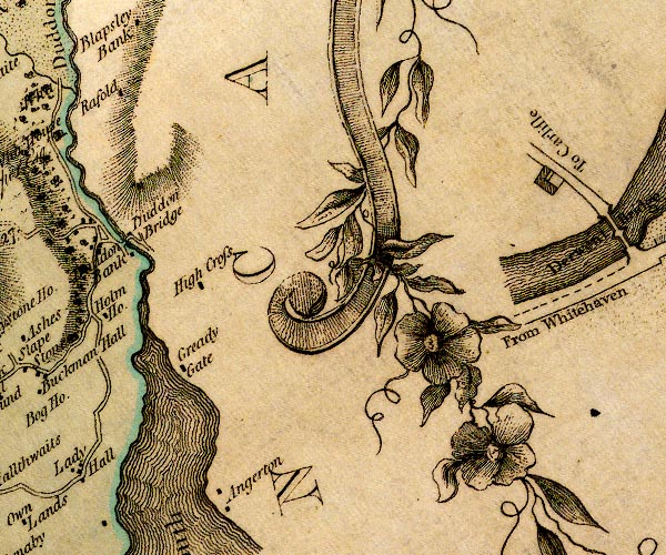 D4SD28NW.jpg 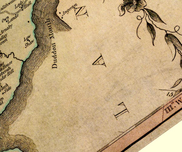 D4SD28SW.jpg "Duddon Mouth" estuary and county boundary item:- Carlisle Library : Map 2 Images © Carlisle Library |
|
|
|
||
| evidence:- | old map:- West 1784 map |
|
| source data:- | Map, hand coloured engraving, A Map of the Lakes in Cumberland,
Westmorland and Lancashire, scale about 3.5 miles to 1 inch,
engraved by Paas, 53 Holborn, London, about 1784.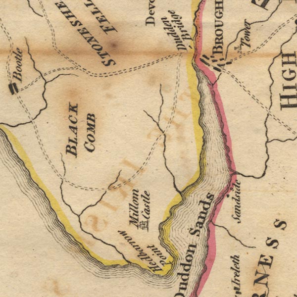 Ws02SD18.jpg 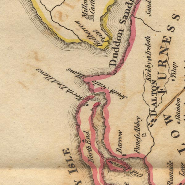 Ws02SD17.jpg item:- Armitt Library : A1221.1 Image © see bottom of page |
|
|
|
||
| evidence:- | old map:- Cooke 1802 placename:- Duddon River |
|
| source data:- | Map, Cumberland, scale about 15.5 miles to 1 inch, by George
Cooke, 1802, bound in Gray's New Book of Roads, 1824, published
by Sherwood, Jones and Co, Paternoster Road, London, 1824. click to enlarge click to enlargeGRA1Cd.jpg "Duddon R" estuary item:- Hampshire Museums : FA2000.62.2 Image © see bottom of page |
|
|
|
||
| evidence:- | old map:- Cooke 1802 placename:- Dudden River |
|
| source data:- | Map, Lancashire, scale about 18 miles to 1 inch, by George
Cooke, 1802, bound in Gray's New Book of Roads, 1824, published
by Sherwood, Jones and Co, Paternoster Road, London, 1824. click to enlarge click to enlargeGRA1La.jpg "Dudden R." estuary item:- Hampshire Museums : FA2000.62.6 Image © see bottom of page |
|
|
|
||
| evidence:- | old map:- Cooper 1808 |
|
| source data:- | Map, uncoloured engraving, Cumberland, scale about 10.5 miles to
1 inch, drawn and engraved by Cooper, published by R Phillips,
Bridge Street, Blackfriars, London, 1808. click to enlarge click to enlargeCOP3.jpg estuary item:- JandMN : 86 Image © see bottom of page |
|
|
|
||
| evidence:- | old map:- Otley 1818 |
|
| source data:- | Map, uncoloured engraving, The District of the Lakes,
Cumberland, Westmorland, and Lancashire, scale about 4 miles to
1 inch, by Jonathan Otley, 1818, engraved by J and G Menzies,
Edinburgh, Scotland, published by Jonathan Otley, Keswick,
Cumberland, et al, 1833.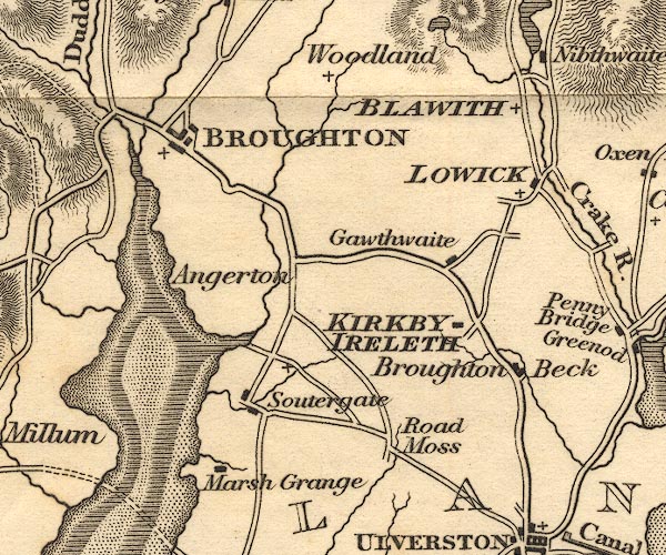 OT02SD28.jpg 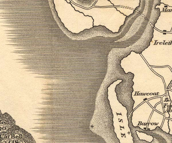 OT02SD17.jpg item:- JandMN : 48.1 Image © see bottom of page |
|
|
|
||
| evidence:- | old map:- Hall 1820 (Cmd) |
|
| source data:- | Map, hand coloured engraving, Cumberland, scale about 21 miles
to 1 inch, engraved by Sidney Hall, published by S Leigh, 18
Strand, London, 1820-31. click to enlarge click to enlargeHA14.jpg estuary item:- JandMN : 91 Image © see bottom of page |
|
|
|
||
| evidence:- | old map:- Perrot 1823 placename:- Riviere Duddon Sand |
|
| source data:- | Map, hand coloured engraving, Cumberland and Westmoreland ie
Westmorland, scale about 38 miles to 1 inch, by Aristide Michel
Perrot, engraved by Migneret, 1823, published by Etienne Ledoux,
9 Rue Guenegaud, Paris, France, 1824-48. click to enlarge click to enlargePER2.jpg "R. Duddon Sand" estuary item:- Dove Cottage : 2007.38.45 Image © see bottom of page |
|
|
|
||
| evidence:- | old map:- Ford 1839 map placename:- Duddon Mouth |
|
| source data:- | Map, uncoloured engraving, Map of the Lake District of
Cumberland, Westmoreland and Lancashire, scale about 3.5 miles
to 1 inch, published by Charles Thurnam, Carlisle, and by R
Groombridge, 5 Paternoster Row, London, 3rd edn 1843.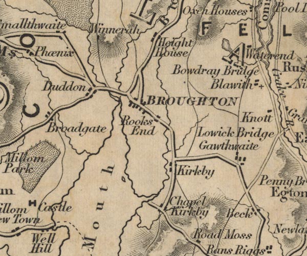 FD02SD28.jpg  FD02SD27.jpg "Duddon Mouth" item:- JandMN : 100.1 Image © see bottom of page |
|
|
|
||
| evidence:- | old map:- Ford 1839 map placename:- Duddon Mouth |
|
| source data:- | Map, uncoloured engraving, Map of the Lake District of
Cumberland, Westmoreland and Lancashire, scale about 3.5 miles
to 1 inch, published by Charles Thurnam, Carlisle, and by R
Groombridge, 5 Paternoster Row, London, 3rd edn 1843. FD02SD28.jpg FD02SD27.jpg "Duddon Mouth" item:- JandMN : 100.1 Image © see bottom of page |
|
|
|
||
| evidence:- | old map:- Hydrographic Office 1850s onwards |
|
| source data:- | Chart, uncoloured engraving, England West Coast sheet XI,
Fleetwood to the Firth of Solway, scale about 2.5 miles to 1
inch, by H Denham and G Williams, 1846, engraved by J and C
Walker, published by the Hydrographic Office, 1850 corrected to
1863 coast view on Admiralty chart 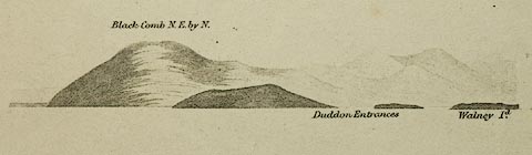 click to enlarge click to enlargeHY01P3.jpg "Duddon Entrances" item:- Carlisle Library : Map 93 Image © Carlisle Library |
|
|
|
||
| evidence:- | old map:- Garnett 1850s-60s H |
|
| source data:- | Map of the English Lakes, in Cumberland, Westmorland and
Lancashire, scale about 3.5 miles to 1 inch, published by John
Garnett, Windermere, Westmorland, 1850s-60s. GAR2SD27.jpg area item:- JandMN : 82.1 Image © see bottom of page |
|
|
|
||
| evidence:- | old text:- Martineau 1855 |
|
| source data:- | Guide book, A Complete Guide to the English Lakes, by Harriet
Martineau, published by John Garnett, Windermere, Westmorland,
and by Whittaker and Co, London, 1855; published 1855-76. goto source goto sourcePage 107:- "... the hills sink into heathery undulations, which again subside into a wide alluvion, which stretches to the estuary. When it is high water, the scene is fine: but the vast reaches of sand at low water are dreary. The coast railway is seen crossing the estuary,- its cobweb tracery showing well against the sand or the water. Near at hand Broughton Tower rises from the woods above the little town: but there is nothing else to detain the eye. ..." |
|
|
|
||
| evidence:- | old print:- Payn 1867 placename:- Mouth of the Duddon |
|
| source data:- | Print, uncoloured engraving, At the Mouth of the Duddon, Cumberland and Lancashire,
by W J Linton, published by J Garnett, Windermere, Westmorland, 1867.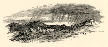 click to enlarge click to enlargePN0344.jpg On p.82 of The Lakes in Sunshine, text by James Payn. item:- Fell and Rock Climbing Club : 184.44 Image © see bottom of page |
|
|
|
||
| evidence:- | old photograph:- Bell 1880s-1940s |
|
| source data:- | Photograph, black and white, Duddon Estuary, Cumberland and Lancashire, by Herbert
Bell, Ambleside, Westmorland, 1890s.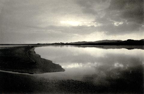 click to enlarge click to enlargeHB0513.jpg item:- Armitt Library : ALPS176 Image © see bottom of page |
|
|
|
||
| evidence:- | old text:- Admiralty 1933 placename:- Duddon Mouth item:- tidal stream |
|
| source data:- | goto source Page 383:- "... At Broughton-in-Furness it [River Duddon] expands into what is termed Duddon mouth, and 11 miles lower down it runs into the sea, after many windings, between the northern end of Walney island and Haverigg point, about 3 miles north-westward. The railway crosses the estuary, on a viaduct, a little below Broughton-in-Furness, and the estuary is navigable by small craft up to this point." "..." "Depths. - Buoys. - The sands which encumber Duddon mouth extend about 2 miles seaward of the line joining the points of the entrance. The bar and channels are so changeable that they should not be attempted without local knowledge." "There are depths of 6 feet (1m8) over Duddon bar, but farther in the channels dry." goto sourcePage 384:- "..." "Clearing marks. - St. Bees light in sight leads not less than three-quarters of a mile westward of the bar buoy. By maintaining low-water depths of not less than 8 fathoms (14m6), a vessel will be outside all dangers." "..." "Tidal streams. - See table for position A on chart 1826. South-westward of this position, the stream sets to and from the estuary of the River Duddon and Morecambe bay, running into those inlets with the rising and out of them with the falling tide. As the time of high water in this area is about the same as that of the high water at Liverpool, the stream may be said to set inwards from 6 hours before until the time of high water at Liverpool, and outwards from the time of high water at Liverpool until 6 hours after." "The rate of the streams at 5 miles off shore does not exceed one knot at springs." |
|
|
|
||
 Click to enlarge BWQ66.jpg (taken 27.5.2012)  Click to enlarge BMV14.jpg At Millom Pier. (taken 13.10.2006) 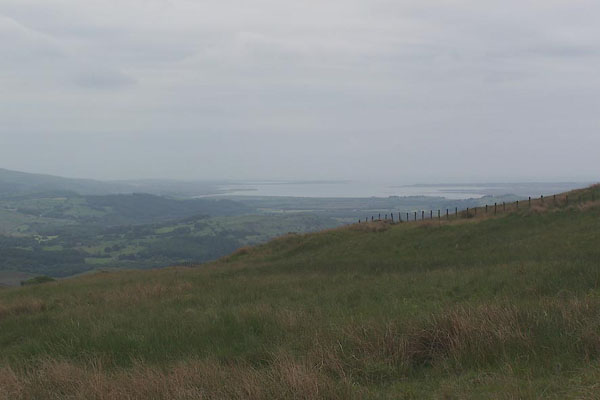 BMG06.jpg (taken 12.6.2006) 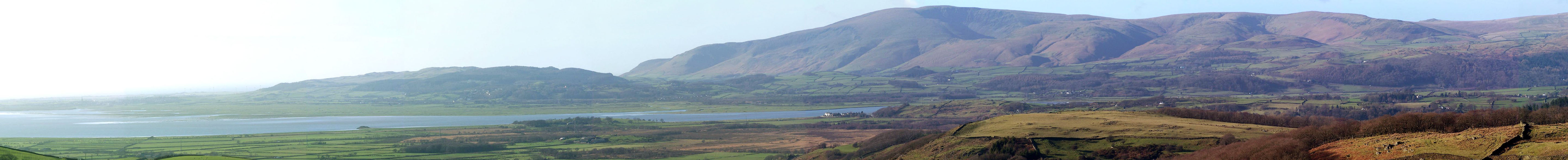 Click to enlarge BND39.jpg From the road above Rigg Well on the side of Great Burney. (taken 2.2.2007) |
||
|
|
||
| : 2002: Duddon Estuary European Marine Site: English Nature |
||
|
|
||
Lakes Guides menu.