 Old Cumbria Gazetteer
 |
 |
|
| Dunnerdale, Dunnerdale-with-Seathwaite | ||
| Dunnerdale | ||
| civil parish:- | Dunnerdale-with-Seathwaite (formerly Lancashire) | |
| civil parish:- | Ulpha (formerly Cumberland) | |
| county:- | Cumbria | |
| locality type:- | valley | |
| coordinates:- | SD20709419 (etc) | |
| 1Km square:- | SD2094 | |
| 10Km square:- | SD29 | |
|
|
||
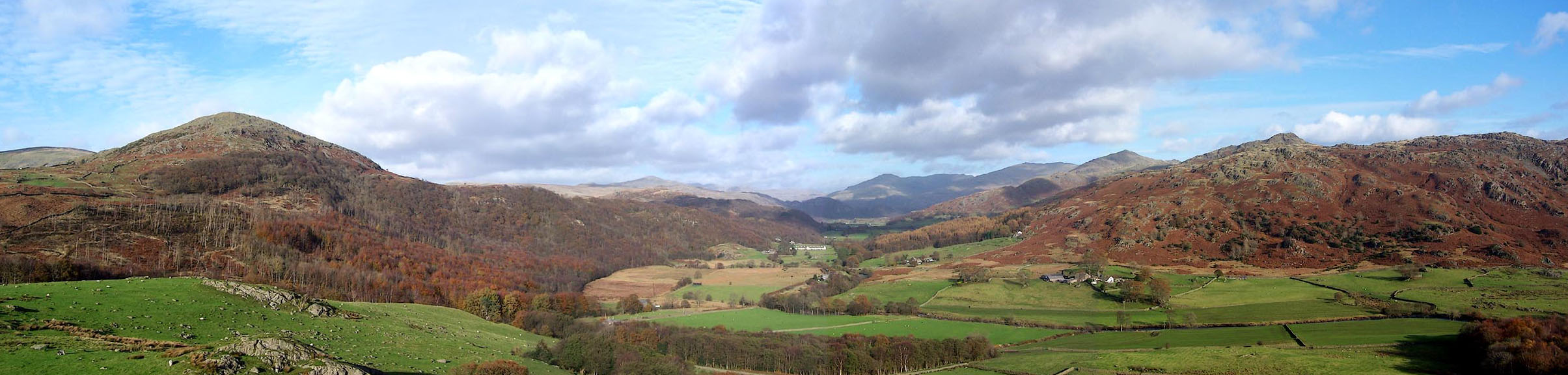 Click to enlarge BOI44.jpg From castle How, S of Ulpha. (taken 6.11.2007) |
||
|
|
||
| evidence:- | old map:- OS County Series (Lan 6 8) placename:- Dunnerdale |
|
| source data:- | Maps, County Series maps of Great Britain, scales 6 and 25
inches to 1 mile, published by the Ordnance Survey, Southampton,
Hampshire, from about 1863 to 1948. |
|
|
|
||
| evidence:- | old drawing:- Aspland 1840s-60s |
|
| source data:- | Drawing, pencil and ink wash, Dunnerdale and Castle How etc, Dunnerdale-with-Seathwaite
and Ulpha, Lancashire and Cumberland, by Theophilus Lindsey Aspland, 1852.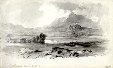 click to enlarge click to enlargeAS0349.jpg "Seathwaite Castle rock &c." page number "36" item:- Armitt Library : 1958.390.49 Image © see bottom of page |
|
|
|
||
| evidence:- | old drawing:- Aspland 1840s-60s |
|
| source data:- | Drawing, pencil, Dunnerdale, Dunnerdale-with-Seathwaite and Ulpha, Lancashire and
Cumberland, by Theophilus Lindsey Aspland, 1852.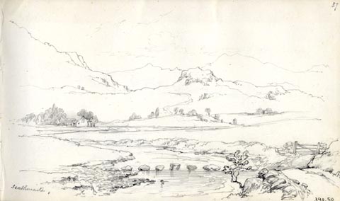 click to enlarge click to enlargeAS0350.jpg "Seathwaite." page number "37" item:- Armitt Library : 1958.390.50 Image © see bottom of page |
|
|
|
||
| evidence:- | old map:- Garnett 1850s-60s H placename:- Ulpha |
|
| source data:- | Map of the English Lakes, in Cumberland, Westmorland and
Lancashire, scale about 3.5 miles to 1 inch, published by John
Garnett, Windermere, Westmorland, 1850s-60s.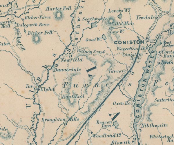 GAR2SD29.jpg "Ulpha" area, river valley item:- JandMN : 82.1 Image © see bottom of page |
|
|
|
||
 Martineau Directory 1855 Martineau Directory 1855 |
||
|
|
||
 Lakes Guides menu.