 Old Cumbria Gazetteer
 |
 |
|
| Field Gate, Bampton | ||
| Field Gate | ||
| Fieldgate House | ||
| locality:- | Bampton Grange | |
| civil parish:- | Bampton (formerly Westmorland) | |
| county:- | Cumbria | |
| locality type:- | buildings | |
| coordinates:- | NY52871813 | |
| 1Km square:- | NY5218 | |
| 10Km square:- | NY51 | |
|
|
||
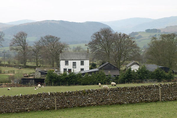 BSO13.jpg (taken 23.4.2010) 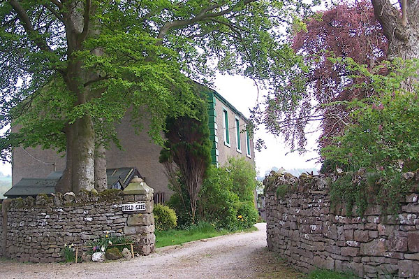 BMC81.jpg (taken 12.5.2006) |
||
|
|
||
| evidence:- | old map:- OS County Series (Wmd 13 8) placename:- Fieldgate House |
|
| source data:- | Maps, County Series maps of Great Britain, scales 6 and 25
inches to 1 mile, published by the Ordnance Survey, Southampton,
Hampshire, from about 1863 to 1948. |
|
|
|
||
| evidence:- | old map:- Jefferys 1770 (Wmd) placename:- Field Yate |
|
| source data:- | Map, 4 sheets, The County of Westmoreland, scale 1 inch to 1
mile, surveyed 1768, and engraved and published by Thomas
Jefferys, London, 1770.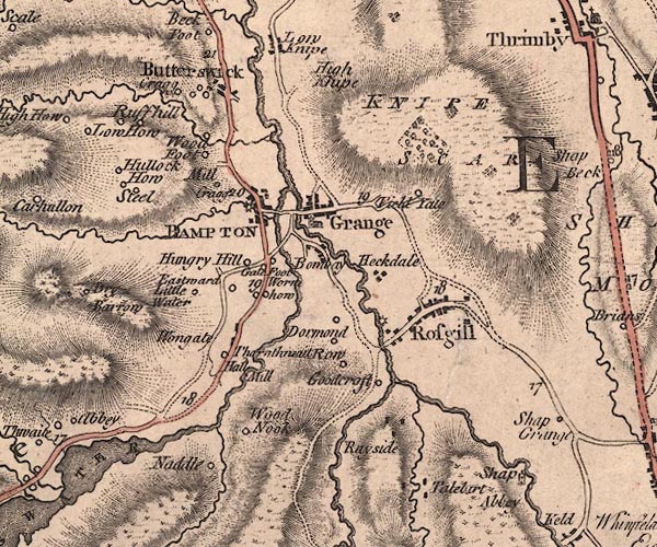 J5NY51NW.jpg "Field Ya[t]e" circle, labelled in italic lowercase text; settlement, farm, house, or hamlet? item:- National Library of Scotland : EME.s.47 Image © National Library of Scotland |
|
|
|
||
| evidence:- | old map:- Cary 1789 (edn 1805) placename:- Field Yate |
|
| source data:- | Map, uncoloured engraving, Westmoreland, scale about 2.5 miles
to 1 inch, by John Cary, London, 1789; edition 1805.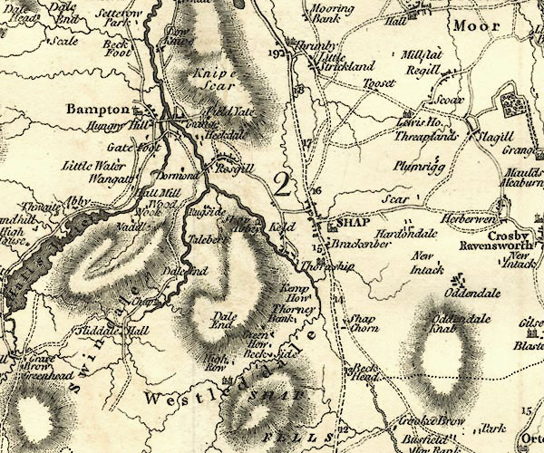 CY24NY51.jpg "Field Yate" block/s, labelled in italic lowercase; house, or hamlet item:- JandMN : 129 Image © see bottom of page |
|
|
|
||
| evidence:- | database:- Listed Buildings 2010 placename:- Field Gate Farm |
|
| source data:- | courtesy of English Heritage "FIELD GATE FARMHOUSE / / BAMPTON GRANGE / BAMPTON / EDEN / CUMBRIA / II / 74474 / NY5287518110" |
|
|
|
||
 BSO15.jpg (taken 23.4.2010) |
||
|
|
||
 Lakes Guides menu.