 Old Cumbria Gazetteer
 |
 |
|
| Gatescarth Beck | ||
| runs into:- |  Hawes Water Hawes Water |
|
|
|
||
| civil parish:- | Shap Rural (formerly Westmorland) | |
| county:- | Cumbria | |
| locality type:- | river | |
| coordinates:- | NY474094 (head, approx) | |
| 1Km square:- | NY4709 | |
| 10Km square:- | NY40 | |
| SummaryText:- | Flows NNW towards Mardale. | |
|
|
||
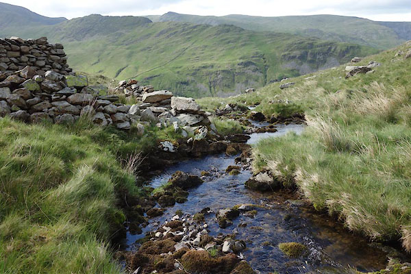 CDL69.jpg (taken 28.6.2015) 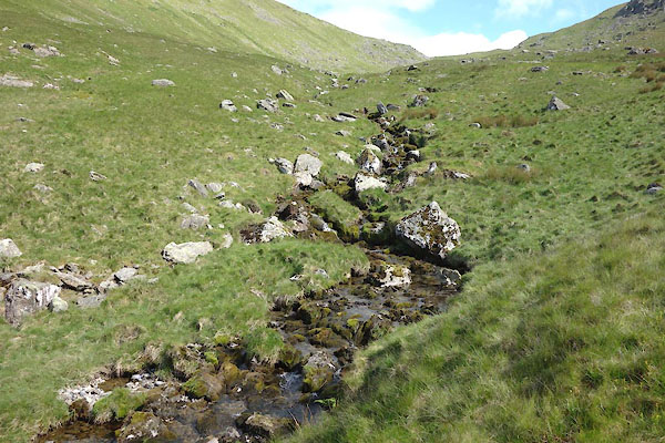 CDL70.jpg (taken 28.6.2015) |
||
|
|
||
| evidence:- | old map:- Jefferys 1770 (Wmd) |
|
| source data:- | Map, 4 sheets, The County of Westmoreland, scale 1 inch to 1
mile, surveyed 1768, and engraved and published by Thomas
Jefferys, London, 1770.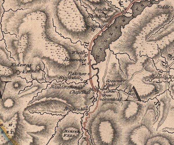 J5NY41SE.jpg single or double wiggly line; river item:- National Library of Scotland : EME.s.47 Image © National Library of Scotland |
|
|
|
||
| evidence:- | map:- OS Six Inch (1956) placename:- Gatescarth Beck |
|
| source data:- | Map series, various editions with the national grid, scale about
6 inches to 1 mile, published by the Ordnance Survey,
Southampton, Hampshire, scale 1 to 10560 from 1950s to 1960s,
then 1 to 10000 from 1960s to 2000s, superseded by print on
demand from digital data.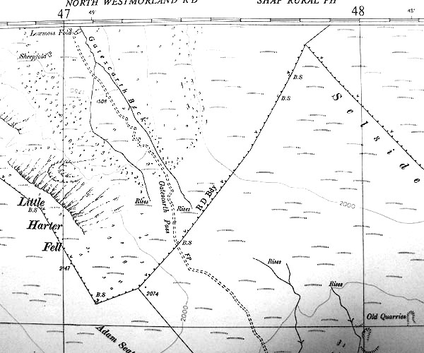 SINY4709.jpg "Gatescarth Beck" |
|
|
|
||
Lakes Guides menu.