 Old Cumbria Gazetteer
 |
 |
|
| Gavel Fell, Ennerdale and Kinniside | ||
| Gavel Fell | ||
| civil parish:- | Ennerdale and Kinniside (formerly Cumberland) | |
| civil parish:- | Loweswater (formerly Cumberland) | |
| county:- | Cumbria | |
| locality type:- | hill | |
| locality type:- | fell | |
| coordinates:- | NY11621844 (etc) | |
| 1Km square:- | NY1118 | |
| 10Km square:- | NY11 | |
| altitude:- | 1726 feet | |
| altitude:- | 526m | |
|
|
||
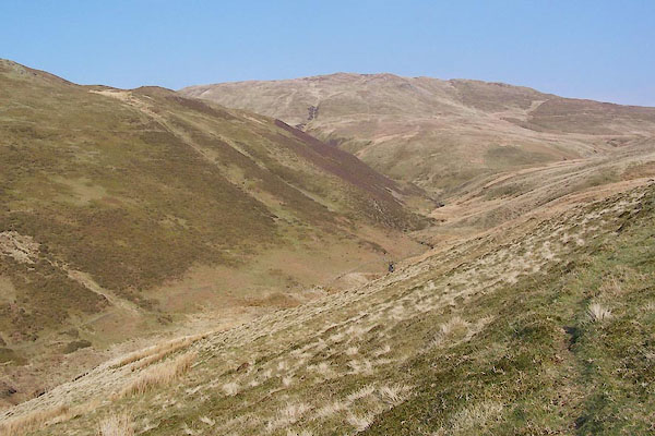 BQJ33.jpg Looking up Croasdale. (taken 1.4.2009) |
||
|
|
||
| evidence:- | old map:- Donald 1774 (Cmd) placename:- Gavel Fell |
|
| source data:- | Map, hand coloured engraving, 3x2 sheets, The County of Cumberland, scale about 1
inch to 1 mile, by Thomas Donald, engraved and published by Joseph Hodskinson, 29
Arundel Street, Strand, London, 1774.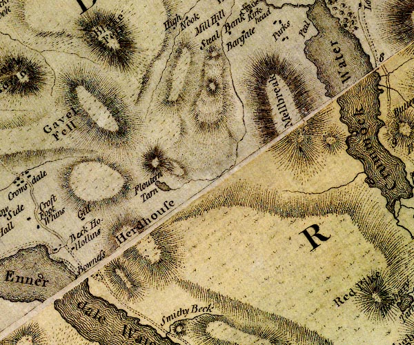 D4NY11NW.jpg "Gavel Fell" hill hachuring; a hill or mountain item:- Carlisle Library : Map 2 Image © Carlisle Library |
|
|
|
||
 Lakes Guides menu.