 Old Cumbria Gazetteer
 |
 |
|
| Grayrigg Hall, Grayrigg | ||
| Grayrigg Hall | ||
| locality:- | Grayrigg | |
| civil parish:- | Grayrigg (formerly Westmorland) | |
| county:- | Cumbria | |
| locality type:- | buildings | |
| coordinates:- | SD57959753 | |
| 1Km square:- | SD5797 | |
| 10Km square:- | SD59 | |
| SummaryText:- | notes about old and present halls. | |
|
|
||
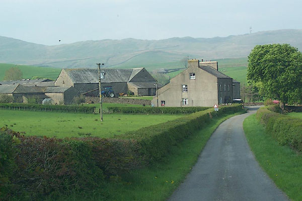 BMC82.jpg (taken 12.5.2006) |
||
|
|
||
| evidence:- | old map:- OS County Series (Wmd 34 11) placename:- Grayrigg Hall |
|
| source data:- | Maps, County Series maps of Great Britain, scales 6 and 25
inches to 1 mile, published by the Ordnance Survey, Southampton,
Hampshire, from about 1863 to 1948. |
|
|
|
||
| evidence:- | old map:- Saxton 1579 placename:- Grarigg Hall |
|
| source data:- | Map, hand coloured engraving, Westmorlandiae et Cumberlandiae Comitatus ie Westmorland
and Cumberland, scale about 5 miles to 1 inch, by Christopher Saxton, London, engraved
by Augustinus Ryther, 1576, published 1579-1645.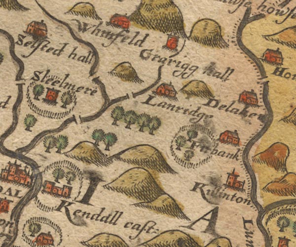 Sax9SD59.jpg Tower, symbol for a house, hall, tower, etc. "Grarigg hall" item:- private collection : 2 Image © see bottom of page |
|
|
|
||
| evidence:- | old map:- Speed 1611 (Wmd) placename:- Grarigge hall |
|
| source data:- | Map, hand coloured engraving, The Countie Westmorland and
Kendale the Cheif Towne, scale about 2.5 miles to 1 inch, by
John Speed, 1610, published by George Humble, Popes Head Alley,
London, 1611-12.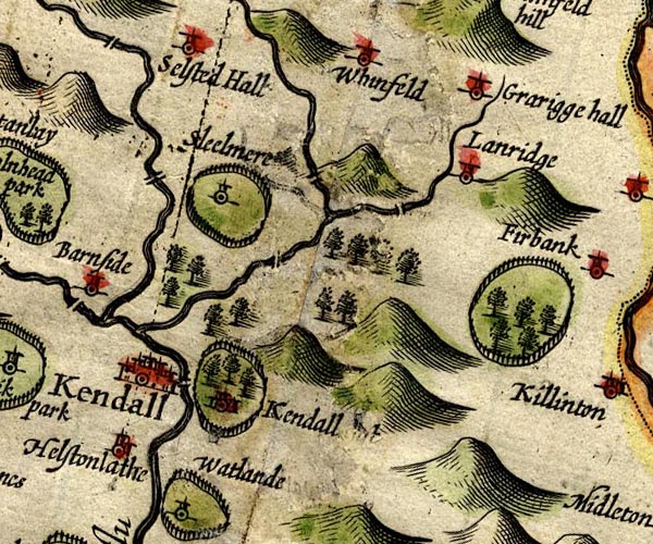 SP14SD59.jpg "Grarigge hall" circle, tower item:- Armitt Library : 2008.14.5 Image © see bottom of page |
|
|
|
||
| evidence:- | old map:- Jansson 1646 placename:- Grariggehall |
|
| source data:- | Map, hand coloured engraving, Cumbria and Westmoria, ie
Cumberland and Westmorland, scale about 3.5 miles to 1 inch, by
John Jansson, Amsterdam, Netherlands, 1646.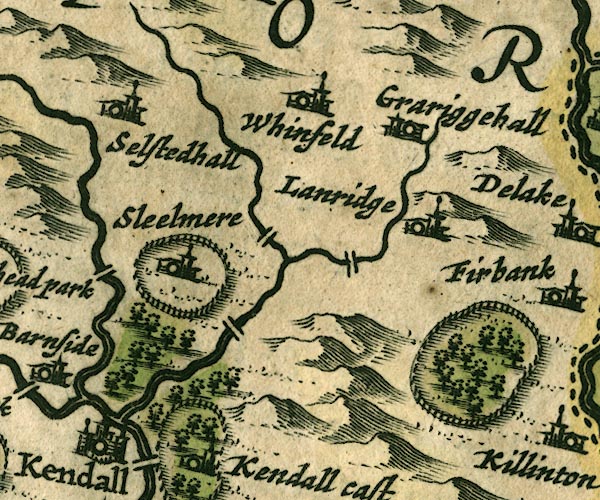 JAN3SD59.jpg "Grariggehall" Buildings and tower. item:- JandMN : 88 Image © see bottom of page |
|
|
|
||
| evidence:- | hearth tax returns:- Hearth Tax 1675 placename:- Grayrigge hall |
|
| source data:- | Records, hearth tax survey returns, Westmorland, 1674/75. "Grayrigge hall" in "Grayrigge" |
|
|
|
||
| evidence:- | old map:- Seller 1694 (Wmd) placename:- Garrige Hall |
|
| source data:- | Map, hand coloured engraving, Westmorland, scale about 8 miles
to 1 inch, by John Seller, 1694. click to enlarge click to enlargeSEL7.jpg "Garrige hall" circle, italic lowercase text; settlement or house item:- Dove Cottage : 2007.38.87 Image © see bottom of page |
|
|
|
||
| evidence:- | old map:- Morden 1695 (Wmd) placename:- Graridg Hall |
|
| source data:- | Map, hand coloured engraving, Westmorland, scale about 2.5 miles to 1 inch, by Robert
Morden, published by Abel Swale, the Unicorn, St Paul's Churchyard, Awnsham, and John
Churchill, the Black Swan, Paternoster Row, London, 1695.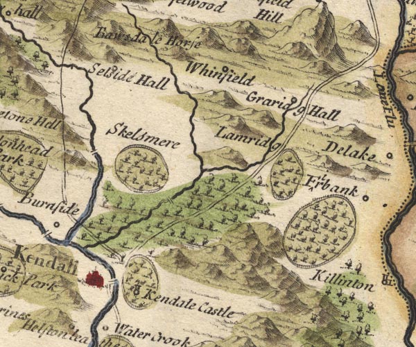 MD10SD59.jpg "Graridg Hall" Circle. item:- JandMN : 24 Image © see bottom of page |
|
|
|
||
| evidence:- | old map:- Simpson 1746 map (Wmd) placename:- Graridge Hall |
|
| source data:- | Map, uncoloured engraving, Westmorland, scale about 8 miles to 1
inch, printed by R Walker, Fleet Lane, London, 1746.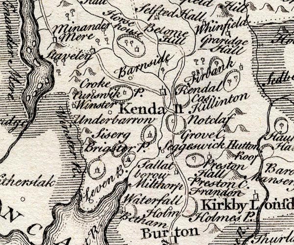 SMP2SDP.jpg "Graridge Hall" Building. item:- Dove Cottage : 2007.38.59 Image © see bottom of page |
|
|
|
||
| evidence:- | old map:- Bowen and Kitchin 1760 placename:- Grarig Hall |
|
| source data:- | Map, hand coloured engraving, A New Map of the Counties of
Cumberland and Westmoreland Divided into their Respective Wards,
scale about 4 miles to 1 inch, by Emanuel Bowen and Thomas
Kitchin et al, published by T Bowles, Robert Sayer, and John
Bowles, London, 1760.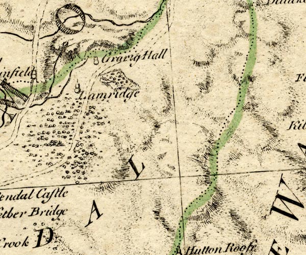 BO18SD59.jpg "Grarig Hall" circle, tower item:- Armitt Library : 2008.14.10 Image © see bottom of page |
|
|
|
||
| evidence:- | old map:- Jefferys 1770 (Wmd) placename:- Grayrigg Hall |
|
| source data:- | Map, 4 sheets, The County of Westmoreland, scale 1 inch to 1
mile, surveyed 1768, and engraved and published by Thomas
Jefferys, London, 1770.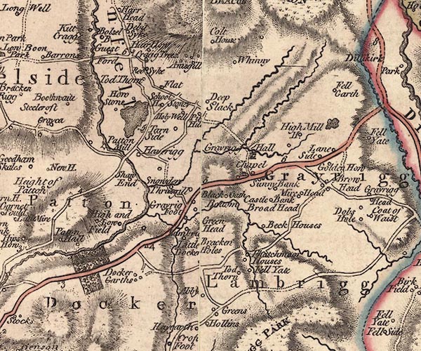 J5SD59NE.jpg "Grayrigg Hall" house item:- National Library of Scotland : EME.s.47 Image © National Library of Scotland |
|
|
|
||
| evidence:- | old map:- Cary 1789 (edn 1805) |
|
| source data:- | Map, uncoloured engraving, Westmoreland, scale about 2.5 miles
to 1 inch, by John Cary, London, 1789; edition 1805.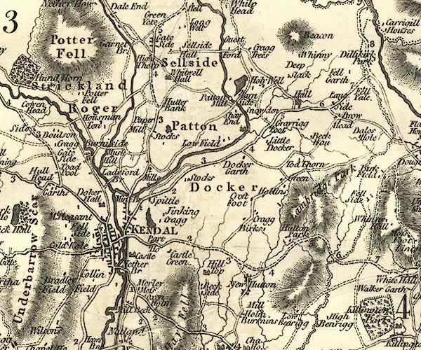 CY24SD59.jpg "Hall" house symbol; large house item:- JandMN : 129 Image © see bottom of page |
|
|
|
||
| evidence:- | database:- Listed Buildings 2010 placename:- Grayrigg Hall |
|
| source data:- | courtesy of English Heritage "GRAYRIGG HALL / / / GRAYRIGG / SOUTH LAKELAND / CUMBRIA / II / 75655 / SD5794397519" |
|
|
|
||
| evidence:- | database:- Listed Buildings 2010 |
|
| source data:- | courtesy of English Heritage "BARN APPROXIMATELY 50M TO NORTH-WEST OF GRAYRIGG HALL / / / GRAYRIGG / SOUTH LAKELAND / CUMBRIA / II / 75656 / SD5793097562" |
|
|
|
||
| hearsay:- |
In the 17th century a magistrate, Mr Duckett, lived at an earlier Grayrigg Hall which
was further out from the village. He sentenced Mr Howgill, a Quaker, to be imprisonned
in the gaol at Appleby. Mr Howgill cursed the magistrate:- |
|
| "Your name will rot out of the earth, and your dwelling house become derelict and a
habitation of owls and jackdaws." |
||
| Mr Duckett's children all died childless; old Grayrigg Hall was taken down, in the
1700s, leaving little more than a roost for the birds. |
||
|
|
||
| notes:- |
hall (which, where?) |
|
| Perriam, D R &Robinson, J: 1998: Medieval Fortified Buildings of Cumbria: CWAAS::
ISBN 1 873124 23 6 |
||
|
|
||
 Lakes Guides menu.