 Old Cumbria Gazetteer
 |
 |
|
| Graythwaite Hall, Satterthwaite | ||
| Graythwaite Hall | ||
| civil parish:- | Satterthwaite (formerly Lancashire) | |
| county:- | Cumbria | |
| locality type:- | buildings | |
| locality type:- | garden | |
| coordinates:- | SD37059126 | |
| 1Km square:- | SD3791 | |
| 10Km square:- | SD39 | |
|
|
||
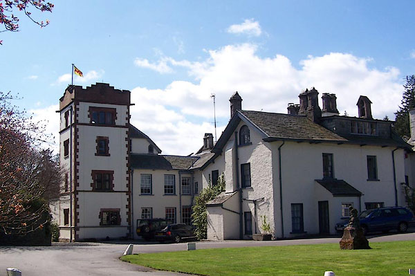 BLZ47.jpg (taken 28.4.2006) 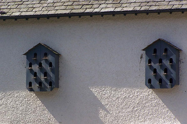 BLZ48.jpg Dovecotes. (taken 28.4.2006) |
||
|
|
||
| evidence:- | old map:- OS County Series (Lan 8 3) placename:- Graythwaite Hall |
|
| source data:- | Maps, County Series maps of Great Britain, scales 6 and 25
inches to 1 mile, published by the Ordnance Survey, Southampton,
Hampshire, from about 1863 to 1948. |
|
|
|
||
| evidence:- | old map:- Crosthwaite 1783-94 (Win/Ble) placename:- High Graithwaite |
|
| source data:- | Map, uncoloured engraving, An Accurate Map of the Grand Lake of
Windermere, scale about 2 inches to 1 mile, by Peter
Crosthwaite, Keswick, Cumberland, 1783, version published 1819.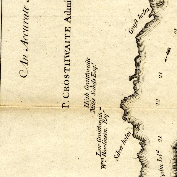 CT9SD39Q.jpg "High Graithwaite / Miles Sands Esqr." block, building/s item:- Armitt Library : 2008.14.102 Image © see bottom of page |
|
|
|
||
| evidence:- | probably old map:- West 1784 map placename:- Graithwaite |
|
| source data:- | Map, hand coloured engraving, A Map of the Lakes in Cumberland,
Westmorland and Lancashire, scale about 3.5 miles to 1 inch,
engraved by Paas, 53 Holborn, London, about 1784.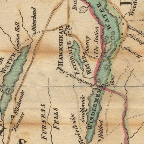 Ws02SD39.jpg item:- Armitt Library : A1221.1 Image © see bottom of page |
|
|
|
||
| evidence:- | old text:- Clarke 1787 placename:- High Grathwaite item:- garden |
|
| source data:- | Guide book, A Survey of the Lakes of Cumberland, Westmorland,
and Lancashire, written and published by James Clarke, Penrith,
Cumberland, and in London etc, 1787; published 1787-93. goto source goto sourcePage 151:- "..." "... Grathwaite consists of two houses, called High and Low Grathwaite; the first, viz. High Grathwaite, belongs to Miles Sandys, Esq; owner of Estthwaite Water. From this family and place came William Lord Sandys, chamberlain to King Henry the VIII. who was by that king (bene merito) advanced to that dignity." goto sourcePage 152:- "... Both these houses are very good modern buildings, and both the owners seem to have a great predilection for gardening; their situation is in a hollow circus, which disappoints them of viewing the Lake Winandermere. ... The houses are sheltered from the winds on every side, but are extremely hot in Summer; and as the descent to the Lake is steep and woody, the traveller will be agreeably surprized at his coming in view (suddenly) of these beautiful mansions, in the midst of wood and desart." |
|
|
|
||
| evidence:- | old map:- Clarke 1787 map (Windermere S) placename:- Grathwaite |
|
| source data:- | Map, A Map of the Southern Part of the Lake Winandermere and its
Environs, scale about 6.5 ins to 1 mile, by James Clarke,
engraved by Samuel John Neele, 352 Strand, published by James
Clarke, Penrith, Cumberland and in London etc, 1787.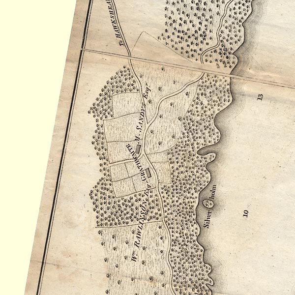 CLBSD39Q.jpg "GRATHWAITE / M. SANDYS Esqr." item:- private collection : 10.11 Image © see bottom of page |
|
|
|
||
| evidence:- | possibly old map:- Otley 1818 placename:- Grathwaite |
|
| source data:- | Map, uncoloured engraving, The District of the Lakes,
Cumberland, Westmorland, and Lancashire, scale about 4 miles to
1 inch, by Jonathan Otley, 1818, engraved by J and G Menzies,
Edinburgh, Scotland, published by Jonathan Otley, Keswick,
Cumberland, et al, 1833. OT02SD39.jpg item:- JandMN : 48.1 Image © see bottom of page |
|
|
|
||
| evidence:- | old map:- Ford 1839 map placename:- High Hall |
|
| source data:- | Map, uncoloured engraving, Map of the Lake District of
Cumberland, Westmoreland and Lancashire, scale about 3.5 miles
to 1 inch, published by Charles Thurnam, Carlisle, and by R
Groombridge, 5 Paternoster Row, London, 3rd edn 1843. FD02SD39.jpg "High Hall" item:- JandMN : 100.1 Image © see bottom of page |
|
|
|
||
| evidence:- | probably old map:- Garnett 1850s-60s H placename:- Graythwaite |
|
| source data:- | Map of the English Lakes, in Cumberland, Westmorland and
Lancashire, scale about 3.5 miles to 1 inch, published by John
Garnett, Windermere, Westmorland, 1850s-60s. GAR2SD39.jpg "Graythwaite" block, building item:- JandMN : 82.1 Image © see bottom of page |
|
|
|
||
| evidence:- | database:- Listed Buildings 2010 placename:- Graythwaite Hall item:- date stone (1578); date stone (1890) |
|
| source data:- | courtesy of English Heritage "GRAYTHWAITE HALL / / / SATTERTHWAITE / SOUTH LAKELAND / CUMBRIA / II / 76881 / SD3705291264" |
|
|
|
||
 sundial sundial |
||
|
|
||
| sundial |
||
|
|
||
| notes:- |
Landscaping and gardens were designed by Thomas H Mawson for Colonel Thomas Myles
Sandys. Garden plans are illustrated in The Art and Craft of Garden Making, by Mawson,
1st edn fig.141. |
|
| In the green garden on the east side of the house there is a sundial, tall pillar
with multifaced dial atop, designed by Dan Gibson. |
||
| Waymark, Janet: 2009: Thomas Mawson, Life, Gardens and Landscapes: Lincoln, Francis
(London) Longville, Tim &Corbett, Val (photr): 2007: Gardens of the Lake District: Lincoln, Frances (London) |
||
|
|
||
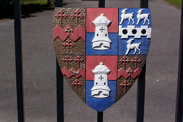 BLZ49.jpg Coat of arms on gates. (taken 28.4.2006) 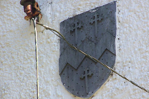 BLZ51.jpg Coat of arms on lodge. (taken 28.4.2006) 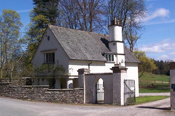 BLZ50.jpg Coat of arms on lodge . (taken 28.4.2006) |
||
|
|
||
| hearsay:- |
Home of the Sandys Family. |
|
|
|
||
| hearsay:- |
The landscape garden was laid out by Thomas Mawson, who wrote about his work in:- |
|
| Life and Work of an English Landscape Architect |
||
|
|
||
Lakes Guides menu.