 Old Cumbria Gazetteer
 |
 |
|
| Greystoke Forest, Greystoke | ||
| Greystoke Forest | ||
| civil parish:- | Greystoke (formerly Cumberland) | |
| county:- | Cumbria | |
| locality type:- | wood | |
| locality type:- | forest | |
| coordinates:- | NY39423287 (etc) | |
| 1Km square:- | NY3932 | |
| 10Km square:- | NY33 | |
|
|
||
| evidence:- | old map:- Saxton 1579 |
|
| source data:- | Map, hand coloured engraving, Westmorlandiae et Cumberlandiae Comitatus ie Westmorland
and Cumberland, scale about 5 miles to 1 inch, by Christopher Saxton, London, engraved
by Augustinus Ryther, 1576, published 1579-1645.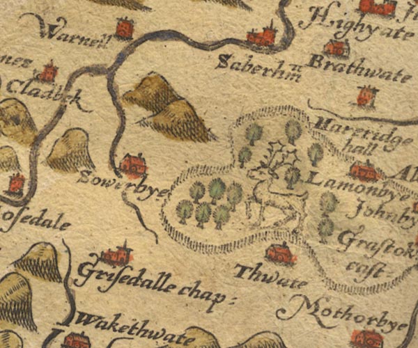 Sax9NY33.jpg  Sax9NY43.jpg Trees, and a stag, within the park. item:- private collection : 2 Image © see bottom of page |
|
|
|
||
| evidence:- | old map:- Jansson 1646 |
|
| source data:- | Map, hand coloured engraving, Cumbria and Westmoria, ie
Cumberland and Westmorland, scale about 3.5 miles to 1 inch, by
John Jansson, Amsterdam, Netherlands, 1646.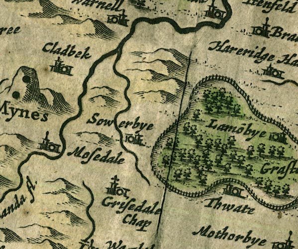 JAN3NY33.jpg Group of tree symbols, in the park. item:- JandMN : 88 Image © see bottom of page |
|
|
|
||
| evidence:- | old map:- Morden 1695 (Cmd) |
|
| source data:- | Map, uncoloured engraving, Cumberland, scale about 4 miles to 1
inch, by Robert Morden, 1695, published by Abel Swale, the
Unicorn, St Paul's Churchyard, Awnsham, and John Churchill, the
Black Swan, Paternoster Row, London, 1695-1715.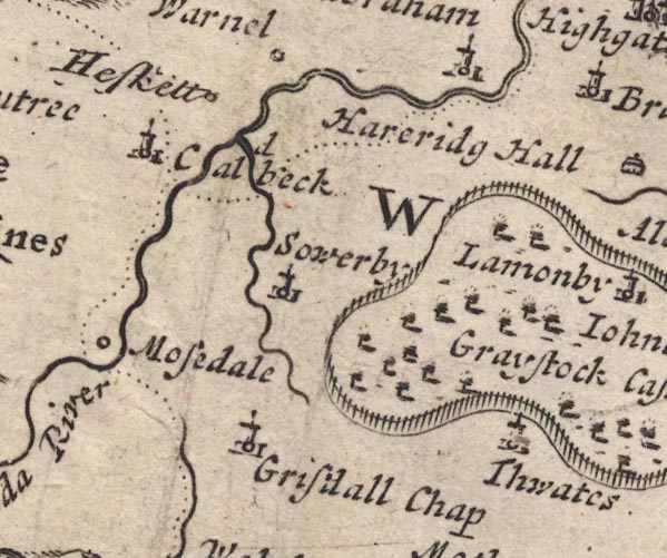 MD12NY33.jpg 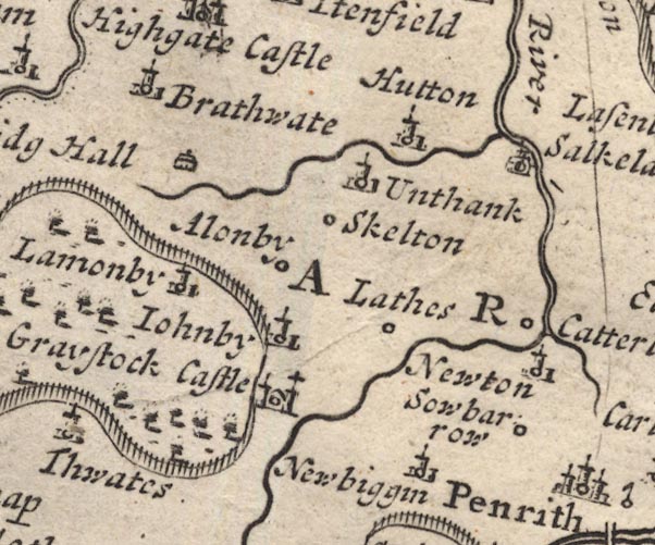 MD12NY43.jpg item:- JandMN : 90 Image © see bottom of page |
|
|
|
||
 Lakes Guides menu.