 Old Cumbria Gazetteer
 |
 |
|
| Haresceugh Castle, Haresceugh | ||
| Haresceugh Castle | ||
| locality:- | Haresceugh | |
| civil parish:- | Kirkoswald (formerly Cumberland) | |
| county:- | Cumbria | |
| locality type:- | castle | |
| coordinates:- | NY61044282 (?) | |
| 1Km square:- | NY6142 | |
| 10Km square:- | NY64 | |
|
|
||
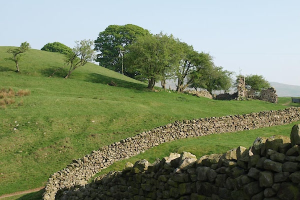 BUK07.jpg (taken 23.4.2011) 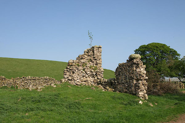 BUK08.jpg (taken 23.4.2011) |
||
|
|
||
| evidence:- | old map:- Donald 1774 (Cmd) |
|
| source data:- | Map, hand coloured engraving, 3x2 sheets, The County of Cumberland, scale about 1
inch to 1 mile, by Thomas Donald, engraved and published by Joseph Hodskinson, 29
Arundel Street, Strand, London, 1774.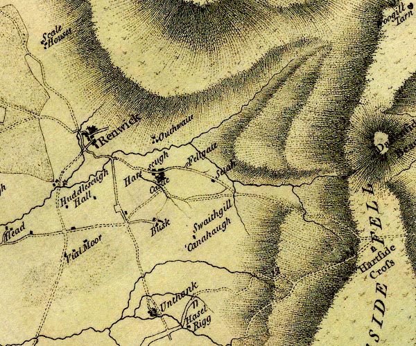 D4NY64SW.jpg "Castle" large building; a castle at Harescugh item:- Carlisle Library : Map 2 Image © Carlisle Library |
|
|
|
||
| evidence:- | old map:- Cooke 1802 placename:- Haresceugh Castle |
|
| source data:- | Map, Cumberland, scale about 15.5 miles to 1 inch, by George
Cooke, 1802, bound in Gray's New Book of Roads, 1824, published
by Sherwood, Jones and Co, Paternoster Road, London, 1824. click to enlarge click to enlargeGRA1Cd.jpg "Haresceugh Cast" castle item:- Hampshire Museums : FA2000.62.2 Image © see bottom of page |
|
|
|
||
| evidence:- | old map:- Wallis 1810 (Cmd) placename:- Haresceugh Castle |
|
| source data:- | Road map, hand coloured engraving, Cumberland, scale about 16
miles to 1 inch, by James Wallis, 77 Berwick Stree, Soho,
London, 1810. click to enlarge click to enlargeWL13.jpg "Haresceugh Cast." castle item:- Dove Cottage : 2009.81.10 Image © see bottom of page |
|
|
|
||
| notes:- |
supposed tower |
|
| Perriam, D R &Robinson, J: 1998: Medieval Fortified Buildings of Cumbria: CWAAS::
ISBN 1 873124 23 6;plan |
||
|
|
||
 Lakes Guides menu.