 Old Cumbria Gazetteer
 |
 |
|
| Hawes Bridge, Natland | ||
| Hawes Bridge | ||
| site name:- | Kent, River | |
| locality:- | Natland | |
| civil parish:- | Natland (formerly Westmorland) | |
| civil parish:- | Helsington (formerly Westmorland) | |
| county:- | Cumbria | |
| locality type:- | bridge | |
| coordinates:- | SD51158908 | |
| 1Km square:- | SD5189 | |
| 10Km square:- | SD58 | |
|
|
||
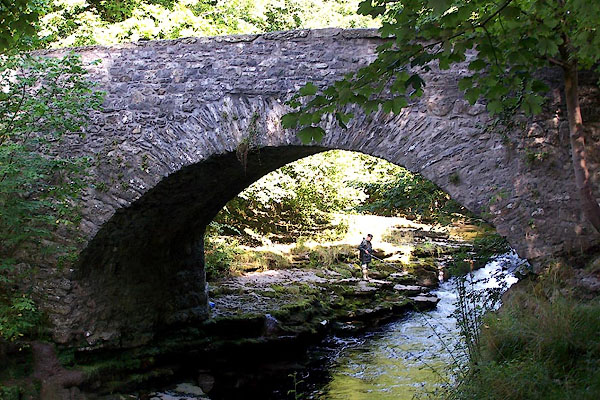 BJU77.jpg From downstream. (taken 12.9.2005) |
||
|
|
||
| evidence:- | old map:- OS County Series (Wmd 38 16) placename:- Hawes Bridge |
|
| source data:- | Maps, County Series maps of Great Britain, scales 6 and 25
inches to 1 mile, published by the Ordnance Survey, Southampton,
Hampshire, from about 1863 to 1948. |
|
|
|
||
| evidence:- | possibly old map:- Bowen and Kitchin 1760 |
|
| source data:- | Map, hand coloured engraving, A New Map of the Counties of
Cumberland and Westmoreland Divided into their Respective Wards,
scale about 4 miles to 1 inch, by Emanuel Bowen and Thomas
Kitchin et al, published by T Bowles, Robert Sayer, and John
Bowles, London, 1760.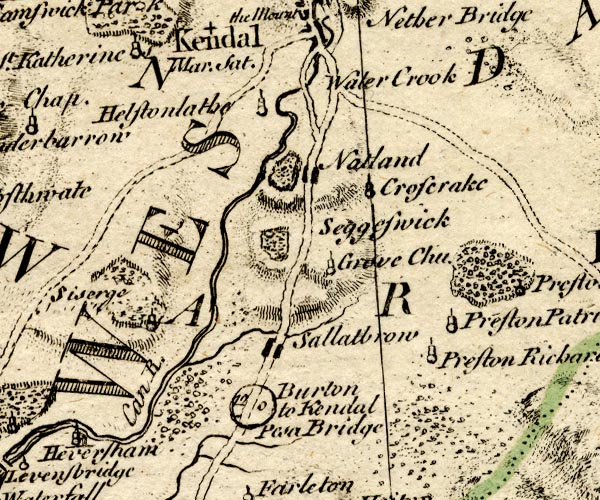 BO18SD48.jpg by road across the Kent item:- Armitt Library : 2008.14.10 Image © see bottom of page |
|
|
|
||
| evidence:- | old map:- Jefferys 1770 (Wmd) placename:- Haws Bridge |
|
| source data:- | Map, 4 sheets, The County of Westmoreland, scale 1 inch to 1
mile, surveyed 1768, and engraved and published by Thomas
Jefferys, London, 1770.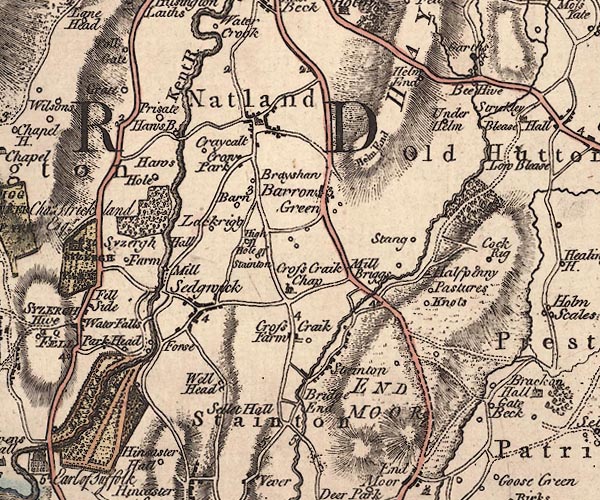 J5SD58NW.jpg "Haws B." double line, road, across a stream; bridge and circle, labelled in italic lowercase text; settlement, farm, house, or hamlet? item:- National Library of Scotland : EME.s.47 Image © National Library of Scotland |
|
|
|
||
| evidence:- | old map:- Cary 1789 (edn 1805) placename:- Haws Bridge |
|
| source data:- | Map, uncoloured engraving, Westmoreland, scale about 2.5 miles
to 1 inch, by John Cary, London, 1789; edition 1805.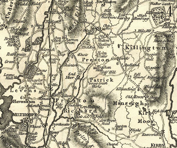 CY24SD58.jpg "Haws Br." road across a stream; bridge over the Kent item:- JandMN : 129 Image © see bottom of page |
|
|
|
||
| evidence:- | old text:- Gents Mag placename:- Haws Bridge item:- geology; fossil; entrochite; Belmintholithus hamonites; botany; flower; Melampyrum sylvaticum; Viburnum opulus; Agaricus chantarellus; temperature |
|
| source data:- | Magazine, The Gentleman's Magazine or Monthly Intelligencer or
Historical Chronicle, published by Edward Cave under the
pseudonym Sylvanus Urban, and by other publishers, London,
monthly from 1731 to 1922. goto source goto sourceGentleman's Magazine 1794 p.112 "..." "At one o'clock in the afternoon, we directed our course Southwards along the banks of the Kent; and, after walking a little more than two miles, reached Haws-bridge, where the whole body of the current forces its way through a deep and narrow chasm in the limestone rock. Here the petrifactions are, generally speaking, entrochites; in which circumstance these strata differ from those we had examined before. Near the bridge we found a complete but small specimen of belmintholithus hamonites, imbedded in a fragment of stone. The botany of the woods on the West side of the river is various; but I shall only mention the melampyrum sylvaticum, viburnum opulus, and agaricus chantarellus, out of the great profusion of plants afforded by this luxuriant place. Fahrenheit's thermometer stood in the shade, a little after 3 P.M. at 67°; and, at the same time, we found the temperature of a very fine spring to be 46.5°." |
|
|
|
||
| evidence:- | :- Hullmandel 1826 placename:- Hawes Bridge |
|
| source data:- | 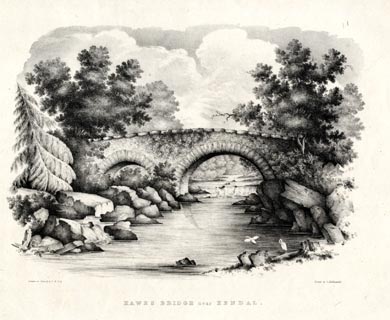 click to enlarge click to enlargeHUL104.jpg Print, uncoloured lithograph, Hawes Bridge near Kendal, Natland, Westmorland, drawn by Miss I Cropper and Miss S Atkins, published by Charles Hullmandel, London, 1826. "Drawn on Stone by I.C & S.A. / Printed by C. Hullmandel. / HAWES BRIDGE near KENDAL" item:- Armitt Library : ALMA370.4 Image © see bottom of page |
|
|
|
||
| evidence:- | database:- Listed Buildings 2010 placename:- Hawes Bridge |
|
| source data:- | courtesy of English Heritage "HAWES BRIDGE OVER THE RIVER KENT / / HAWES LANE / NATLAND / SOUTH LAKELAND / CUMBRIA / II / 76451 / SD5115589081" |
|
| source data:- | courtesy of English Heritage "HAWES BRIDGE OVER THE RIVER KENT / / / HELSINGTON / SOUTH LAKELAND / CUMBRIA / II / 75280 / SD5115589082" |
|
| source data:- | courtesy of English Heritage "Bridge probably C18. Limestone rubble with rough dressed limestone copings to parapet. Large triangular cut water between arches on upstream side. Curved in Plan. 2 arches carry single carriageway road over small river gorge in limestone. Forms part of most attractive setting. Local legend has it that the body of Sir Charles de Leyburne of Cunswick Hall (Underbarrow and Bradleyfield Parish) was washed up here after being murdered and thrown into the river by his son Roger, who wished to come into his inheritance so he could marry. Roger said to have committed suicide when the body was found and his ghost haunts- Cunswick Scar." |
|
|
|
||
| ghost story:- |
There are said to be dobbies chained to the foundations of the bridge. If you see
one it will be silent: if you hear one swearing it will be invisible. |
|
|
|
||
Lakes Guides menu.