 Old Cumbria Gazetteer
 |
 |
|
| Helton Tarn, Upper Allithwaite | ||
| Helton Tarn | ||
| site name:- | Winster, River | |
| civil parish:- | Upper Allithwaite (formerly Lancashire) | |
| civil parish:- | Witherslack (formerly Westmorland) | |
| county:- | Cumbria | |
| locality type:- | tarn | |
| locality type:- | boundary feature | |
| locality type:- | parish boundary feature | |
| locality type:- | county boundary feature (old) | |
| coordinates:- | SD41948491 (etc) | |
| 1Km square:- | SD4184 | |
| 10Km square:- | SD48 | |
| altitude:- | 20 feet | |
| altitude:- | 6m | |
| SummaryText:- | an old course of the River Winster is apparent on the 1960s 6inch map. | |
|
|
||
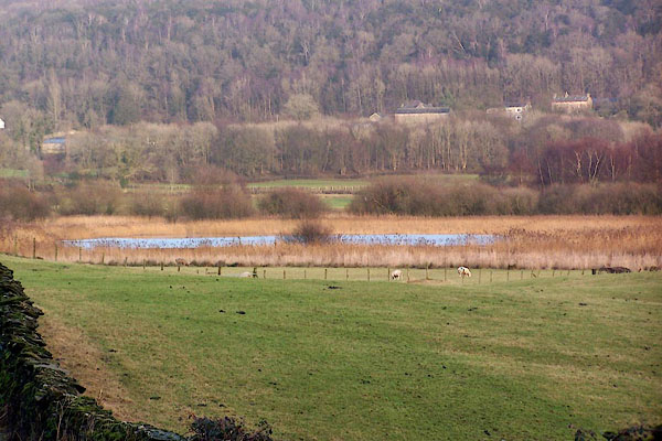 BLM99.jpg (taken 31.12.2005) |
||
|
|
||
| evidence:- | old map:- OS County Series (Wmd 41 12) placename:- Helton Tarn |
|
| source data:- | Maps, County Series maps of Great Britain, scales 6 and 25
inches to 1 mile, published by the Ordnance Survey, Southampton,
Hampshire, from about 1863 to 1948. OS County Series (Lan 13 1) |
|
|
|
||
| evidence:- | old map:- Otley 1818 |
|
| source data:- | Map, uncoloured engraving, The District of the Lakes,
Cumberland, Westmorland, and Lancashire, scale about 4 miles to
1 inch, by Jonathan Otley, 1818, engraved by J and G Menzies,
Edinburgh, Scotland, published by Jonathan Otley, Keswick,
Cumberland, et al, 1833.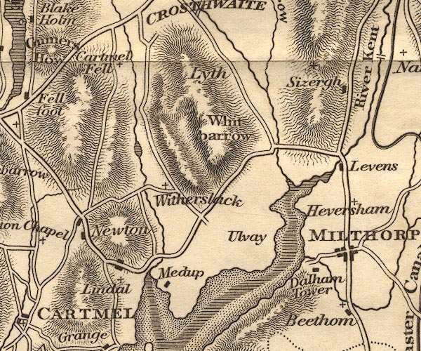 OT02SD48.jpg item:- JandMN : 48.1 Image © see bottom of page |
|
|
|
||
| hearsay:- |
They say that the first iron boat is sunk here. It was made by John Wilkinson, iron
master, Lindale, mid 18th century. It was used to carry peat, for fuel, from Lindale
Moss to the iron works at Lindale. |
|
|
|
||
 Lakes Guides menu.