 Old Cumbria Gazetteer
 |
 |
|
| Highbarn Wood, Longsleddale | ||
| Highbarn Wood | ||
| civil parish:- | Longsleddale (formerly Westmorland) | |
| county:- | Cumbria | |
| locality type:- | wood | |
| coordinates:- | NY49350504 | |
| 1Km square:- | NY4905 | |
| 10Km square:- | NY40 | |
|
|
||
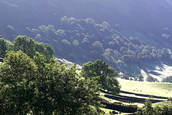 BMN60.jpg (taken 21.8.2006) |
||
|
|
||
| evidence:- | old map:- OS County Series (Wmd 27 7) placename:- Highbarn Wood |
|
| source data:- | Maps, County Series maps of Great Britain, scales 6 and 25
inches to 1 mile, published by the Ordnance Survey, Southampton,
Hampshire, from about 1863 to 1948. Parcels 132 8.350 acres, 131 11.957 acres? |
|
|
|
||
| evidence:- | old map:- Fields 1875 placename:- High Wood |
|
| source data:- | 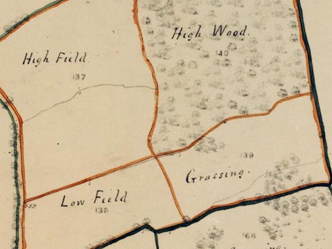 LFld0263.jpg courtesy of Ruth Fishwick piece no = 140 |
|
|
|
||
| evidence:- | map:- OS Six Inch (1956) placename:- Highbarn Wood |
|
| source data:- | Map series, various editions with the national grid, scale about
6 inches to 1 mile, published by the Ordnance Survey,
Southampton, Hampshire, scale 1 to 10560 from 1950s to 1960s,
then 1 to 10000 from 1960s to 2000s, superseded by print on
demand from digital data.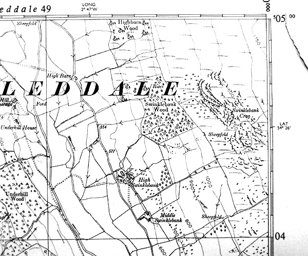 SINY4904.jpg "Highbarn Wood" part |
|
|
|
||
| evidence:- | map:- OS Six Inch (1956) placename:- Highbarn Wood |
|
| source data:- | Map series, various editions with the national grid, scale about
6 inches to 1 mile, published by the Ordnance Survey,
Southampton, Hampshire, scale 1 to 10560 from 1950s to 1960s,
then 1 to 10000 from 1960s to 2000s, superseded by print on
demand from digital data.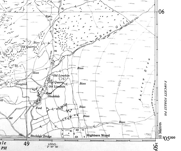 SINY4905.jpg "Highbarn Wood" part |
|
|
|
||
 Lakes Guides menu.