 Old Cumbria Gazetteer
 |
 |
|
| Hollin Root, St John's Castlerigg etc | ||
| Hollin Root | ||
| locality:- | St John's in the Vale | |
| civil parish:- | St John's Castlerigg and Wythburn (formerly Cumberland) | |
| county:- | Cumbria | |
| locality type:- | buildings | |
| coordinates:- | NY30842391 | |
| 1Km square:- | NY3023 | |
| 10Km square:- | NY32 | |
|
|
||
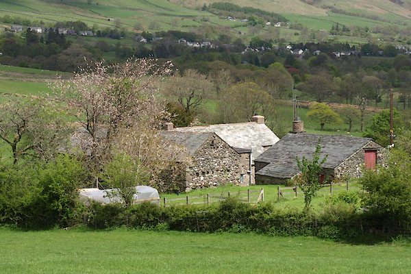 BYI67.jpg (taken 21.5.2013) |
||
|
|
||
| evidence:- | old map:- Donald 1774 (Cmd) placename:- Hollin Root |
|
| source data:- | Map, hand coloured engraving, 3x2 sheets, The County of Cumberland, scale about 1
inch to 1 mile, by Thomas Donald, engraved and published by Joseph Hodskinson, 29
Arundel Street, Strand, London, 1774.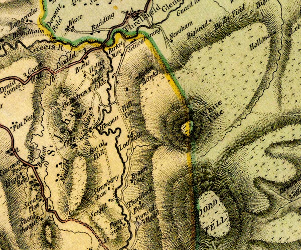 D4NY32SW.jpg "Hollin Root" block or blocks, labelled in lowercase; a hamlet or just a house item:- Carlisle Library : Map 2 Image © Carlisle Library |
|
|
|
||
| evidence:- | database:- Listed Buildings 2010 placename:- Hollin Root |
|
| source data:- | courtesy of English Heritage "HOLLIN ROOT / / / ST JOHNS CASTLERIGG AND WYTHBURN / ALLERDALE / CUMBRIA / II / 72173 / NY3084723915" |
|
|
|
||
| evidence:- | database:- Listed Buildings 2010 placename:- Hollin Root Old House |
|
| source data:- | courtesy of English Heritage "HOLLIN ROOT OLD HOUSE / / / ST JOHNS CASTLERIGG AND WYTHBURN / ALLERDALE / CUMBRIA / II / 351317 / NY3084423894" |
|
|
|
||
 Lakes Guides menu.