 Old Cumbria Gazetteer
 |
 |
|
| Irton | ||
| civil parish:- | Irton with Santon (formerly Cumberland) | |
| county:- | Cumbria | |
| locality type:- | locality | |
| coordinates:- | NY10610047 (etc, about) | |
| 1Km square:- | NY1000 | |
| 10Km square:- | NY10 | |
|
|
||
| evidence:- | old map:- Saxton 1579 placename:- Irton |
|
| source data:- | Map, hand coloured engraving, Westmorlandiae et Cumberlandiae Comitatus ie Westmorland
and Cumberland, scale about 5 miles to 1 inch, by Christopher Saxton, London, engraved
by Augustinus Ryther, 1576, published 1579-1645.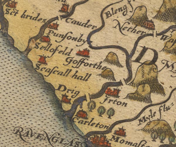 Sax9NY00.jpg Church, symbol for a parish or village, with a parish church. "Irton" item:- private collection : 2 Image © see bottom of page |
|
|
|
||
| evidence:- | old map:- Mercator 1595 (edn?) placename:- Irton |
|
| source data:- | Map, hand coloured engraving, Northumbria, Cumberlandia, et
Dunelmensis Episcopatus, ie Northumberland, Cumberland and
Durham etc, scale about 6.5 miles to 1 inch, by Gerard Mercator,
Duisberg, Germany, about 1595. MER8CumE.jpg "Irton" circle item:- JandMN : 169 Image © see bottom of page |
|
|
|
||
| evidence:- | old map:- Speed 1611 (Cmd) placename:- Irton |
|
| source data:- | Map, hand coloured engraving, Cumberland and the Ancient Citie
Carlile Described, scale about 4 miles to 1 inch, by John Speed,
1610, published by J Sudbury and George Humble, Popes Head
Alley, London, 1611-12.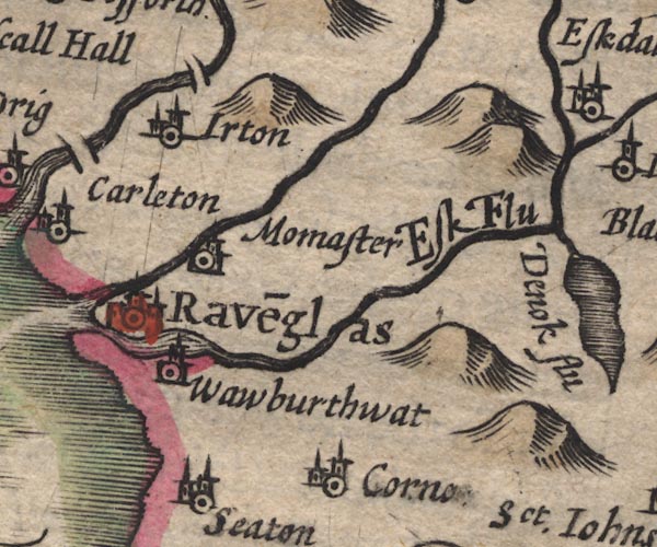 SP11SD19.jpg "Irton" circle, building, tower item:- private collection : 16 Image © see bottom of page |
|
|
|
||
| evidence:- | old map:- Jenner 1643 placename:- Irton |
|
| source data:- | Tables of distances with a maps, Westmerland, scale about 16
miles to 1 inch, and Cumberland, scale about 21 miles to 1 inch,
published by Thomas Jenner, London, 1643; published 1643-80.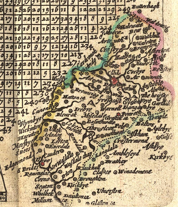 JEN4Sq.jpg "Irton" circle |
|
|
|
||
| evidence:- | old map:- Morden 1695 (Cmd) placename:- Irton |
|
| source data:- | Map, uncoloured engraving, Cumberland, scale about 4 miles to 1
inch, by Robert Morden, 1695, published by Abel Swale, the
Unicorn, St Paul's Churchyard, Awnsham, and John Churchill, the
Black Swan, Paternoster Row, London, 1695-1715.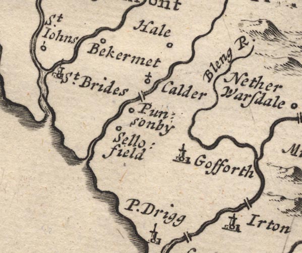 MD12NY00.jpg "Irton" Circle, building and tower. item:- JandMN : 90 Image © see bottom of page |
|
|
|
||
| evidence:- | old map:- Bowen and Kitchin 1760 placename:- Irton |
|
| source data:- | Map, hand coloured engraving, A New Map of the Counties of
Cumberland and Westmoreland Divided into their Respective Wards,
scale about 4 miles to 1 inch, by Emanuel Bowen and Thomas
Kitchin et al, published by T Bowles, Robert Sayer, and John
Bowles, London, 1760.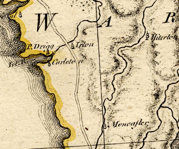 BO18SD09.jpg "Irton" circle, tower item:- Armitt Library : 2008.14.10 Image © see bottom of page |
|
|
|
||
| evidence:- | old text:- Camden 1789 (Gough Additions) placename:- Irt placename:- Irton |
|
| source data:- | Book, Britannia, or A Chorographical Description of the Flourishing Kingdoms of England,
Scotland, and Ireland, by William Camden, 1586, translated from the 1607 Latin edition
by Richard Gough, published London, 1789. goto source goto sourcePage 180:- "..." "On the Irt stands the town of Irt or Irton; the manor of which belonged to an antient family of that name in the reign of Henry II. of whom was Ralph Irton prior of Gisburn and bishop of Carlisle 1280. ..." |
|
|
|
||
| evidence:- | old map:- Otley 1818 placename:- Irton |
|
| source data:- | Map, uncoloured engraving, The District of the Lakes,
Cumberland, Westmorland, and Lancashire, scale about 4 miles to
1 inch, by Jonathan Otley, 1818, engraved by J and G Menzies,
Edinburgh, Scotland, published by Jonathan Otley, Keswick,
Cumberland, et al, 1833.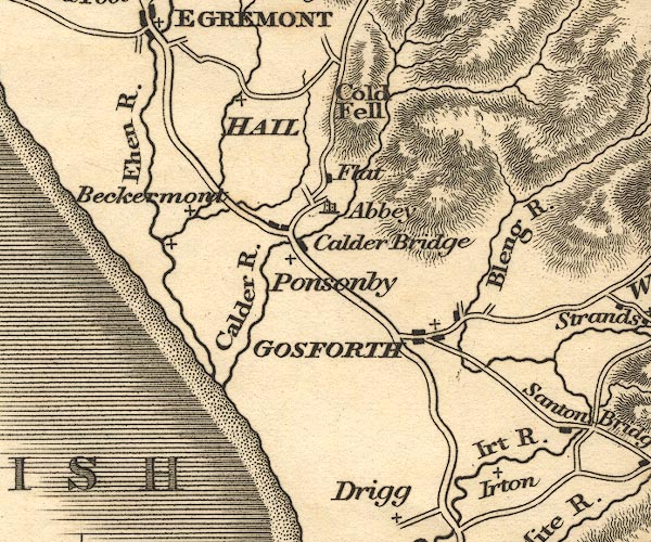 OT02NY00.jpg item:- JandMN : 48.1 Image © see bottom of page |
|
|
|
||
Lakes Guides menu.