 Old Cumbria Gazetteer
 |
 |
|
| Kentmere Pike, Kentmere | ||
| Kentmere Pike | ||
| civil parish:- | Kentmere (formerly Westmorland) | |
| civil parish:- | Longsleddale (formerly Westmorland) | |
| county:- | Cumbria | |
| locality type:- | hill | |
| coordinates:- | NY46530779 | |
| 1Km square:- | NY4607 | |
| 10Km square:- | NY40 | |
| altitude:- | 2397 feet | |
| altitude:- | 731m | |
|
|
||
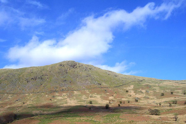 BNO95.jpg (taken 18.4.2007) 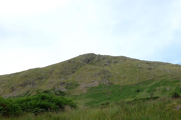 CBD67.jpg From W. (taken 15.7.2014) |
||
|
|
||
| evidence:- | old map:- OS 1881-82 New Series (outline edition) |
|
| source data:- | Map, engraving, area north of Kendal, Westmorland, New Series
one inch map, outline edition, sheet 39, scale 1 inch to 1 mile,
published by the Ordnance Survey, Southampton, Hampshire,
1881-82.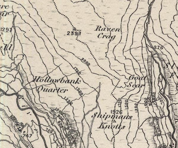 O21NY40T.jpg "2397" item:- JandMN : 61 Image © see bottom of page |
|
|
|
||
| evidence:- | descriptive text:- Wilson 1912 |
|
| source data:- | Guide book, Longsleddale, by F M Wilson, published by T Wilson,
Kendal, Westmorland, 1912. "The pathway up to the elevated plateau of Gatescarth is very steep and rough, but when you reach the top, the view is indescribably grand. ... on looking back you see the range of Kentmere hills in all their beauty of form and colour; ..." |
|
|
|
||
| evidence:- | map:- OS Six Inch (1956) placename:- Kentmere Pike |
|
| source data:- | Map series, various editions with the national grid, scale about
6 inches to 1 mile, published by the Ordnance Survey,
Southampton, Hampshire, scale 1 to 10560 from 1950s to 1960s,
then 1 to 10000 from 1960s to 2000s, superseded by print on
demand from digital data.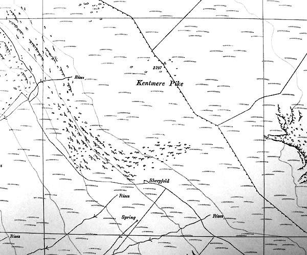 SINY4607.jpg "Kentmere Pike / 2397" trig point |
|
|
|
||
 Lakes Guides menu.