 Old Cumbria Gazetteer
 |
 |
|
| Knipe Scar, Knipe | ||
| Knipe Scar | ||
| locality:- | Knipe | |
| civil parish:- | Bampton (formerly Westmorland) | |
| county:- | Cumbria | |
| locality type:- | rocks | |
| coordinates:- | NY52761906 (etc) | |
| 1Km square:- | NY5219 | |
| 10Km square:- | NY51 | |
|
|
||
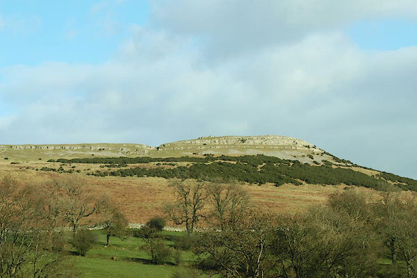
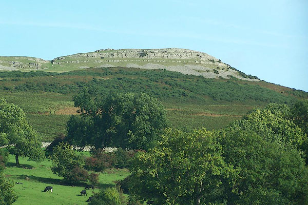 BMR46.jpg From Knipe Moor. (taken 19.9.2006) 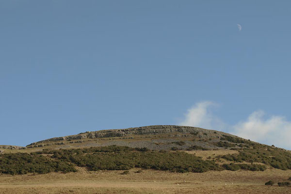 BUA54.jpg (taken 10.2.2011) |
||
|
|
||
| evidence:- | old map:- OS County Series (Wmd 13 4) placename:- Knipe Scar |
|
| source data:- | Maps, County Series maps of Great Britain, scales 6 and 25
inches to 1 mile, published by the Ordnance Survey, Southampton,
Hampshire, from about 1863 to 1948. |
|
|
|
||
| evidence:- | old map:- Jefferys 1770 (Wmd) placename:- Knipe Scar |
|
| source data:- | Map, 4 sheets, The County of Westmoreland, scale 1 inch to 1
mile, surveyed 1768, and engraved and published by Thomas
Jefferys, London, 1770.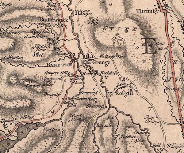 J5NY51NW.jpg "KNIPE SCAR" hill hachuring; hill or mountain item:- National Library of Scotland : EME.s.47 Image © National Library of Scotland |
|
|
|
||
| evidence:- | old map:- Cary 1789 (edn 1805) placename:- Knipe Scar |
|
| source data:- | Map, uncoloured engraving, Westmoreland, scale about 2.5 miles
to 1 inch, by John Cary, London, 1789; edition 1805.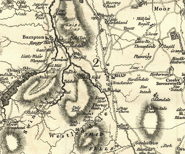 CY24NY51.jpg "Knipe Scar" hill hachuring item:- JandMN : 129 Image © see bottom of page |
|
|
|
||
| evidence:- | old map:- Ford 1839 map placename:- Knipe Scar |
|
| source data:- | Map, uncoloured engraving, Map of the Lake District of
Cumberland, Westmoreland and Lancashire, scale about 3.5 miles
to 1 inch, published by Charles Thurnam, Carlisle, and by R
Groombridge, 5 Paternoster Row, London, 3rd edn 1843.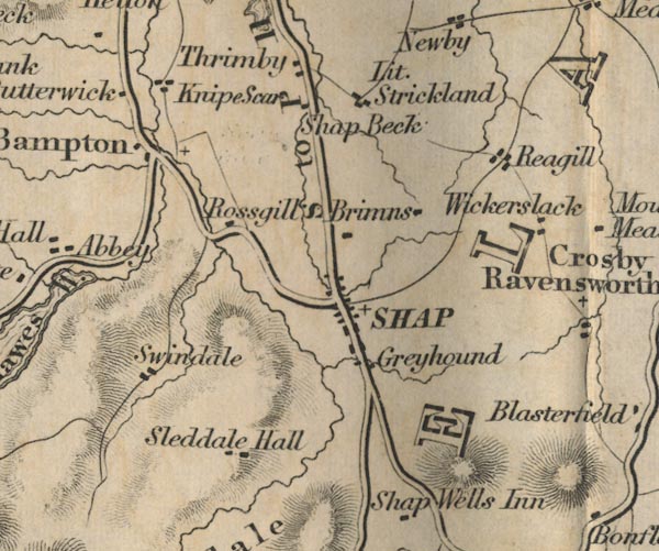 FD02NY51.jpg "Knipe Scar" Label by building/s, or the scar? item:- JandMN : 100.1 Image © see bottom of page |
|
|
|
||
 BQG48.jpg From Knipe Moor. (taken 14.3.2009) 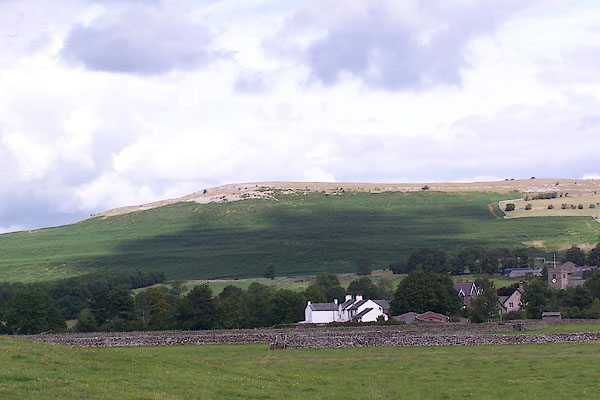 BJT63.jpg From near Halfa Bridge. (taken 22.8.2005) |
||
|
|
||
 Lakes Guides menu.