 Old Cumbria Gazetteer
 |
 |
|
| Lamb Bridge, Matterdale | ||
| Lamb Bridge | ||
| site name:- | Trout Beck (3) | |
| civil parish:- | Matterdale (formerly Cumberland) | |
| civil parish:- | Threlkeld (formerly Cumberland) | |
| county:- | Cumbria | |
| locality type:- | bridge | |
| coordinates:- | NY35372676 | |
| 1Km square:- | NY3526 | |
| 10Km square:- | NY32 | |
|
|
||
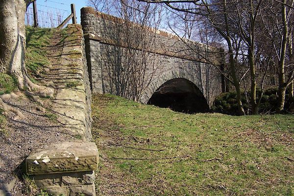 BNK54.jpg (taken 24.3.2007) 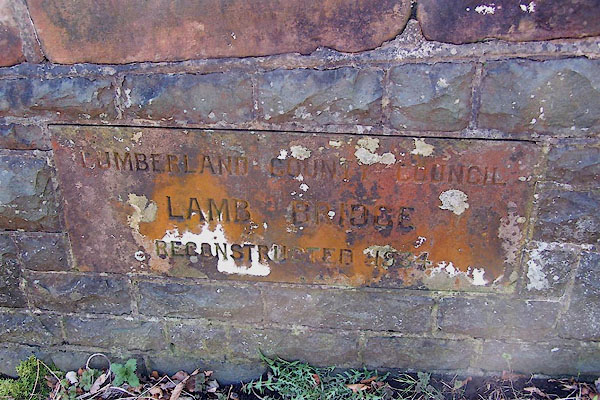 BNK55.jpg Plaque:- "CUMBERLAND COUNTY COUNCIL / LAMB BRIDGE / RECONSTRUCTED 1934" (taken 24.3.2007) |
||
|
|
||
| evidence:- | old map:- OS County Series (Cmd 57 14) placename:- Lamb Bridge |
|
| source data:- | Maps, County Series maps of Great Britain, scales 6 and 25
inches to 1 mile, published by the Ordnance Survey, Southampton,
Hampshire, from about 1863 to 1948. |
|
|
|
||
| evidence:- | old map:- Saxton 1579 |
|
| source data:- | Map, hand coloured engraving, Westmorlandiae et Cumberlandiae Comitatus ie Westmorland
and Cumberland, scale about 5 miles to 1 inch, by Christopher Saxton, London, engraved
by Augustinus Ryther, 1576, published 1579-1645.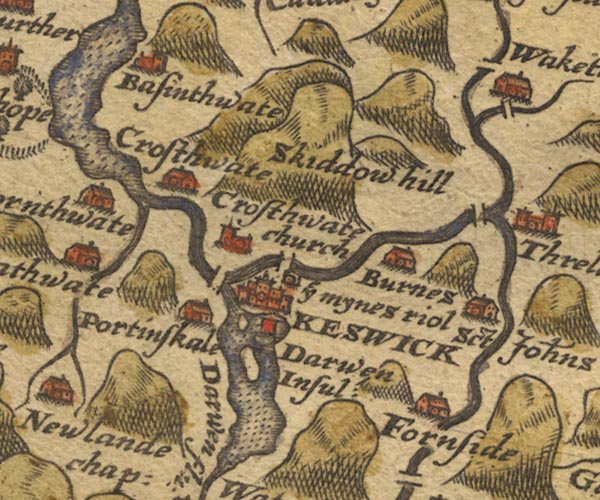 Sax9NY22.jpg NW of Wakethate. item:- private collection : 2 Image © see bottom of page |
|
|
|
||
| evidence:- | old map:- Speed 1611 (Cmd) |
|
| source data:- | Map, hand coloured engraving, Cumberland and the Ancient Citie
Carlile Described, scale about 4 miles to 1 inch, by John Speed,
1610, published by J Sudbury and George Humble, Popes Head
Alley, London, 1611-12.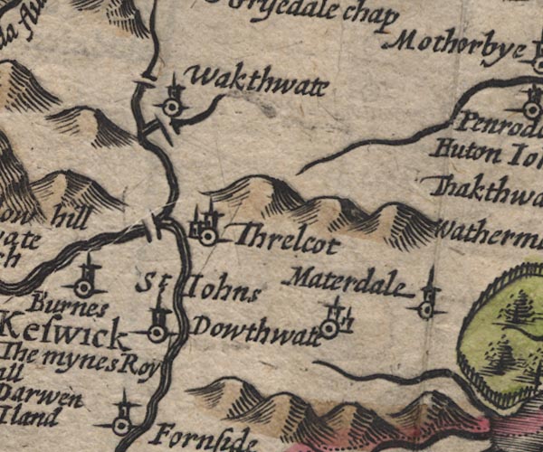 SP11NY32.jpg double line across the Glenderamackin item:- private collection : 16 Image © see bottom of page |
|
|
|
||
| evidence:- | old map:- Jansson 1646 |
|
| source data:- | Map, hand coloured engraving, Cumbria and Westmoria, ie
Cumberland and Westmorland, scale about 3.5 miles to 1 inch, by
John Jansson, Amsterdam, Netherlands, 1646.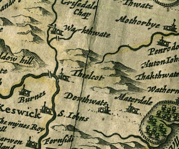 JAN3NY32.jpg Double line crossing the stream. item:- JandMN : 88 Image © see bottom of page |
|
|
|
||
| evidence:- | old map:- Morden 1695 (Cmd) |
|
| source data:- | Map, uncoloured engraving, Cumberland, scale about 4 miles to 1
inch, by Robert Morden, 1695, published by Abel Swale, the
Unicorn, St Paul's Churchyard, Awnsham, and John Churchill, the
Black Swan, Paternoster Row, London, 1695-1715.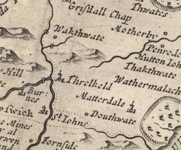 MD12NY32.jpg Double line over the Glenderamakin, near Wakthwate (Wallthwaite). item:- JandMN : 90 Image © see bottom of page |
|
|
|
||
| evidence:- | old map:- Donald 1774 (Cmd) |
|
| source data:- | Map, hand coloured engraving, 3x2 sheets, The County of Cumberland, scale about 1
inch to 1 mile, by Thomas Donald, engraved and published by Joseph Hodskinson, 29
Arundel Street, Strand, London, 1774.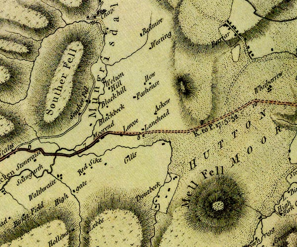 D4NY32NE.jpg double line across a river; a bridge over the Glendermacken item:- Carlisle Library : Map 2 Image © Carlisle Library |
|
|
|
||
| evidence:- | old map:- Bell 1892 placename:- Lamb Bridge |
|
| source data:- | Map, colour lithograph, Road Map of Cumberland, by George Joseph
Bell, scale about 2.5 miles to 1 inch, printed by Charles
Thurnam and Sons, Carlisle, Cumberland, 1892.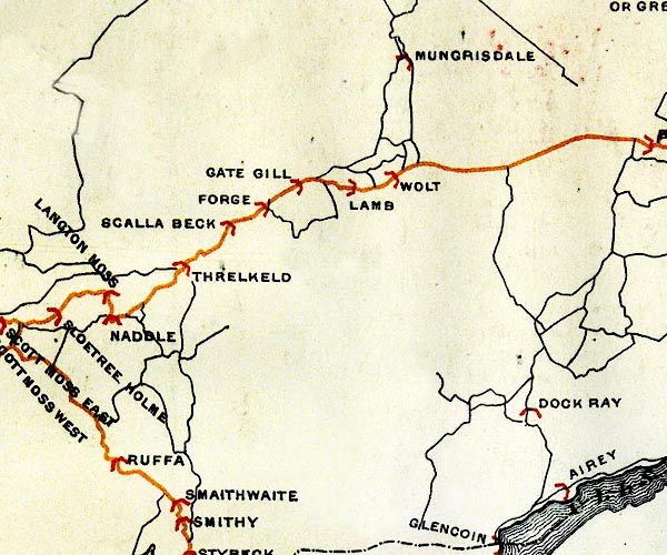 BEL9NY32.jpg "LAMB" bridge symbol Road map of Cumberland showing County Bridges item:- Carlisle Library : Map 38 Image © Carlisle Library |
|
|
|
||
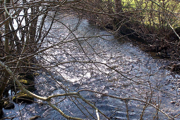 BNK56.jpg View of river. From Lamb Bridge. (taken 24.3.2007) |
||
|
|
||
 Lakes Guides menu.