 Old Cumbria Gazetteer
 |
 |
|
| Liddel, Nicholforest | ||
| Liddel | ||
| civil parish:- | Nicholforest (formerly Cumberland) | |
| county:- | Cumbria | |
| locality type:- | locality | |
| coordinates:- | NY46487921 (etc, guess) | |
| 1Km square:- | NY4679 | |
| 10Km square:- | NY47 | |
|
|
||
| evidence:- | old map:- Ogilby 1675 (plate 62) placename:- Lethell |
|
| source data:- | Raod strip map, uncoloured engraving, the Road from Carlisle to
Barwick, scale about 1 inch to 1 mile, by John Ogilby, London,
1675.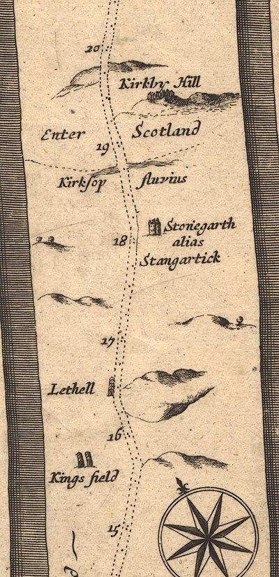 OG62m015.jpg In mile 16, Cumberland. "Lethell" houses on the left of the road. item:- JandMN : 83 Image © see bottom of page |
|
|
|
||
| evidence:- | old map:- Morden 1695 (Cmd) placename:- Lethel |
|
| source data:- | Map, uncoloured engraving, Cumberland, scale about 4 miles to 1
inch, by Robert Morden, 1695, published by Abel Swale, the
Unicorn, St Paul's Churchyard, Awnsham, and John Churchill, the
Black Swan, Paternoster Row, London, 1695-1715.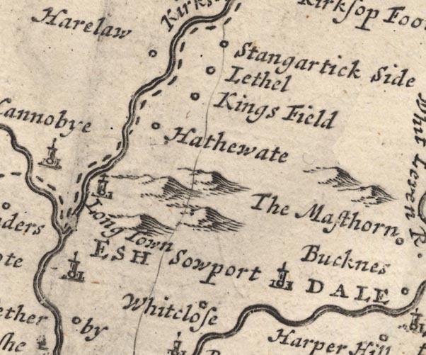 MD12NY47.jpg "Lethel" Circle. item:- JandMN : 90 Image © see bottom of page |
|
|
|
||
| evidence:- | probably old map:- Bowen 1720 (plate 161) placename:- Lethell |
|
| source data:- | Road strip map, uncoloured engraving, pl.161, part of The Road
from Carlisle to Barwick, scale about 2 miles to 1 inch, with
sections in Cumberland, and Scotland, published by Emanuel
Bowen, St Katherines, London, 1720.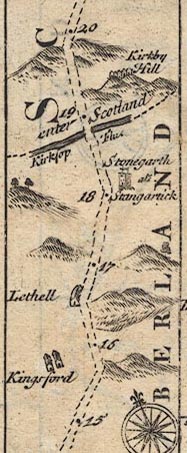 B161m15.jpg "Lethell" Buildings west side of road; mile 16½. item:- JandMN : 65.161 Image © see bottom of page |
|
|
|
||
| evidence:- | old map:- Bowen and Kitchin 1760 placename:- Lethel |
|
| source data:- | Map, hand coloured engraving, A New Map of the Counties of
Cumberland and Westmoreland Divided into their Respective Wards,
scale about 4 miles to 1 inch, by Emanuel Bowen and Thomas
Kitchin et al, published by T Bowles, Robert Sayer, and John
Bowles, London, 1760.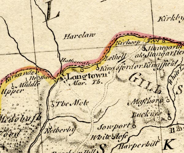 BO18NY47.jpg "Lethel" blocks, on road item:- Armitt Library : 2008.14.10 Image © see bottom of page |
|
|
|
||
| evidence:- | perhaps market notes:- item:- market |
|
| source data:- | www.history.ac.uk/cmh/gaz/gazweb2.htm | |
|
|
||
 Lakes Guides menu.