Old Cumbria Gazetteer
 |
 |
|
||
| Little Crosthwaite, Underskiddaw | ||||
| Little Crosthwaite | ||||
| civil parish:- | Underskiddaw (formerly Cumberland) | |||
| county:- | Cumbria | |||
| locality type:- | locality | |||
| locality type:- | buildings | |||
| coordinates:- | NY23462763 (etc) | |||
| 1Km square:- | NY2327 | |||
| 10Km square:- | NY22 | |||
|
|
||||
| evidence:- | old map:- OS County Series (Cmd 56 9) placename:- Little Crosthwaite placename:- Crosthwaite, Little |
|||
| source data:- | Maps, County Series maps of Great Britain, scales 6 and 25
inches to 1 mile, published by the Ordnance Survey, Southampton,
Hampshire, from about 1863 to 1948. |
|||
|
|
||||
| evidence:- | old map:- Saxton 1579 placename:- Crosthwate |
|||
| source data:- | Map, hand coloured engraving, Westmorlandiae et Cumberlandiae Comitatus ie Westmorland
and Cumberland, scale about 5 miles to 1 inch, by Christopher Saxton, London, engraved
by Augustinus Ryther, 1576, published 1579-1645.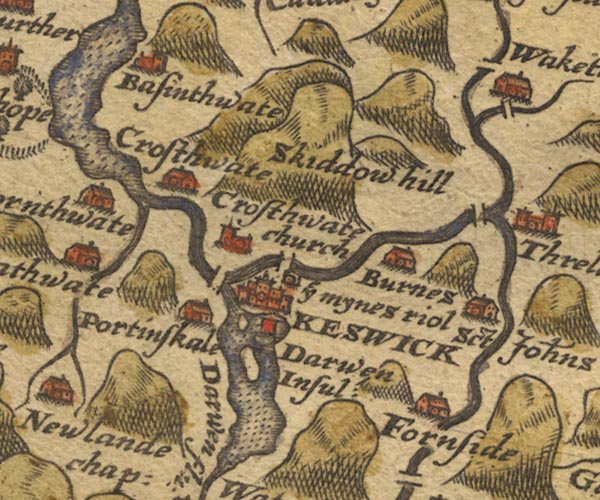 Sax9NY22.jpg Building, symbol for a hamlet, which may or may not have a nucleus. "Crosthwate" item:- private collection : 2 Image © see bottom of page |
|||
|
|
||||
| evidence:- | old map:- Speed 1611 (Cmd) |
|||
| source data:- | Map, hand coloured engraving, Cumberland and the Ancient Citie
Carlile Described, scale about 4 miles to 1 inch, by John Speed,
1610, published by J Sudbury and George Humble, Popes Head
Alley, London, 1611-12.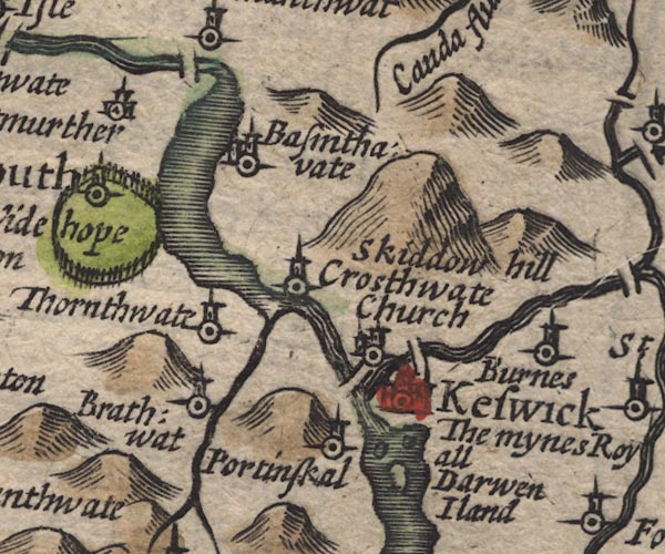 SP11NY22.jpg circle, tower; where the Newlands Beck and Derwent meet Bassenthwaite Lake item:- private collection : 16 Image © see bottom of page |
|||
|
|
||||
| evidence:- | old map:- Jansson 1646 placename:- Crosthwate |
|||
| source data:- | Map, hand coloured engraving, Cumbria and Westmoria, ie
Cumberland and Westmorland, scale about 3.5 miles to 1 inch, by
John Jansson, Amsterdam, Netherlands, 1646.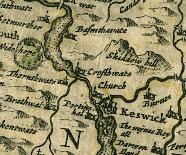 JAN3NY22.jpg "Crosthwate" Buildings and tower. item:- JandMN : 88 Image © see bottom of page |
|||
|
|
||||
| evidence:- | old map:- Ogilby 1675 (plate 96) placename:- Little Crosthwait |
|||
| source data:- | Road strip map, hand coloured engraving, the Road from Kendal to
Cockermouth, and the Road from Egremond to Carlisle, scale about
1 inch to 1 mile, by John Ogilby, London, 1675.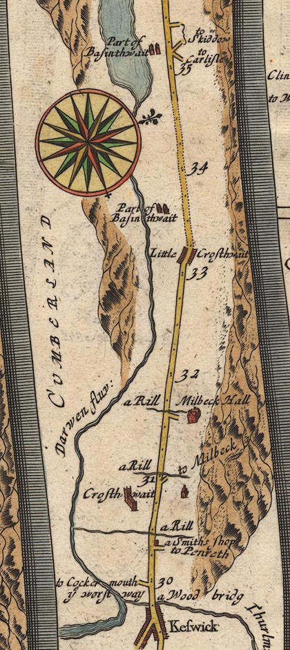 OG96m030.jpg In mile 33, Cumberland. "Little Crosthwait" houses each side of the road. item:- JandMN : 22 Image © see bottom of page |
|||
|
|
||||
| evidence:- | old map:- Berry 1679 placename:- Little Crossthwaite placename:- Crossthwaite, Little |
|||
| source data:- | Road map, diagram, The Grand Roads of England, engraved by John
Rich, made and published by William Berry, at the Sign of the
Globe, London, 1679. "Little Crossthw:" |
|||
|
|
||||
| evidence:- | old map:- Morden 1695 (Cmd) |
|||
| source data:- | Map, uncoloured engraving, Cumberland, scale about 4 miles to 1
inch, by Robert Morden, 1695, published by Abel Swale, the
Unicorn, St Paul's Churchyard, Awnsham, and John Churchill, the
Black Swan, Paternoster Row, London, 1695-1715.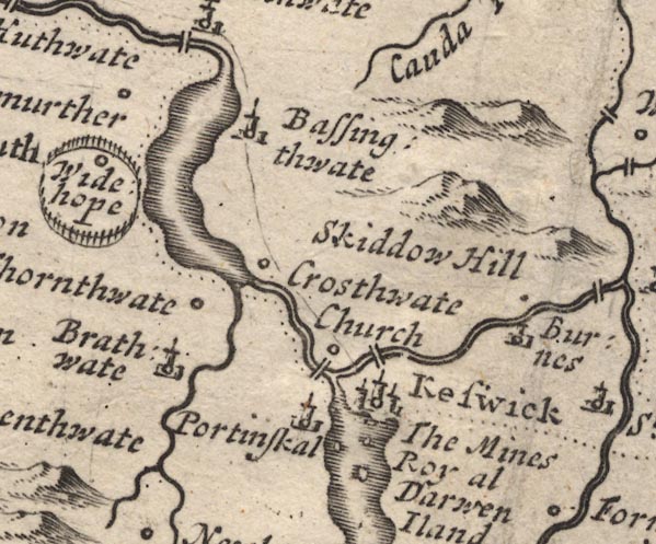 MD12NY22.jpg Circle, perhaps sharing a label with Crosthwaite? item:- JandMN : 90 Image © see bottom of page |
|||
|
|
||||
| evidence:- | old map:- Bowen 1720 (plate 260) placename:- Little Crosthwate |
|||
| source data:- | Road strip map, uncoloured engraving, pl.260, The Road from
Kendal to Cockermouth, scale about 2 miles to 1 inch, with
sections in Westmorland and Cumberland, published by Emanuel
Bowen, St Katherines, London, 1720.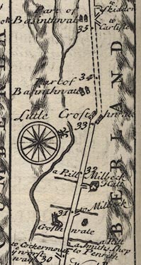 B260m30.jpg At mile 33. item:- private collection : 1.260 Image © see bottom of page |
|||
|
|
||||
| evidence:- | old map:- Bowen and Kitchin 1760 placename:- Little Crosthwate |
|||
| source data:- | Map, hand coloured engraving, A New Map of the Counties of
Cumberland and Westmoreland Divided into their Respective Wards,
scale about 4 miles to 1 inch, by Emanuel Bowen and Thomas
Kitchin et al, published by T Bowles, Robert Sayer, and John
Bowles, London, 1760.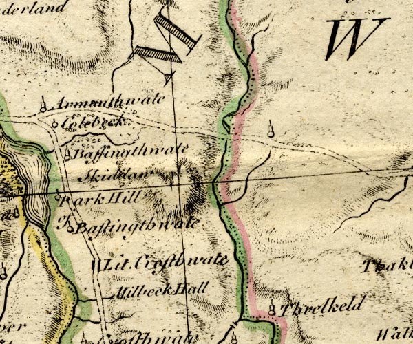 BO18NY22.jpg "Lit. Crosthwate" blocks, on road item:- Armitt Library : 2008.14.10 Image © see bottom of page |
|||
|
|
||||
| evidence:- | old map:- Donald 1774 (Cmd) placename:- Little Crosthwaite placename:- Crosthwaite, Little |
|||
| source data:- | Map, hand coloured engraving, 3x2 sheets, The County of Cumberland, scale about 1
inch to 1 mile, by Thomas Donald, engraved and published by Joseph Hodskinson, 29
Arundel Street, Strand, London, 1774.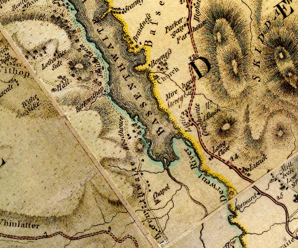 D4NY22NW.jpg "Little Crosthwaite / [ ]" block or blocks, labelled in lowercase; a hamlet or just a house, and an illegible resident item:- Carlisle Library : Map 2 Image © Carlisle Library |
|||
|
|
||||
| evidence:- | old map:- Crosthwaite 1783-94 (Bas) |
|||
| source data:- | Map, uncoloured engraving, An Accurate Map of Broadwater or
Bassenthwaite Lake, scale about 3 inches to 1 mile, by Peter
Crosthwaite, Keswick, Cumberland, 1783, version published 1800.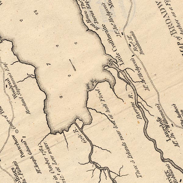 CT6NY22I.jpg "Revd. Mr. Braithwaite's" At Little Crosthwaite. item:- Armitt Library : 1959.191.4 Image © see bottom of page |
|||
|
|
||||
| evidence:- | old map:- Crosthwaite 1783-94 (Bas) placename:- Little Crosthwaite |
|||
| source data:- | Map, uncoloured engraving, An Accurate Map of Broadwater or
Bassenthwaite Lake, scale about 3 inches to 1 mile, by Peter
Crosthwaite, Keswick, Cumberland, 1783, version published 1800. CT6NY22I.jpg "Little Crosthwaite" item:- Armitt Library : 1959.191.4 Image © see bottom of page |
|||
|
|
||||
| evidence:- | old map:- Clarke 1787 map (Bassenthwaite Lake) placename:- Little Crossthwaite |
|||
| source data:- | Map, A Map of Broadwater and its Environs, ie Bassenthwaite
Lake, scale about 6.5 ins to 1 mile, by James Clarke, engraved
by Neele, 352 Strand, published by James Clarke, Penrith,
Cumberland and in London etc, 1787.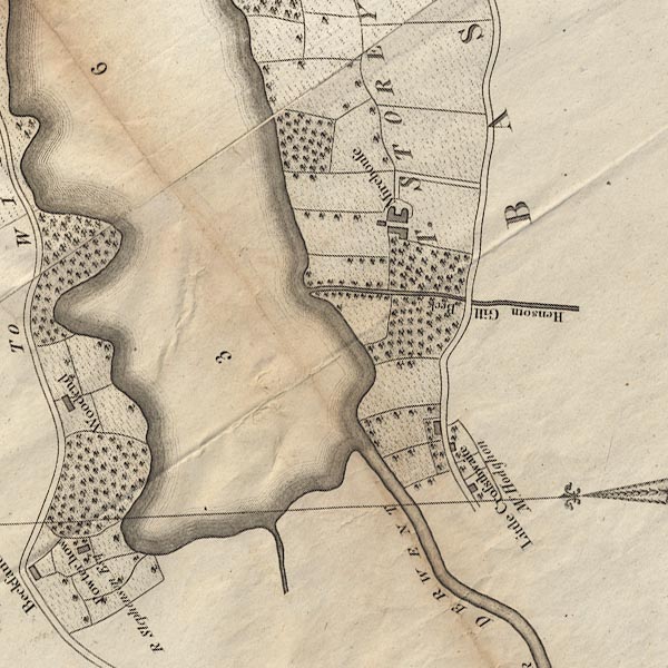 CL8NY22I.jpg "Little Crossthwaite / Mr. Hodghon" item:- private collection : 10.8 Image © see bottom of page |
|||
|
|
||||
| evidence:- | road book:- Cary 1798 (2nd edn 1802) placename:- Little Crosthwaite |
|||
| source data:- | Road book, itineraries, Cary's New Itinerary, by John Cary, 181
Strand, London, 2nd edn 1802. goto source goto source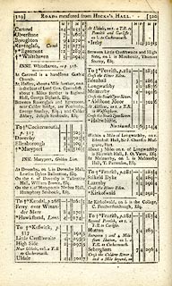 click to enlarge click to enlargeC38319.jpg page 319-320 "Little Crosthwaite" item:- JandMN : 228.1 Image © see bottom of page |
|||
|
|
||||
| evidence:- | old map:- Laurie and Whittle 1806 placename:- Little Crosthwaite |
|||
| source data:- | Road map, Completion of the Roads to the Lakes, scale about 10
miles to 1 inch, by Nathaniel Coltman? 1806, published by Robert
H Laurie, 53 Fleet Street, London, 1834. click to enlarge click to enlargeLw18.jpg "Little Crosthwaite 294¾" village or other place; distance from London item:- private collection : 18.18 Image © see bottom of page |
|||
|
|
||||
| evidence:- | old print:- Green 1822 (plate 39) placename:- Little Crosthwaite |
|||
| source data:- | Print, uncoloured soft ground etching, Little Crosthwaite, Underskiddaw, Cumberland,
by William Green, Ambleside, Westmorland, 1822.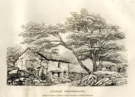 click to enlarge click to enlargeGN0839.jpg Plate 39 in Forty Etchings from Nature. printed at bottom:- "LITTLE CROSTHWAITE. / Etched from Nature by William Green, &Published at Ambleside, Feby. 1, 1822." item:- Armitt Library : A6644.39 Image © see bottom of page |
|||
|
|
||||
| places:- |
|
|||
|
||||
|
||||
|
||||
Lakes Guides menu.