 Old Cumbria Gazetteer
 |
 |
|
| Low Plains, Lazonby | ||
| Low Plains | ||
| civil parish:- | Lazonby (formerly Cumberland) | |
| county:- | Cumbria | |
| locality type:- | buildings | |
| coordinates:- | NY49534164 | |
| 1Km square:- | NY4941 | |
| 10Km square:- | NY44 | |
|
|
||
| evidence:- | old map:- OS County Series (Cmd 39 7) placename:- Low Plains placename:- Plains, Low |
|
| source data:- | Maps, County Series maps of Great Britain, scales 6 and 25
inches to 1 mile, published by the Ordnance Survey, Southampton,
Hampshire, from about 1863 to 1948. |
|
|
|
||
| evidence:- | old map:- Otley 1818 placename:- Low Plains |
|
| source data:- | Map, uncoloured engraving, The District of the Lakes,
Cumberland, Westmorland, and Lancashire, scale about 4 miles to
1 inch, by Jonathan Otley, 1818, engraved by J and G Menzies,
Edinburgh, Scotland, published by Jonathan Otley, Keswick,
Cumberland, et al, 1833.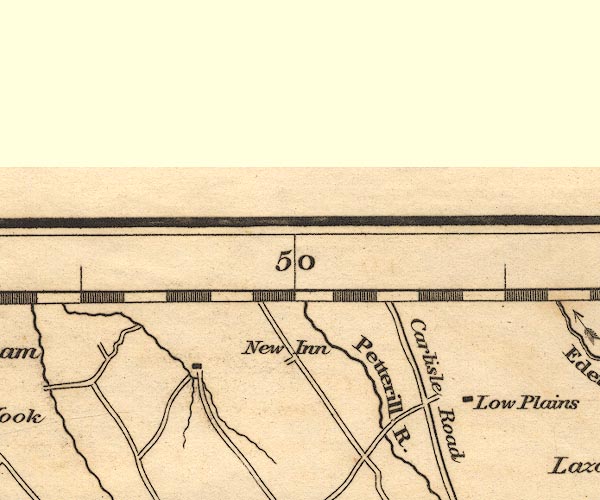 OT02NY44.jpg item:- JandMN : 48.1 Image © see bottom of page |
|
|
|
||
| evidence:- | database:- Listed Buildings 2010 placename:- Low Plains |
|
| source data:- | courtesy of English Heritage "LOW PLAINS / / / LAZONBY / EDEN / CUMBRIA / II / 74316 / NY4953441645" |
|
|
|
||
 Lakes Guides menu.