 Old Cumbria Gazetteer
 |
 |
|
| Low Water, Coniston | ||
| runs into:- |  Low Water Beck Low Water Beck |
|
|
|
||
| Low Water | ||
| locality:- | Old Man of Coniston, The | |
| civil parish:- | Coniston (formerly Lancashire) | |
| county:- | Cumbria | |
| locality type:- | tarn | |
| coordinates:- | SD27489825 | |
| 1Km square:- | SD2798 | |
| 10Km square:- | SD29 | |
| altitude:- | 1785 feet | |
| altitude:- | 544m | |
|
|
||
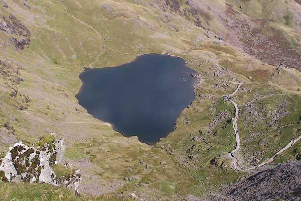 BTN49.jpg (taken 8.9.2010) 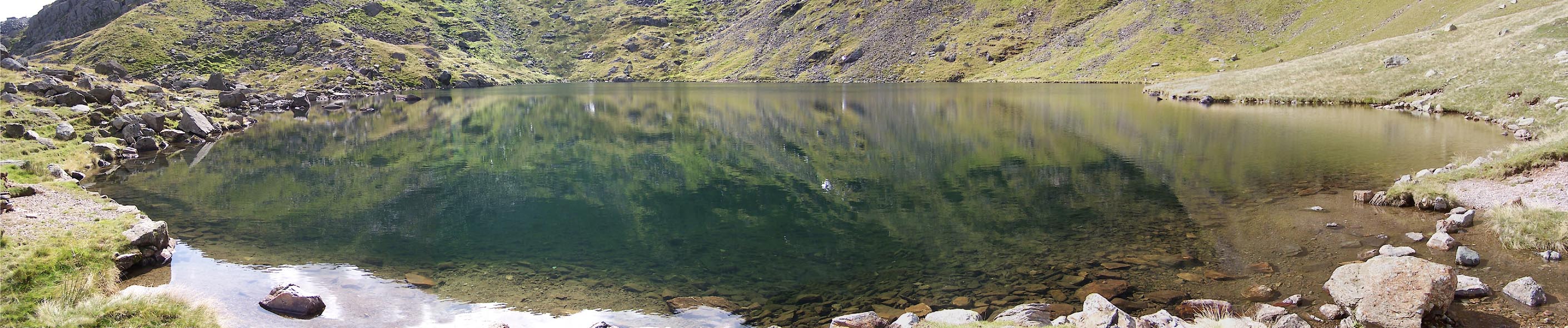 Click to enlarge BTN51.jpg (taken 8.9.2010) |
||
|
|
||
| evidence:- | old map:- OS County Series (Lan 4 3) placename:- Low Water placename:- Water, Low |
|
| source data:- | Maps, County Series maps of Great Britain, scales 6 and 25
inches to 1 mile, published by the Ordnance Survey, Southampton,
Hampshire, from about 1863 to 1948. |
|
|
|
||
| evidence:- | old map:- Otley 1818 |
|
| source data:- | Map, uncoloured engraving, The District of the Lakes,
Cumberland, Westmorland, and Lancashire, scale about 4 miles to
1 inch, by Jonathan Otley, 1818, engraved by J and G Menzies,
Edinburgh, Scotland, published by Jonathan Otley, Keswick,
Cumberland, et al, 1833.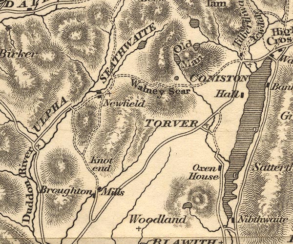 OT02SD29.jpg item:- JandMN : 48.1 Image © see bottom of page |
|
|
|
||
| evidence:- | descriptive text:- Otley 1823 (5th edn 1834) |
|
| source data:- | Guide book, A Concise Description of the English Lakes, the
mountains in their vicinity, and the roads by which they may be
visited, with remarks on the mineralogy and geology of the
district, by Jonathan Otley, published by the author, Keswick,
Cumberland now Cumbria, by J Richardson, London, and by Arthur
Foster, Kirkby Lonsdale, Cumbria, 1823; published 1823-49,
latterly as the Descriptive Guide to the English Lakes. goto source Page 36:- "... Low Water, placed on the Old Man's side, belies its name, as it occupies the highest level. ..." |
|
|
|
||
| evidence:- | old map:- Garnett 1850s-60s H placename:- Low Water |
|
| source data:- | Map of the English Lakes, in Cumberland, Westmorland and
Lancashire, scale about 3.5 miles to 1 inch, published by John
Garnett, Windermere, Westmorland, 1850s-60s.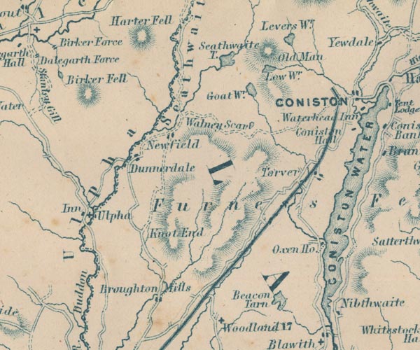 GAR2SD29.jpg "Low Wr." outline with shore form lines, lake or tarn item:- JandMN : 82.1 Image © see bottom of page |
|
|
|
||
| evidence:- | old text:- Martineau 1855 item:- altitude, Low Water |
|
| source data:- | Guide book, A Complete Guide to the English Lakes, by Harriet
Martineau, published by John Garnett, Windermere, Westmorland,
and by Whittaker and Co, London, 1855; published 1855-76. goto source Page 168:- "... The summit [Old Man of Coniston] is the edge of a line of rocks overhanging another tarn,- Low Water,- which is 2,000 feet above the sea level, ..." |
|
|
|
||
| evidence:- | old photograph:- Bell 1880s-1940s |
|
| source data:- | Photograph, sepia, Low Water, Coniston, Lancashire, by Herbert Bell, Ambleside, Westmorland,
1890s.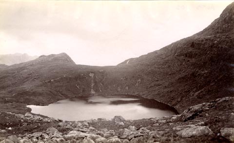 click to enlarge click to enlargeHB0447.jpg item:- Armitt Library : ALPS102 Image © see bottom of page |
|
|
|
||
| evidence:- | old print:- MacBride 1922 placename:- Low Water Tarn |
|
| source data:- | Print, colour, Low Water Tarn, Coniston, by Alfred Heaton Cooper, published by Adam
and Charles Black, 4-6 Soho Square, London, 2nd edn 1928.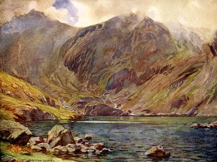 click to enlarge click to enlargeMB0123.jpg Tipped in opposite p.160 in Wild Lakeland by MacKenzie MacBride. printed at bottom:- "LOW WATER TARN, CONISTON" signed at lower left:- "A. HEATON COOPER" item:- JandMN : 195.25 Image © see bottom of page |
|
|
|
||
 BTN50.jpg (taken 8.9.2010) |
||
|
|
||
Lakes Guides menu.