 Old Cumbria Gazetteer
 |
 |
|
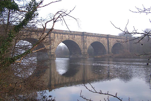
| Lune Aqueduct, Lancaster Canal | ||
| Lune Aqueduct | ||
| site name:- | Lancaster Canal | |
| site name:- | Lune, River | |
| county:- | Lancashire | |
| locality type:- | canal aqueduct | |
| locality type:- | aqueduct | |
| coordinates:- | SD48436390 | |
| 1Km square:- | SD4863 | |
| 10Km square:- | SD46 | |
|
|
||
 BNC50.jpg (taken 20.12.2006) 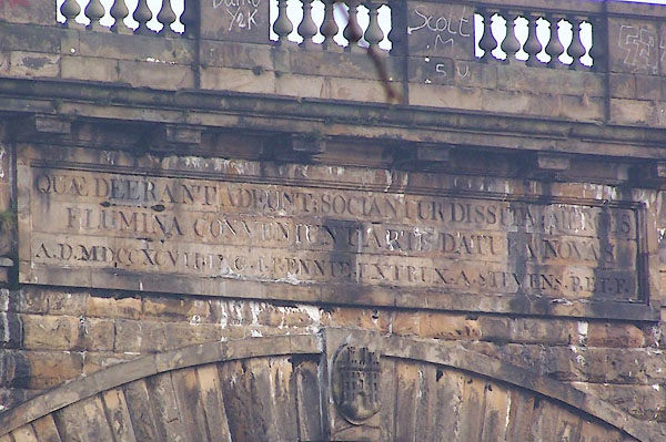 BNC51.jpg Inscribed stone, downstream face:- "[ ]" (taken 20.12.2006) |
||
|
|
||
| evidence:- | descriptive text:- West 1778 (11th edn 1821) |
|
| source data:- | Guide book, A Guide to the Lakes, by Thomas West, published by
William Pennington, Kendal, Cumbria once Westmorland, and in
London, 1778 to 1821. goto source goto sourcePage 24:- "[1] ... It [Lancaster Canal] is carried over the river Lune by the largest aqueduct in the kingdom, which is an amazing grand object, and is seen to advantage from Lancaster bridge, about two miles off." |
|
|
|
||
| evidence:- | old map:- West 1784 map |
|
| source data:- | Map, hand coloured engraving, A Map of the Lakes in Cumberland,
Westmorland and Lancashire, scale about 3.5 miles to 1 inch,
engraved by Paas, 53 Holborn, London, about 1784.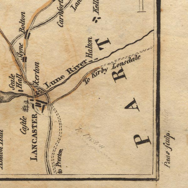 Ws02SD55.jpg The canal aqueduct over the River Lune is drawn with the river crossing over the canal. item:- Armitt Library : A1221.1 Image © see bottom of page |
|
|
|
||
| evidence:- | road book:- Cary 1798 (2nd edn 1802) |
|
| source data:- | Road book, itineraries, Cary's New Itinerary, by John Cary, 181
Strand, London, 2nd edn 1802. goto source click to enlarge click to enlargeC38273.jpg page 273-274 "At Lancaster, the Objects which claim the attention of the Traveller are ... and the Aqueduct Bridge over the Loyne near Beaumont Hall." item:- JandMN : 228.1 Image © see bottom of page |
|
|
|
||
| evidence:- | descriptive text:- Baker 1802 |
|
| source data:- | Perspective road map with sections in Lancashire, Westmorland,
and Cumberland, by J Baker, London 1802. pp.25-26:- "... a noble aqueduct will be found on the right of the road [Lancaster to Kendal], supporting a navigable canal, lately formed from the coal countries about Chorly, and which passes hence to Kendal. ..." |
|
|
|
||
| evidence:- | old map:- Baker 1802 |
|
| source data:- | Perspective road maps with sections in Lancashire, Westmorland
and Cumberland, by J Baker, London 1802.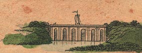 Bk03Vg25.jpg "Aquaduct" item:- private collection : 3 Image © see bottom of page |
|
|
|
||
| evidence:- | old map:- Otley 1818 |
|
| source data:- | Map, uncoloured engraving, The District of the Lakes,
Cumberland, Westmorland, and Lancashire, scale about 4 miles to
1 inch, by Jonathan Otley, 1818, engraved by J and G Menzies,
Edinburgh, Scotland, published by Jonathan Otley, Keswick,
Cumberland, et al, 1833. OT02SD46.jpg The canal is drawn in a very straight line over the river. item:- JandMN : 48.1 Image © see bottom of page |
|
|
|
||
 BNC52.jpg (taken 20.12.2006) 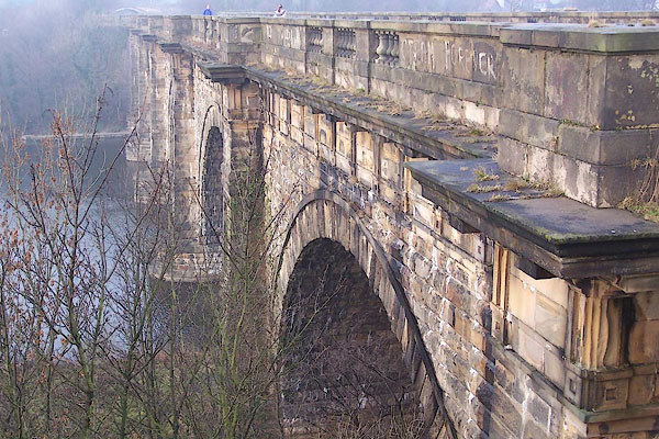 BNC53.jpg (taken 20.12.2006) 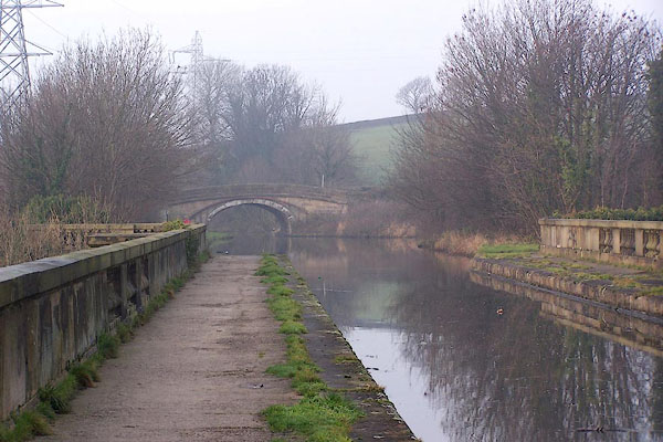 BNC54.jpg View N on canal. (taken 20.12.2006) 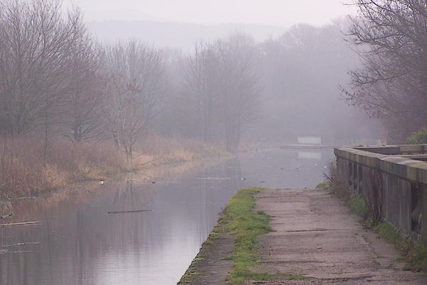 BNC55.jpg View S on canal. (taken 20.12.2006) |
||
|
|
||
| person:- | canal engineer : Rennie, John |
|
| person:- | builder : Stevens, Alexander and Son |
|
| date:- | 1797 |
|
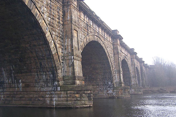
| Stone aqueduct, 600 feet across the River Lune, 60 feet high, designed by John Rennie,
built by Alexander Stevens and Son, 1794-96. |
||
| There is an inscription on the downsteam side, translated as:- |
||
| '[Things that were wanting are brought together; / Things remote are connected; /
Rivers themsleves meet by the assistance of art, / To afford new objects of commerce.]' |
||
| On the upstream side is:- |
||
| '[To Public Prosperity]' |
||
|
|
||
Lakes Guides menu.