 Old Cumbria Gazetteer
 |
 |
|
| Nether Bridge, Kendal | ||
| Nether Bridge | ||
| site name:- | Kent, River | |
| locality:- | Kendal | |
| civil parish:- | Kendal (formerly Westmorland) | |
| county:- | Cumbria | |
| locality type:- | bridge | |
| coordinates:- | SD51669193 | |
| 1Km square:- | SD5191 | |
| 10Km square:- | SD59 | |
|
|
||
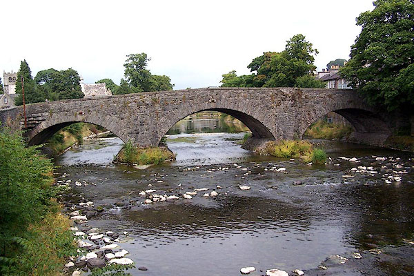 BJS42.jpg From downstream. (taken 14.8.2005) 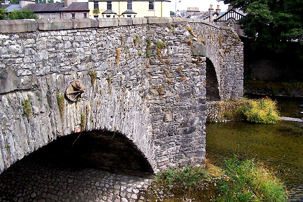 BJS43.jpg (taken 14.8.2005) |
||
|
|
||
| evidence:- | old map:- OS County Series (Wmd 38 8) placename:- Nether Bridge |
|
| source data:- | Maps, County Series maps of Great Britain, scales 6 and 25
inches to 1 mile, published by the Ordnance Survey, Southampton,
Hampshire, from about 1863 to 1948. |
|
|
|
||
| evidence:- | old map:- Speed 1611 placename:- Neither Bridge |
|
| source data:- | Map, hand coloured engraving, The Countie Westmorland and
Kendale the Cheif Towne, scale about 2.5 miles to 1 inch, by
John Speed, 1610, published by George Humble, Popes Head Alley,
London, 1611-12.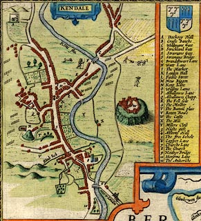 click to enlarge click to enlargeSP14Mk.jpg "9 Neither Bridge" bridge of 3 arches over the Kent item:- Armitt Library : 2008.14.5 Image © see bottom of page |
|
|
|
||
| evidence:- | old map:- Ogilby 1675 (plate 38) placename:- Neither Bridge |
|
| source data:- | Road strip map, hand coloured engraving, continuation of the
Road from London to Carlisle, scale about 1 inch to 1 mile, by
John Ogilby, London, 1675.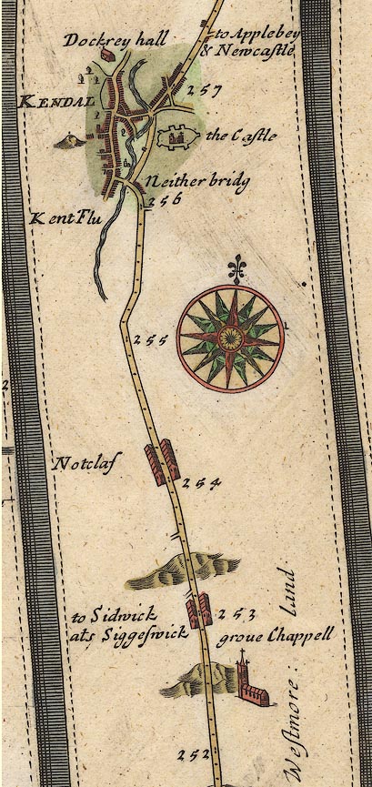 OG38m252.jpg In mile 256, Westmoreland. A turning into Kendal crosses the river at:- "Neither bridg" item:- JandMN : 21 Image © see bottom of page |
|
|
|
||
| evidence:- | old map:- Morden 1695 (Wmd) |
|
| source data:- | Map, hand coloured engraving, Westmorland, scale about 2.5 miles to 1 inch, by Robert
Morden, published by Abel Swale, the Unicorn, St Paul's Churchyard, Awnsham, and John
Churchill, the Black Swan, Paternoster Row, London, 1695.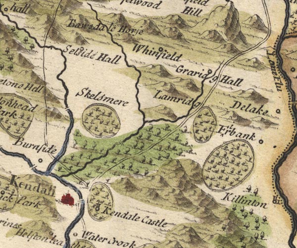 MD10SD59.jpg Road and river intersect. item:- JandMN : 24 Image © see bottom of page |
|
|
|
||
| evidence:- | old map:- Bowen 1720 (plate 93) placename:- Nether Bridge |
|
| source data:- | Strip maps, uncoloured engravings, road maps, The Road from
London to Carlisle, scale about 2 miles to 1 inch, with sections
in Lancashire and Westmorland, published by Emanuel Bowen, St
Katherines, London, 1720.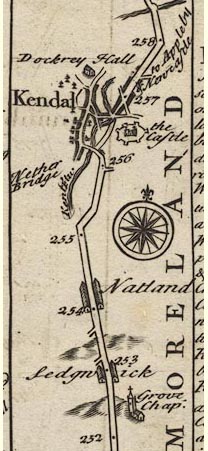 B093m252.jpg At mile 256+. item:- Dove Cottage : 2007.38.100 Image © see bottom of page |
|
|
|
||
| evidence:- | possibly old map:- Badeslade 1742 placename:- |
|
| source data:- | Map, uncoloured engraving, A Map of Westmorland North from
London, scale about 10 miles to 1 inch, with descriptive text,
by Thomas Badeslade, London, engraved and published by William
Henry Toms, Union Court, Holborn, London, 1742. click to enlarge click to enlargeBD12.jpg "" double line across a stream item:- Dove Cottage : 2007.38.62 Image © see bottom of page |
|
|
|
||
| evidence:- | descriptive text:- Simpson 1746 |
|
| source data:- | Atlas, three volumes of maps and descriptive text published as
'The Agreeable Historian, or the Compleat English Traveller
...', by Samuel Simpson, 1746. goto source goto sourcePage 1023:- "..." "Kendal, called also Kirkby Candale, i.e. a Church in the Valley upon the River Can, over which it has two Bridges of Stone, and one of Wood, ..." |
|
|
|
||
| evidence:- | old map:- Bowen and Kitchin 1760 placename:- Nether Bridge |
|
| source data:- | Map, hand coloured engraving, A New Map of the Counties of
Cumberland and Westmoreland Divided into their Respective Wards,
scale about 4 miles to 1 inch, by Emanuel Bowen and Thomas
Kitchin et al, published by T Bowles, Robert Sayer, and John
Bowles, London, 1760.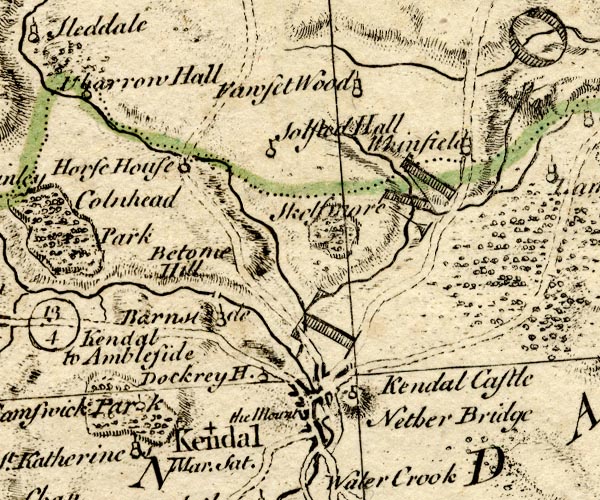 BO18SD49.jpg "Nether Bridge" road across the Kent item:- Armitt Library : 2008.14.10 Image © see bottom of page |
|
|
|
||
| evidence:- | old map:- Jefferys 1770 placename:- Nether Bridge |
|
| source data:- | Map, 4 sheets, The County of Westmoreland, scale 1 inch to 1
mile, surveyed 1768, and engraved and published by Thomas
Jefferys, London, 1770.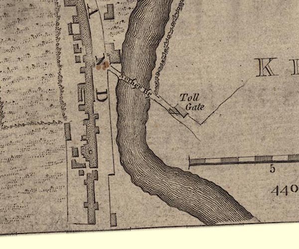 J55191U.jpg "Nether Br" bridge item:- National Library of Scotland : EME.s.47 Image © National Library of Scotland |
|
|
|
||
| evidence:- | old map:- Jefferys 1770 (Wmd) placename:- Nether Bridge |
|
| source data:- | Map, 4 sheets, The County of Westmoreland, scale 1 inch to 1
mile, surveyed 1768, and engraved and published by Thomas
Jefferys, London, 1770.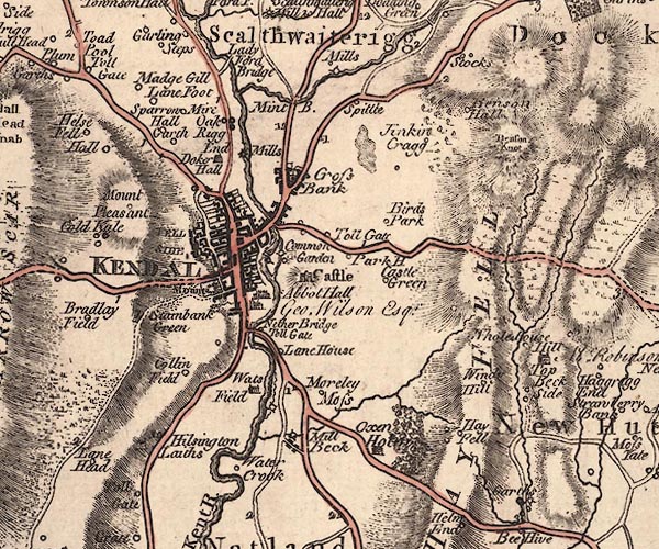 J5SD59SW.jpg "Nether Bridge" double line, road, across a stream; bridge item:- National Library of Scotland : EME.s.47 Image © National Library of Scotland |
|
|
|
||
| evidence:- | descriptive text:- West 1778 (11th edn 1821) |
|
| source data:- | Guide book, A Guide to the Lakes, by Thomas West, published by
William Pennington, Kendal, Cumbria once Westmorland, and in
London, 1778 to 1821. goto source Page 177:- "... The entrance [to Kendal] from the south is by another bridge, which makes a short awkward turn into the suburbs, but after that, the street opens well, and the town has a chearful appearance. ..." |
|
|
|
||
| evidence:- | old map:- Cary 1789 (edn 1805) placename:- Nether Bridge |
|
| source data:- | Map, uncoloured engraving, Westmoreland, scale about 2.5 miles
to 1 inch, by John Cary, London, 1789; edition 1805.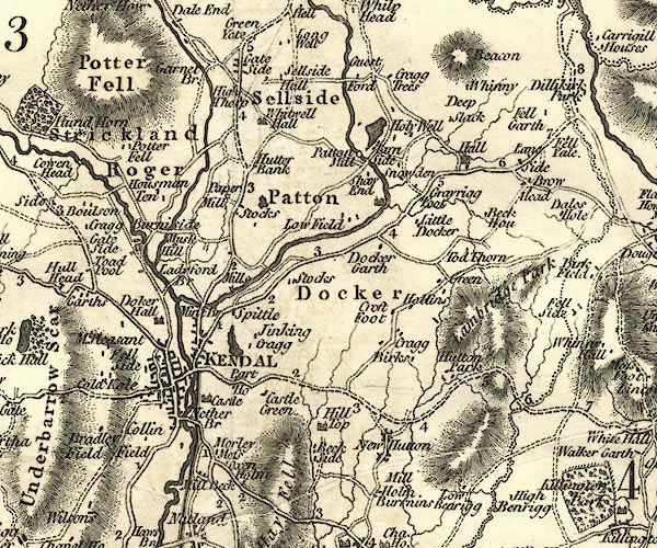 CY24SD59.jpg "Nether Br" road across a stream; bridge over the Kent item:- JandMN : 129 Image © see bottom of page |
|
|
|
||
| evidence:- | old map:- Cooper 1808 |
|
| source data:- | Map, hand coloured engraving, Westmoreland ie Westmorland, scale
about 9 miles to 1 inch, by H Cooper, 1808, published by R
Phillips, Bridge Street, Blackfriars, London, 1808. click to enlarge click to enlargeCOP4.jpg road across stream; bridge? item:- Dove Cottage : 2007.38.53 Image © see bottom of page |
|
|
|
||
| evidence:- | old map:- Otley 1818 |
|
| source data:- | Map, uncoloured engraving, The District of the Lakes,
Cumberland, Westmorland, and Lancashire, scale about 4 miles to
1 inch, by Jonathan Otley, 1818, engraved by J and G Menzies,
Edinburgh, Scotland, published by Jonathan Otley, Keswick,
Cumberland, et al, 1833. OT02SD59.jpg Implied by a road across the Kent. item:- JandMN : 48.1 Image © see bottom of page |
|
|
|
||
| evidence:- | old print:- Bradley 1901 |
|
| source data:- | Print, uncoloured lithograph, Kendal, Westmorland, by Joseph Pennell, published by
Macmillan and Co, London, 1901.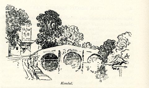 click to enlarge click to enlargeBRL177.jpg The bridge is Nether Bridge. On page 298 of Highways and Byways in the Lake District, by A G Bradley. printed at bottom:- "Kendal." item:- JandMN : 464.77 Image © see bottom of page |
|
|
|
||
| hearsay:- |
In 1376, Edward II made a grant of pontage for three years, the right to charge tolls,
to |
|
| "the good men of Kirkeby in Kendal for three years in aid of their bridge which is
broken down ..." |
||
| The signs of an old packhorse bridge on the downstream side are visible under the
arches; the middle section was an addition in 1722 when the route was turnpiked; the
upstream side dates from 1908. |
||
|
|
||
Lakes Guides menu.