 Old Cumbria Gazetteer
 |
 |
|
| Nibthwaite ironworks, Colton | ||
| gone | ||
| Nibthwaite Ironworks | ||
| locality:- | Nibthwaite | |
| civil parish:- | Colton (formerly Lancashire) | |
| county:- | Cumbria | |
| locality type:- | ironworks | |
| locality type:- | blast furnace | |
| coordinates:- | SD295883 | |
| 1Km square:- | SD2988 | |
| 10Km square:- | SD28 | |
|
|
||
| evidence:- | old map:- West 1784 map |
|
| source data:- | Map, hand coloured engraving, A Map of the Lakes in Cumberland,
Westmorland and Lancashire, scale about 3.5 miles to 1 inch,
engraved by Paas, 53 Holborn, London, about 1784.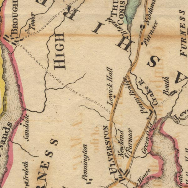 Ws02SD28.jpg "Furnace" By Nibthwaite. item:- Armitt Library : A1221.1 Image © see bottom of page |
|
|
|
||
| :- |
Furnace, foundry etc, from 1735; closed 1850. |
|
| Early blast furnace using charcoal fuel, the blowing worked by water power. |
||
| Marshall, J D &Davies-Shiel, Michael: 1977 (2nd edn): Industrial Archaeology of the
Lake Counties: Moon, Michael (Beckermet, Cumbria):: ISBN 0 904131 13 0 Lancaster and Wattleworth 1977 |
||
|
|
||
 Lakes Guides menu.