 Old Cumbria Gazetteer
 |
 |
|
| Over Kellet, Lancashire | ||
| Over Kellet | ||
| county:- | Lancashire | |
| locality type:- | buildings | |
| 1Km square:- | SD5269 | |
| 10Km square:- | SD56 | |
|
|
||
| evidence:- | probably old map:- West 1784 map placename:- Kellet |
|
| source data:- | Map, hand coloured engraving, A Map of the Lakes in Cumberland,
Westmorland and Lancashire, scale about 3.5 miles to 1 inch,
engraved by Paas, 53 Holborn, London, about 1784.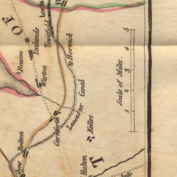 Ws02SD56.jpg item:- Armitt Library : A1221.1 Image © see bottom of page |
|
|
|
||
| evidence:- | old map:- Baker 1802 placename:- Kellet |
|
| source data:- | Perspective road maps with sections in Lancashire, Westmorland
and Cumberland, by J Baker, London 1802. Bk03Vg23.jpg "Kellet" item:- private collection : 3 Image © see bottom of page |
|
|
|
||
| evidence:- | probably old map:- Otley 1818 placename:- Kellet |
|
| source data:- | Map, uncoloured engraving, The District of the Lakes,
Cumberland, Westmorland, and Lancashire, scale about 4 miles to
1 inch, by Jonathan Otley, 1818, engraved by J and G Menzies,
Edinburgh, Scotland, published by Jonathan Otley, Keswick,
Cumberland, et al, 1833.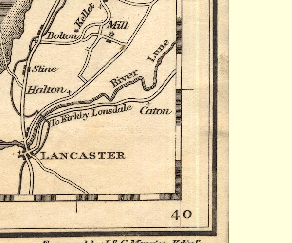 OT02SD56.jpg item:- JandMN : 48.1 Image © see bottom of page |
|
|
|
||
 Lakes Guides menu.