 Old Cumbria Gazetteer
 |
 |
|
| Penny Bridge, Egton with Newland | ||
| Penny Bridge | ||
| locality:- | Crake Valley | |
| civil parish:- | Egton with Newland (formerly Lancashire) | |
| county:- | Cumbria | |
| locality type:- | buildings | |
| coordinates:- | SD309828 | |
| 1Km square:- | SD3082 | |
| 10Km square:- | SD38 | |
|
|
||
| evidence:- | old map:- West 1784 map placename:- Penny Bridge |
|
| source data:- | Map, hand coloured engraving, A Map of the Lakes in Cumberland,
Westmorland and Lancashire, scale about 3.5 miles to 1 inch,
engraved by Paas, 53 Holborn, London, about 1784.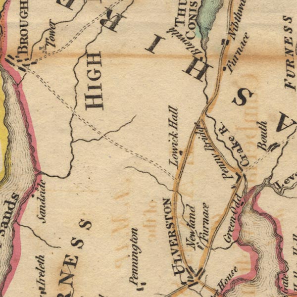 Ws02SD28.jpg item:- Armitt Library : A1221.1 Image © see bottom of page |
|
|
|
||
| evidence:- | road book:- Cary 1798 (2nd edn 1802) placename:- Penny Bridge |
|
| source data:- | Road book, itineraries, Cary's New Itinerary, by John Cary, 181
Strand, London, 2nd edn 1802. goto source goto source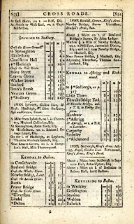 click to enlarge click to enlargeC38653.jpg page 653-654 "Penny Bridge" "Near Penny Bridge, J, Machell, Esq." item:- JandMN : 228.2 Image © see bottom of page |
|
|
|
||
| evidence:- | old map:- Laurie and Whittle 1806 placename:- Penny Bridge |
|
| source data:- | Road map, Completion of the Roads to the Lakes, scale about 10
miles to 1 inch, by Nathaniel Coltman? 1806, published by Robert
H Laurie, 53 Fleet Street, London, 1834. click to enlarge click to enlargeLw18.jpg "Penny Br." village or other place item:- private collection : 18.18 Image © see bottom of page |
|
|
|
||
| evidence:- | old map:- Otley 1818 placename:- Penny Bridge |
|
| source data:- | Map, uncoloured engraving, The District of the Lakes,
Cumberland, Westmorland, and Lancashire, scale about 4 miles to
1 inch, by Jonathan Otley, 1818, engraved by J and G Menzies,
Edinburgh, Scotland, published by Jonathan Otley, Keswick,
Cumberland, et al, 1833.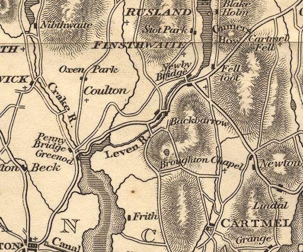 OT02SD38.jpg item:- JandMN : 48.1 Image © see bottom of page |
|
|
|
||
| evidence:- | old map:- Ford 1839 map placename:- Penny Bridge |
|
| source data:- | Map, uncoloured engraving, Map of the Lake District of
Cumberland, Westmoreland and Lancashire, scale about 3.5 miles
to 1 inch, published by Charles Thurnam, Carlisle, and by R
Groombridge, 5 Paternoster Row, London, 3rd edn 1843.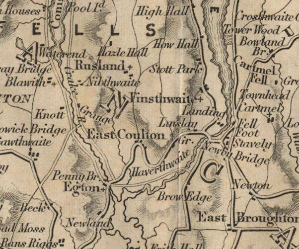 FD02SD38.jpg "Penny Bridge" item:- JandMN : 100.1 Image © see bottom of page |
|
|
|
||
| evidence:- | old map:- Garnett 1850s-60s H placename:- Penny Bridge |
|
| source data:- | Map of the English Lakes, in Cumberland, Westmorland and
Lancashire, scale about 3.5 miles to 1 inch, published by John
Garnett, Windermere, Westmorland, 1850s-60s.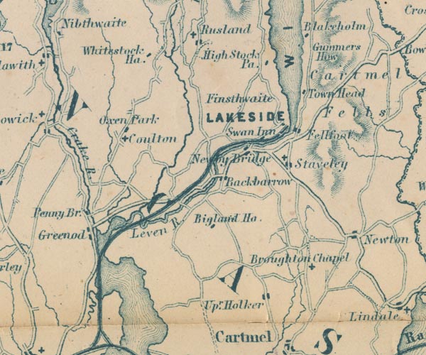 GAR2SD38.jpg "Penny Br." block, building item:- JandMN : 82.1 Image © see bottom of page |
|
|
|
||
Lakes Guides menu.