Old Cumbria Gazetteer
 |
 |
|
||
| Powter How, Above Derwent | ||||
| Powter How | ||||
| civil parish:- | Above Derwent (formerly Cumberland) | |||
| county:- | Cumbria | |||
| locality type:- | locality | |||
| locality type:- | buildings | |||
| coordinates:- | NY22032643 (etc) | |||
| 1Km square:- | NY2226 | |||
| 10Km square:- | NY22 | |||
|
|
||||
| evidence:- | old map:- OS County Series (Cmd 55 16) placename:- Powter How |
|||
| source data:- | Maps, County Series maps of Great Britain, scales 6 and 25
inches to 1 mile, published by the Ordnance Survey, Southampton,
Hampshire, from about 1863 to 1948. |
|||
|
|
||||
| evidence:- | old map:- Crosthwaite 1783-94 (Bas) placename:- Powterhow |
|||
| source data:- | Map, uncoloured engraving, An Accurate Map of Broadwater or
Bassenthwaite Lake, scale about 3 inches to 1 mile, by Peter
Crosthwaite, Keswick, Cumberland, 1783, version published 1800.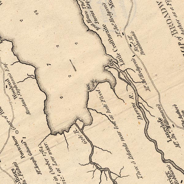 CT6NY22I.jpg "Powterhow / Mr. Joseph Gibson's" 2 houses shown. item:- Armitt Library : 1959.191.4 Image © see bottom of page |
|||
|
|
||||
| evidence:- | old text:- Clarke 1787 placename:- Powter How |
|||
| source data:- | Guide book, A Survey of the Lakes of Cumberland, Westmorland,
and Lancashire, written and published by James Clarke, Penrith,
Cumberland, and in London etc, 1787; published 1787-93. goto source goto sourcePage 92:- "... Powter-How, a pretty building, situated under a hill covered with oaks; these shelter it entirely from the northern blasts, and the front commands an elegant south view of the impending mountains; a view to which the low situation of the house gives additional grandeur, by increasing the apparent height of the surrounding hills. ..." |
|||
|
|
||||
| evidence:- | old map:- Clarke 1787 map (Bassenthwaite Lake) placename:- Powterhow |
|||
| source data:- | Map, A Map of Broadwater and its Environs, ie Bassenthwaite
Lake, scale about 6.5 ins to 1 mile, by James Clarke, engraved
by Neele, 352 Strand, published by James Clarke, Penrith,
Cumberland and in London etc, 1787.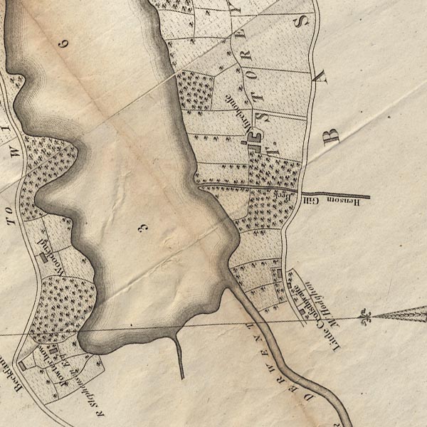 CL8NY22I.jpg "Powterhow / R Stephenson Esqr." item:- private collection : 10.8 Image © see bottom of page |
|||
|
|
||||
| evidence:- | presumably old map:- Ford 1839 map placename:- Powder Hill |
|||
| source data:- | Map, uncoloured engraving, Map of the Lake District of
Cumberland, Westmoreland and Lancashire, scale about 3.5 miles
to 1 inch, published by Charles Thurnam, Carlisle, and by R
Groombridge, 5 Paternoster Row, London, 3rd edn 1843.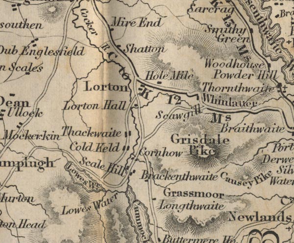 FD02NY12.jpg "Powder Hill" Hill hachuring. item:- JandMN : 100.1 Image © see bottom of page |
|||
|
|
||||
| places:- |
|
|||
|
||||
|
||||
Lakes Guides menu.