 Old Cumbria Gazetteer
 |
 |
|
| Rampson, Stainmore | ||
| Rampson | ||
| civil parish:- | Stainmore (formerly Westmorland) | |
| county:- | Cumbria | |
| locality type:- | buildings | |
| coordinates:- | NY85411331 | |
| 1Km square:- | NY8513 | |
| 10Km square:- | NY81 | |
|
|
||
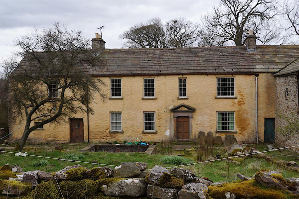 CAH94.jpg (taken 11.4.2014) 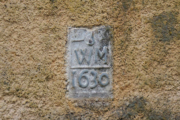 CAH95.jpg Date stone:- "[S] / W M / 1630" (taken 11.4.2014) |
||
|
|
||
| evidence:- | old map:- OS County Series (Wmd 24 2) placename:- Rampson |
|
| source data:- | Maps, County Series maps of Great Britain, scales 6 and 25
inches to 1 mile, published by the Ordnance Survey, Southampton,
Hampshire, from about 1863 to 1948. |
|
|
|
||
| evidence:- | database:- Listed Buildings 2010 placename:- Rampson Farm item:- date stone (1630) |
|
| source data:- | courtesy of English Heritage "RAMPSON FARMHOUSE AND ATTACHED OUTBUILDINGS / / / STAINMORE / EDEN / CUMBRIA / II / 461112 / NY8541913313" "RAMPSON FARMHOUSE / / / STAINMORE / EDEN / CUMBRIA / II / 73427 / NY8523213437" |
|
|
|
||
 Lakes Guides menu.