 Old Cumbria Gazetteer
 |
 |
|
| Ribton Hall, Camerton | ||
| Ribton Hall | ||
| locality:- | Ribton | |
| civil parish:- | Camerton (formerly Cumberland) | |
| county:- | Cumbria | |
| locality type:- | buildings | |
| coordinates:- | NY04763054 | |
| 1Km square:- | NY0430 | |
| 10Km square:- | NY03 | |
|
|
||
| evidence:- | old map:- OS County Series (Cmd 54 1) placename:- Ribton Hall |
|
| source data:- | Maps, County Series maps of Great Britain, scales 6 and 25
inches to 1 mile, published by the Ordnance Survey, Southampton,
Hampshire, from about 1863 to 1948. |
|
|
|
||
| evidence:- | old map:- Saxton 1579 placename:- Ribton |
|
| source data:- | Map, hand coloured engraving, Westmorlandiae et Cumberlandiae Comitatus ie Westmorland
and Cumberland, scale about 5 miles to 1 inch, by Christopher Saxton, London, engraved
by Augustinus Ryther, 1576, published 1579-1645.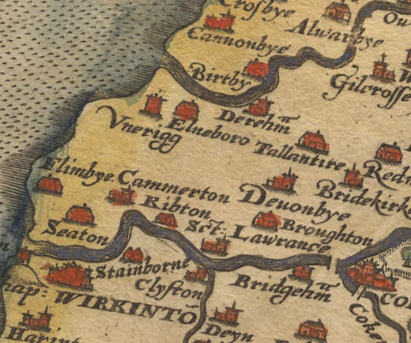 Sax9NY03.jpg Building, symbol for a hamlet, which may or may not have a nucleus. "Ribton" item:- private collection : 2 Image © see bottom of page |
|
|
|
||
| evidence:- | possibly old map:- Mercator 1595 (edn?) placename:- St Laurence |
|
| source data:- | Map, hand coloured engraving, Northumbria, Cumberlandia, et
Dunelmensis Episcopatus, ie Northumberland, Cumberland and
Durham etc, scale about 6.5 miles to 1 inch, by Gerard Mercator,
Duisberg, Germany, about 1595.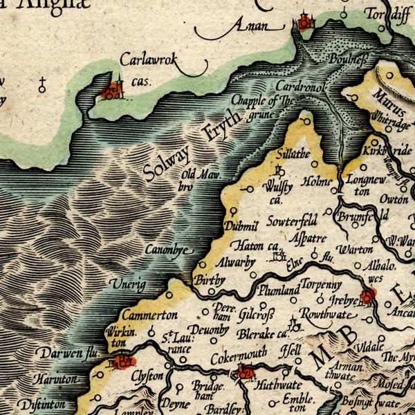 MER8CumB.jpg "St. Laurence" circle item:- JandMN : 169 Image © see bottom of page |
|
|
|
||
| evidence:- | old map:- Speed 1611 (Cmd) placename:- Ribton placename:- St Lawrance |
|
| source data:- | Map, hand coloured engraving, Cumberland and the Ancient Citie
Carlile Described, scale about 4 miles to 1 inch, by John Speed,
1610, published by J Sudbury and George Humble, Popes Head
Alley, London, 1611-12.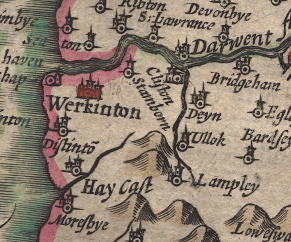 SP11NY02.jpg "Ribton" circle, building, tower AND circle, tower item:- private collection : 16 Image © see bottom of page |
|
|
|
||
| evidence:- | old map:- Jansson 1646 placename:- Ribton |
|
| source data:- | Map, hand coloured engraving, Cumbria and Westmoria, ie
Cumberland and Westmorland, scale about 3.5 miles to 1 inch, by
John Jansson, Amsterdam, Netherlands, 1646.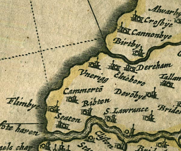 JAN3NY03.jpg "Ribton" Buildings and tower. item:- JandMN : 88 Image © see bottom of page |
|
|
|
||
| evidence:- | possibly old map:- Morden 1695 (Cmd) placename:- St Lawrence |
|
| source data:- | Map, uncoloured engraving, Cumberland, scale about 4 miles to 1
inch, by Robert Morden, 1695, published by Abel Swale, the
Unicorn, St Paul's Churchyard, Awnsham, and John Churchill, the
Black Swan, Paternoster Row, London, 1695-1715.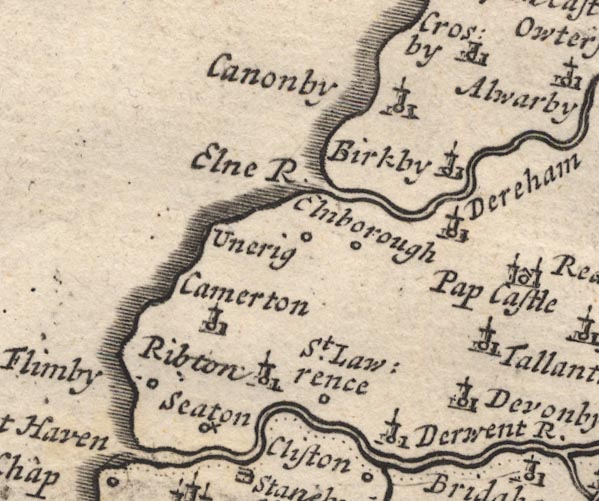 MD12NY03.jpg "St. Lawrence" Circle. item:- JandMN : 90 Image © see bottom of page |
|
|
|
||
| evidence:- | old map:- Bowen and Kitchin 1760 placename:- Ribston |
|
| source data:- | Map, hand coloured engraving, A New Map of the Counties of
Cumberland and Westmoreland Divided into their Respective Wards,
scale about 4 miles to 1 inch, by Emanuel Bowen and Thomas
Kitchin et al, published by T Bowles, Robert Sayer, and John
Bowles, London, 1760.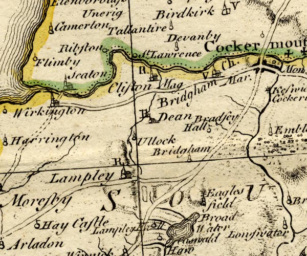 BO18NY02.jpg "Ribston" circle item:- Armitt Library : 2008.14.10 Image © see bottom of page |
|
|
|
||
| evidence:- | old map:- Donald 1774 (Cmd) placename:- Ribton Hall |
|
| source data:- | Map, hand coloured engraving, 3x2 sheets, The County of Cumberland, scale about 1
inch to 1 mile, by Thomas Donald, engraved and published by Joseph Hodskinson, 29
Arundel Street, Strand, London, 1774.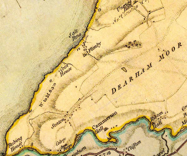 D4NY03SW.jpg "Ribton Hall" house item:- Carlisle Library : Map 2 Image © Carlisle Library |
|
|
|
||
| evidence:- | old print:- Taylor 1892 placename:- Ribton Hall |
|
| source data:- | Print, halftone photograph, Ribton Hall, Camerton, Cumberland, published for the Cumberland
and Westmorland Antiquarian and Archaeological Society, by Titus Wilson, Kendal, Westmorland,
and by Charles Thurnam and Sons, Carlisle, Cumberland, 1892.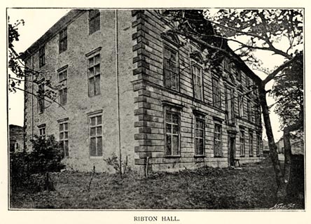 click to enlarge click to enlargeTY5077.jpg Tipped in opposite p.334 of The Old Manorial Halls of Cumberland and Westmorland, by Michael Waistell Taylor. item:- Armitt Library : A785.77 Image © see bottom of page |
|
|
|
||
 Lakes Guides menu.