 Old Cumbria Gazetteer
 |
 |
|
| Riggindale, Bampton | ||
| Riggindale | ||
| civil parish:- | Bampton (formerly Westmorland) | |
| civil parish:- | Shap Rural (formerly Westmorland) | |
| county:- | Cumbria | |
| locality type:- | valley | |
| coordinates:- | NY460117 (etc) | |
| 1Km square:- | NY4611 | |
| 10Km square:- | NY41 | |
|
|
||
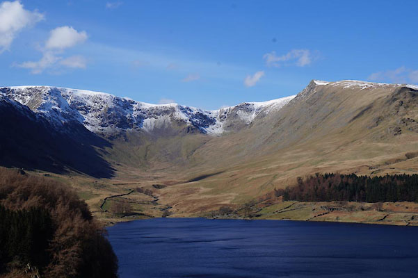
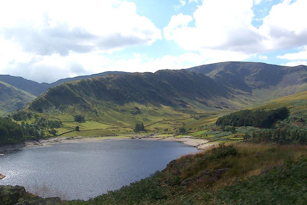 BJT68.jpg Riggindale Crag and Riggindale, High Street, and Haweswater. (taken 22.8.2005) 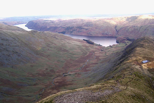 BPV13.jpg Hawes Water behind, from Long Stile. (taken 17.11.2008) |
||
|
|
||
| evidence:- | old map:- Jefferys 1770 (Wmd) |
|
| source data:- | Map, 4 sheets, The County of Westmoreland, scale 1 inch to 1
mile, surveyed 1768, and engraved and published by Thomas
Jefferys, London, 1770.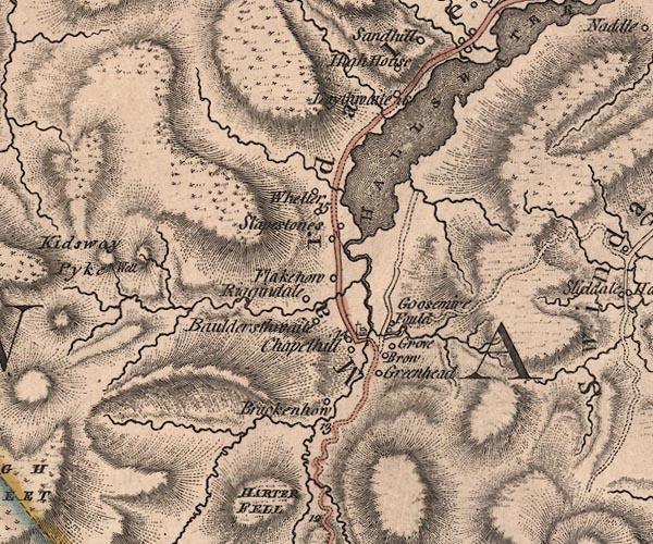 J5NY41SE.jpg hill hachuring; valley item:- National Library of Scotland : EME.s.47 Image © National Library of Scotland |
|
|
|
||
| evidence:- | old text:- Green 1814 placename:- Riggendale |
|
| source data:- | Set of prints, soft ground etchings, Sixty Small Prints, with
text, A Description of a Series of Sixty Small Prints, by
William Green, Ambleside, Westmorland, 1814. goto source goto sourcepage 34:- "..." "Branstree, Harter Fell, Riggendale, High Street, Kidstay, and Whelter, are all grand mountains lying at the head of the lake [Hawes Water] ..." |
|
|
|
||
 CAD73.jpg (taken 24.3.2014) 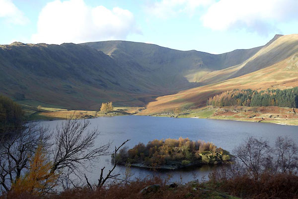 BZR01.jpg (taken 12.11.2013) 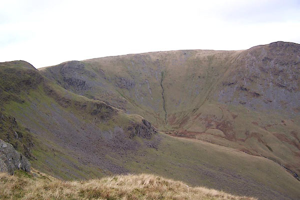 BPV15.jpg Head of Riggindale; Short Stile, Twopenny Crag, Sale Pot, etc. (taken 17.11.2008)  BOT61.jpg Riggindale beyond the line of the crag. (taken 4.3.2008) |
||
|
|
||
Lakes Guides menu.