 Old Cumbria Gazetteer
 |
 |
|
| Seathwaite Fell, Borrowdale | ||
| Seathwaite Fell | ||
| civil parish:- | Borrowdale (formerly Cumberland) | |
| county:- | Cumbria | |
| locality type:- | hill | |
| locality type:- | fell | |
| coordinates:- | NY22901018 | |
| 1Km square:- | NY2210 | |
| 10Km square:- | NY21 | |
| altitude:- | 1972 feet | |
| altitude:- | 601m | |
|
|
||
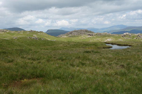
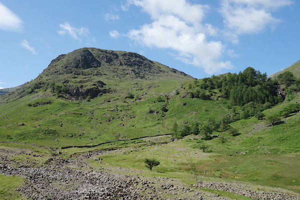 CAY68.jpg (taken 23.6.2014) 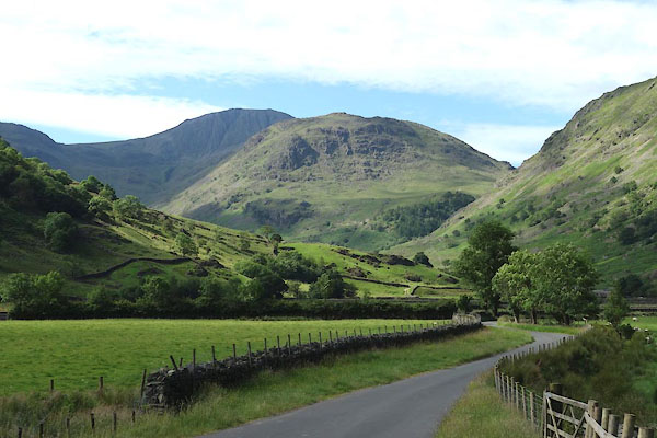 CAY67.jpg (taken 23.6.2014) |
||
|
|
||
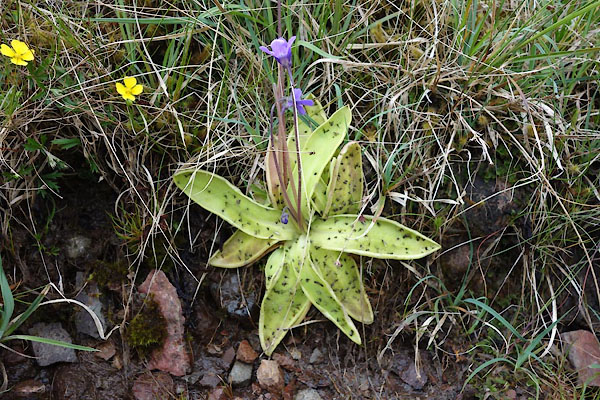 CAY75.jpg Common butterwort, Pinguicula vulgaris. (taken 23.6.2014) 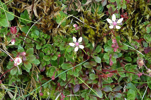 CAY76.jpg Saxifrage, Saxifraga sp. (taken 23.6.2014) 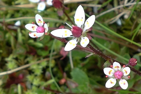 CAY77.jpg Saxifrage, Saxifraga sp. (taken 23.6.2014) |
||
|
|
||
| evidence:- | old map:- OS County Series (Cmd 75 5) placename:- Seathwaite Fell |
|
| source data:- | Maps, County Series maps of Great Britain, scales 6 and 25
inches to 1 mile, published by the Ordnance Survey, Southampton,
Hampshire, from about 1863 to 1948. |
|
|
|
||
| evidence:- | old text:- Green 1810 placename:- Sprinkling Mountain |
|
| source data:- | Set of prints, soft ground etchings, Sixty Studies from Nature,
by William Green, Ambleside, Westmorland, drawn 1808-10,
published 1810. goto source goto sourcepage 78:- "... The source of the river passing under this bridge [Folly Bridge] is in Sprinkling Tarn, which, decending the mountain Sprinkling, unites itself with Sty Head Tarn; and having reached the valley, winds between the village of Seathwaite and" page 79:- "the Black Lead Mines, to Folly Bridge, ..." |
|
|
|
||
| evidence:- | old print:- Green 1814 (plate 37) |
|
| source data:- | Print, tinted soft ground etching, Stockley Bridge, Borrowdale, Cumberland, by William
Green, Ambleside, Westmorland, 1814.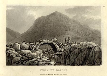 click to enlarge click to enlargeGN1037.jpg Plate 37 in Sixty Small Prints. printed at top right:- "37" printed at bottom:- "STOCKLEY BRIDGE. / Published at Ambleside Augst. 1, 1814, by Wm. Green." item:- Armitt Library : A6653.37 Image © see bottom of page |
|
|
|
||
| evidence:- | old print:- Green 1814 (plate 37) |
|
| source data:- | Print, uncoloured soft ground etching, Stockley Bridge, Borrowdale, Cumberland, by
William Green, Ambleside, Westmorland, 1814.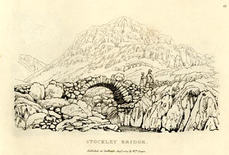 click to enlarge click to enlargeGN0937.jpg Plate 37 in Sixty Small Prints. printed at top right:- "37" printed at bottom:- "STOCKLEY BRIDGE. / Published at Ambleside Augst. 1, 1814, by Wm. Green." item:- Armitt Library : A6656.37 Image © see bottom of page |
|
|
|
||
| evidence:- | perhaps old text:- Green 1814 placename:- Sprinkling mountain |
|
| source data:- | Set of prints, soft ground etchings, Sixty Small Prints, with
text, A Description of a Series of Sixty Small Prints, by
William Green, Ambleside, Westmorland, 1814. goto source page 20:- "..." "The source of the stream passing under this bridge [Longthwaite Bridge] is in Sprinkling Tarn, which descending the mountain Sprinkling, unites itself with Sty Head Tarn, and having reached the valley, winds between the village of Seathwaite and the black lead mines to Langthwaite Bridge, which is a quarter of a mile from Rosthwaite." "..." "This [Stockley Bridge] is the last bridge in Borrowdale, on the road from Rosthwaite to Wasdale Head, and it is over a gill tumbling down the southern side of the mountain Sprinkling, which mountain is the back-ground of this scene." |
|
|
|
||
| evidence:- | probably outline view:- Jenkinson 1875 placename:- Sprinkling Fell |
|
| source data:- | Print, lithograph, outline view, Panoramic Sketches from Skiddaw, Cumberland, by Edwin
A Pettitt, London, published by Edward Stanford, 55 Charing Cross, London, 1875.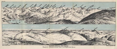 click to enlarge click to enlargeJk01E2.jpg "... Sprinkling Fell ..." item:- JandMN : 28.8 Image © see bottom of page |
|
|
|
||
 CAY81.jpg On top of the fell. (taken 23.6.2014) 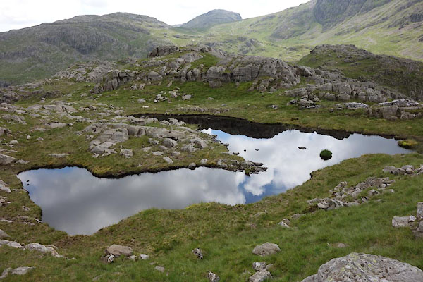 CAY82.jpg On top of the fell. (taken 23.6.2014) 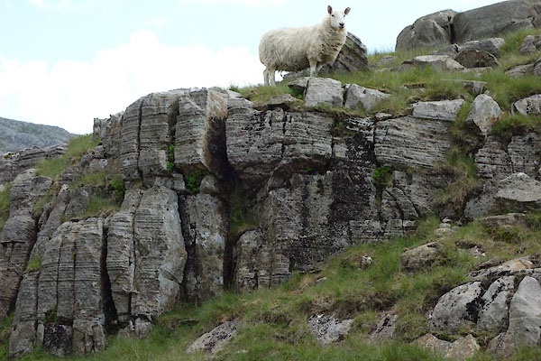 CAY83.jpg On top of the fell; sheep. (taken 23.6.2014) 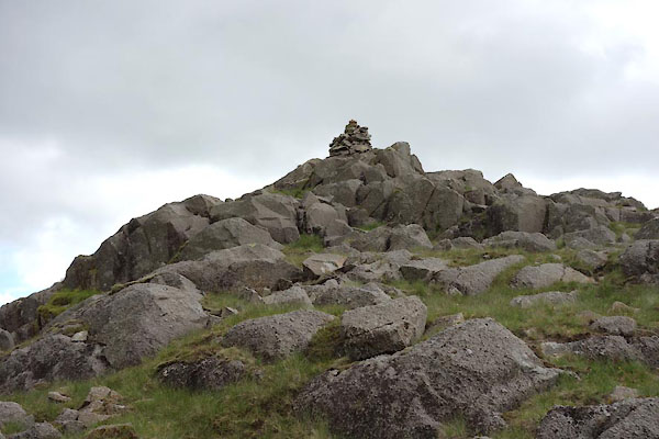 CAY78.jpg Cairn, not the highest. (taken 23.6.2014) 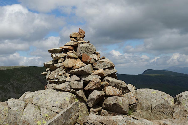 CAY79.jpg Cairn, not the highest. (taken 23.6.2014) 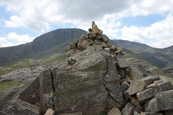 CAY80.jpg Cairn, the highest. (taken 23.6.2014)  Click to enlarge CAY95.jpg Panorama, Great End to Great Gable. (taken 23.6.2014) |
||
|
|
||
Lakes Guides menu.