 Old Cumbria Gazetteer
 |
 |
|
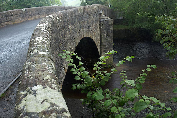
| New Bridge, Sedbergh | ||
| New Bridge | ||
| Sedbergh New Bridge | ||
| site name:- | Rawthey, River | |
| Street:- | Hawes Road | |
| locality:- | Sedbergh | |
| civil parish:- | Sedbergh (formerly Yorkshire) | |
| county:- | Cumbria | |
| locality type:- | bridge | |
| coordinates:- | SD66519194 | |
| 1Km square:- | SD6691 | |
| 10Km square:- | SD69 | |
|
|
||
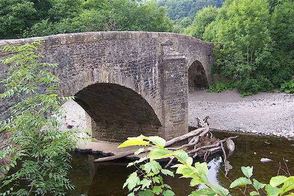 BJQ88.jpg (taken 24.7.2005) 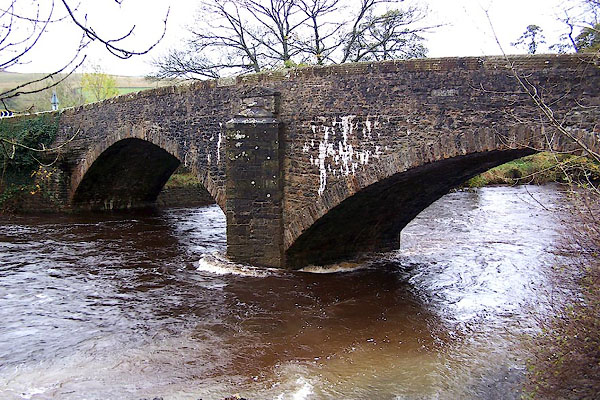 BJZ05.jpg (taken 4.11.2005) |
||
|
|
||
| evidence:- | old map:- OS County Series (Yrk 63 4) placename:- New Bridge placename:- Bridge, New |
|
| source data:- | Maps, County Series maps of Great Britain, scales 6 and 25
inches to 1 mile, published by the Ordnance Survey, Southampton,
Hampshire, from about 1863 to 1948. |
|
|
|
||
| evidence:- | old map:- Saxton 1579 |
|
| source data:- | Map, hand coloured engraving, Westmorlandiae et Cumberlandiae Comitatus ie Westmorland
and Cumberland, scale about 5 miles to 1 inch, by Christopher Saxton, London, engraved
by Augustinus Ryther, 1576, published 1579-1645.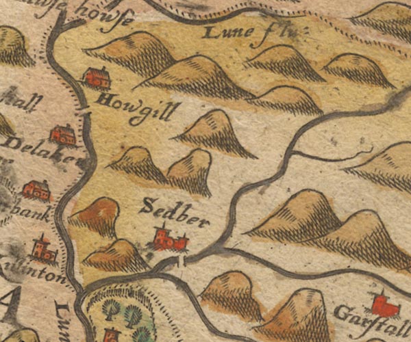 Sax9SD69.jpg Over the Rawthey. item:- private collection : 2 Image © see bottom of page |
|
|
|
||
| evidence:- | old map:- Speed 1611 (Wmd) |
|
| source data:- | Map, hand coloured engraving, The Countie Westmorland and
Kendale the Cheif Towne, scale about 2.5 miles to 1 inch, by
John Speed, 1610, published by George Humble, Popes Head Alley,
London, 1611-12.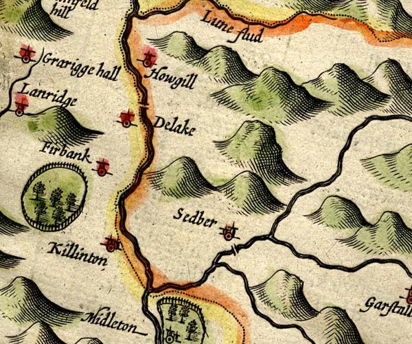 SP14SD69.jpg double line across the Rawthey at Sedbergh item:- Armitt Library : 2008.14.5 Image © see bottom of page |
|
|
|
||
| evidence:- | old map:- Sanson 1679 |
|
| source data:- | Map, hand coloured engraving, Ancien Royaume de Northumberland
aujourdhuy Provinces de Nort, ie the Ancient Kingdom of
Northumberland or the Northern Provinces, scale about 9.5 miles
to 1 inch, by Nicholas Sanson, Paris, France, 1679. click to enlarge click to enlargeSAN2Cm.jpg double line over a stream; bridge item:- Dove Cottage : 2007.38.15 Image © see bottom of page |
|
|
|
||
| evidence:- | probably old map:- Morden 1695 (Wmd) |
|
| source data:- | Map, hand coloured engraving, Westmorland, scale about 2.5 miles to 1 inch, by Robert
Morden, published by Abel Swale, the Unicorn, St Paul's Churchyard, Awnsham, and John
Churchill, the Black Swan, Paternoster Row, London, 1695.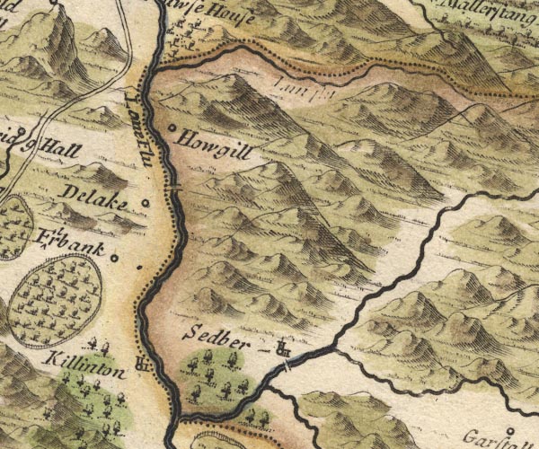 MD10SD69.jpg Double line over a stream over the Rawthey. item:- JandMN : 24 Image © see bottom of page |
|
|
|
||
| evidence:- | old map:- Jefferys 1770 (Wmd) |
|
| source data:- | Map, 4 sheets, The County of Westmoreland, scale 1 inch to 1
mile, surveyed 1768, and engraved and published by Thomas
Jefferys, London, 1770.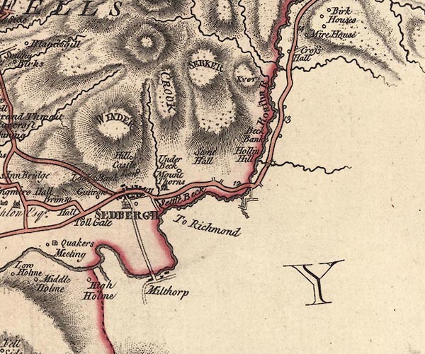 J5SD69SE.jpg no bridge, but the road to Richmond runs straight to the river item:- National Library of Scotland : EME.s.47 Image © National Library of Scotland |
|
|
|
||
| evidence:- | database:- Listed Buildings 2010 placename:- New Bridge |
|
| source data:- | courtesy of English Heritage "NEW BRIDGE / / HAWES ROAD / SEDBERGH / SOUTH LAKELAND / CUMBRIA / II / 484570 / SD6651791950" |
|
| source data:- | courtesy of English Heritage "Public road bridge over River Rawthey. C18. Slobbered rubble. Two wide segmental arches springing from a central pier which has triangular cutwaters on both sides, each with a small pediment above it; squinches at the north-west and south-east corners; parapets with rounded and grooved coping stones, curved outwards at the corner with the squinches." |
|
|
|
||
| evidence:- | old map:- OS County series (Yrk 63) placename:- Soolbank Bridge |
|
| source data:- | "Soolbank Bridge" |
|
|
|
||
 BVI32.jpg (taken 10.9.2011) |
||
|
|
||
 Lakes Guides menu.