 Old Cumbria Gazetteer
 |
 |
|
| Snake Holme, Windermere lake | ||
| Snake Holme | ||
| Stake Holme | ||
| site name:- | Windermere lake | |
| civil parish:- | Windermere (formerly Westmorland) | |
| county:- | Cumbria | |
| locality type:- | island | |
| coordinates:- | SD39609681 | |
| 1Km square:- | SD3996 | |
| 10Km square:- | SD39 | |
|
|
||
| evidence:- | old map:- OS County Series (Wmd 32 11) placename:- Snake Holme |
|
| source data:- | Maps, County Series maps of Great Britain, scales 6 and 25
inches to 1 mile, published by the Ordnance Survey, Southampton,
Hampshire, from about 1863 to 1948. |
|
|
|
||
| evidence:- | old map:- Clarke 1787 map (Windermere N) |
|
| source data:- | Map, A Map of the Northern Part of the Lake Winandermere and its
Environs, scale about 6.5 ins to 1 mile, by James Clarke,
engraved by Samuel John Neele, 352 Strand, published by James
Clarke, Penrith, Cumberland and in London etc, 1787.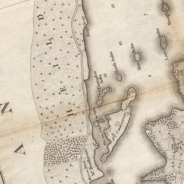 CLASD39Y.jpg The headland on Belle Isle then seems to correspond to this island now. item:- private collection : 10.10 Image © see bottom of page |
|
|
|
||
 Lakes Guides menu.