 Old Cumbria Gazetteer
 |
 |
|
| Snow Cove, Longsleddale | ||
| Snow Cove | ||
| Snowcove Gill | ||
| site name:- | Brown Crags | |
| civil parish:- | Longsleddale (formerly Westmorland) | |
| county:- | Cumbria | |
| locality type:- | cirque | |
| locality type:- | ravine | |
| coordinates:- | NY47500748 (middle-ish) | |
| 1Km square:- | NY4707 | |
| 10Km square:- | NY40 | |
|
|
||
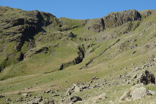 CAK13.jpg (taken 19.4.2014) |
||
|
|
||
| evidence:- | old map:- OS County Series (Wmd 27 2) placename:- Snowcove Gill |
|
| source data:- | Maps, County Series maps of Great Britain, scales 6 and 25
inches to 1 mile, published by the Ordnance Survey, Southampton,
Hampshire, from about 1863 to 1948. |
|
|
|
||
| evidence:- | textbook:- EPNS Westmorland 1967 placename:- Suancoue placename:- Snawecowe placename:- Snawcoo placename:- Snakey Gill |
|
| source data:- | Book, The Place Names of Westmorland, two volumes, by A H Smith,
published for the English Place Name Society by Cambridge
University Press, Cambridgeshire, 1967 |
|
|
|
||
| evidence:- | map:- OS Six Inch (1956) placename:- Snowcove Gill |
|
| source data:- | Map series, various editions with the national grid, scale about
6 inches to 1 mile, published by the Ordnance Survey,
Southampton, Hampshire, scale 1 to 10560 from 1950s to 1960s,
then 1 to 10000 from 1960s to 2000s, superseded by print on
demand from digital data.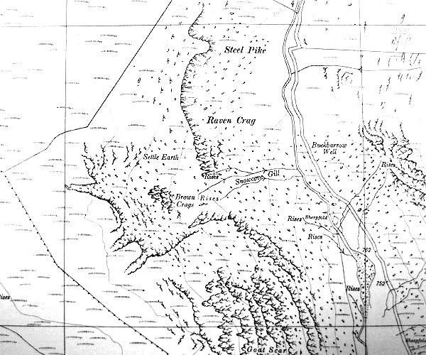 SINY4707.jpg Cf Snowcove Gill running from the coomb. |
|
|
|
||
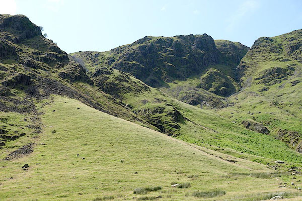 BRB92.jpg (taken 19.7.2009) 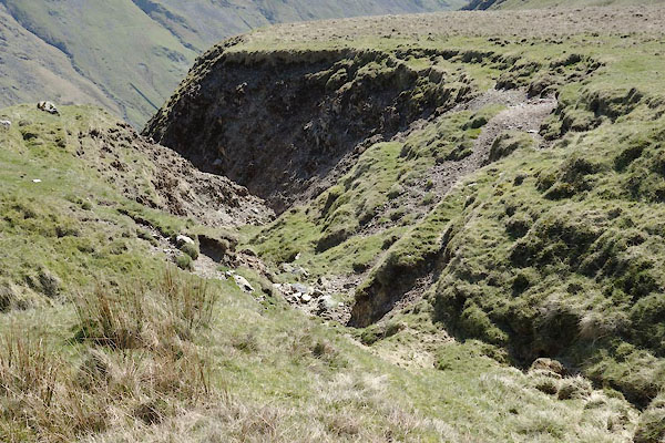 CAK36.jpg On top of the crags. (taken 19.4.2014) |
||
|
|
||
 Lakes Guides menu.