 Old Cumbria Gazetteer
 |
 |
|
| Southerfell, Mungrisdale | ||
| Southerfell | ||
| civil parish:- | Mungrisdale (formerly Cumberland) | |
| county:- | Cumbria | |
| locality type:- | buildings | |
| locality type:- | locality | |
| coordinates:- | NY35952789 | |
| 1Km square:- | NY3527 | |
| 10Km square:- | NY32 | |
|
|
||
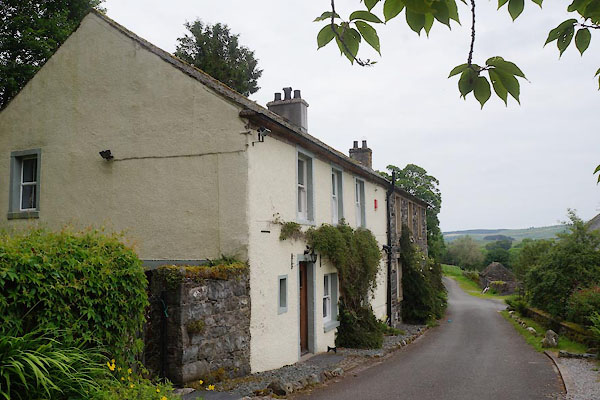 CAX37.jpg (taken 13.6.2014) |
||
|
|
||
| evidence:- | old map:- OS County Series (Cmd 57 10) placename:- Southerfell |
|
| source data:- | Maps, County Series maps of Great Britain, scales 6 and 25
inches to 1 mile, published by the Ordnance Survey, Southampton,
Hampshire, from about 1863 to 1948. |
|
|
|
||
| evidence:- | old map:- Gents Mag 1747 placename:- Suterfell Side |
|
| source data:- | Map, uncoloured engraving, perspective view, Caudbeck Fells ie
Caldbeck Fells, scale about 1+ miles to 1 inch, published in the
Gentleman's Magazine, 1747. GM1409.jpg "Suterfell Side" building item:- Carlisle Library : Map 43 Image © Carlisle Library |
|
|
|
||
| evidence:- | old map:- Donald 1774 (Cmd) placename:- Souther Fell |
|
| source data:- | Map, hand coloured engraving, 3x2 sheets, The County of Cumberland, scale about 1
inch to 1 mile, by Thomas Donald, engraved and published by Joseph Hodskinson, 29
Arundel Street, Strand, London, 1774.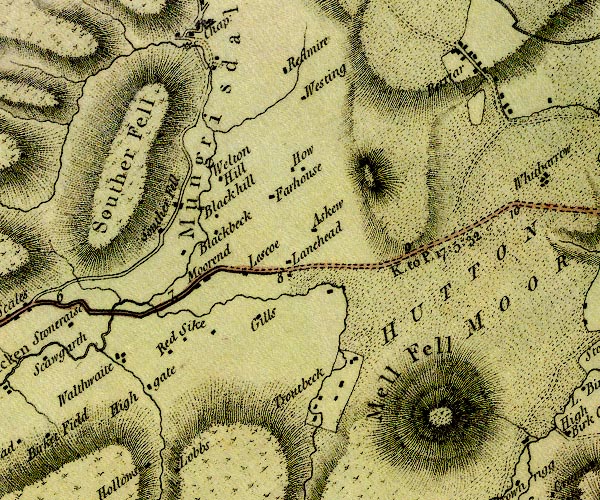 D4NY32NE.jpg "Souther Fell" block or blocks, labelled in lowercase; a hamlet or just a house item:- Carlisle Library : Map 2 Image © Carlisle Library |
|
|
|
||
| evidence:- | database:- Listed Buildings 2010 placename:- Southerfell Farm |
|
| source data:- | courtesy of English Heritage "SOUTHERFELL FARMHOUSE / / / MUNGRISDALE / EDEN / CUMBRIA / II / 73562 / NY3595027893" |
|
|
|
||
 Lakes Guides menu.