 Old Cumbria Gazetteer
 |
 |
|
| Tarn Crags, Mungrisdale | ||
| Tarn Crags | ||
| locality:- | Bowscale Fell | |
| civil parish:- | Mungrisdale (formerly Cumberland) | |
| county:- | Cumbria | |
| locality type:- | rocks | |
| coordinates:- | NY33503116 (etc) | |
| 1Km square:- | NY3331 | |
| 10Km square:- | NY33 | |
|
|
||
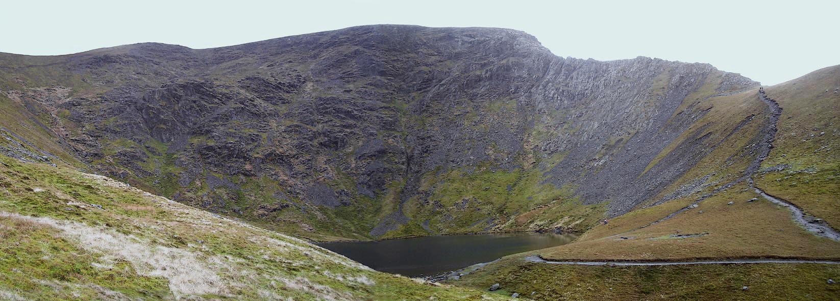 Click to enlarge BPC97.jpg (taken 2.5.2008) |
||
|
|
||
| evidence:- | old map:- OS County Series (Cmd 57 1) placename:- Tarn Crags |
|
| source data:- | Maps, County Series maps of Great Britain, scales 6 and 25
inches to 1 mile, published by the Ordnance Survey, Southampton,
Hampshire, from about 1863 to 1948. |
|
|
|
||
| evidence:- | old map:- Gents Mag 1747 placename:- Tarn Craigs |
|
| source data:- | Map, uncoloured engraving, perspective view, Caudbeck Fells ie
Caldbeck Fells, scale about 1+ miles to 1 inch, published in the
Gentleman's Magazine, 1747.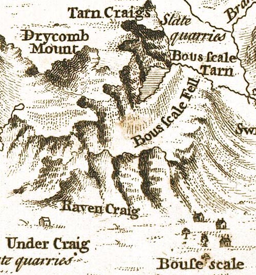 GM1404.jpg "Tarn Craigs" crags item:- Carlisle Library : Map 43 Image © Carlisle Library |
|
|
|
||
| evidence:- | old text:- Gents Mag 1747 placename:- Tarn Craigs |
|
| source data:- | Map, perspective view, Caudbeck Fells ie Caldbeck Fells, scale about 1+ miles to 1
inch, and descriptive text, published in the Gentleman's Magazine, November 1747. goto source goto sourcePage 523:- "... Bouscale-tarn, ... so strangely surrounded with a more eminent amphitheatrical ridge of quarry rocks, that it is excluded the benefit of the sun for at least four months, in the middle of winter; ..." |
|
|
|
||
Lakes Guides menu.