 Old Cumbria Gazetteer
 |
 |
|
| Temon, Upper Denton | ||
| Temon | ||
| civil parish:- | Upper Denton (formerly Cumberland) | |
| county:- | Cumbria | |
| locality type:- | buildings | |
| coordinates:- | NY61696382 | |
| 1Km square:- | NY6163 | |
| 10Km square:- | NY66 | |
|
|
||
| MN photo:- |
There are said to be the remains of a bastle house in this group. |
|
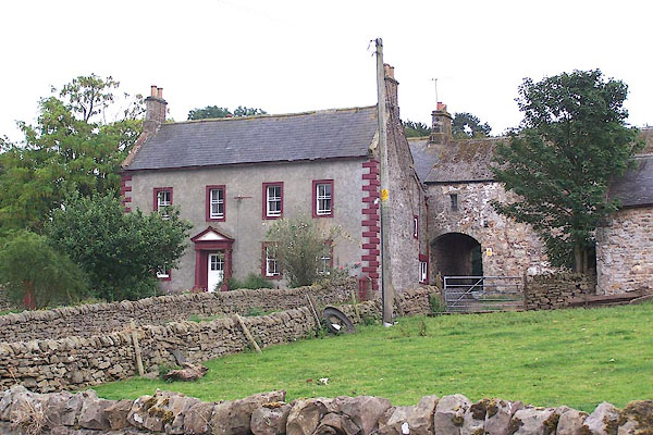 BML75.jpg (taken 29.7.2006) |
||
|
|
||
| evidence:- | old map:- OS County Series (Cmd 12 16) placename:- Temon |
|
| source data:- | Maps, County Series maps of Great Britain, scales 6 and 25
inches to 1 mile, published by the Ordnance Survey, Southampton,
Hampshire, from about 1863 to 1948. |
|
|
|
||
| evidence:- | old map:- Donald 1774 (Cmd) placename:- Temmon |
|
| source data:- | Map, hand coloured engraving, 3x2 sheets, The County of Cumberland, scale about 1
inch to 1 mile, by Thomas Donald, engraved and published by Joseph Hodskinson, 29
Arundel Street, Strand, London, 1774.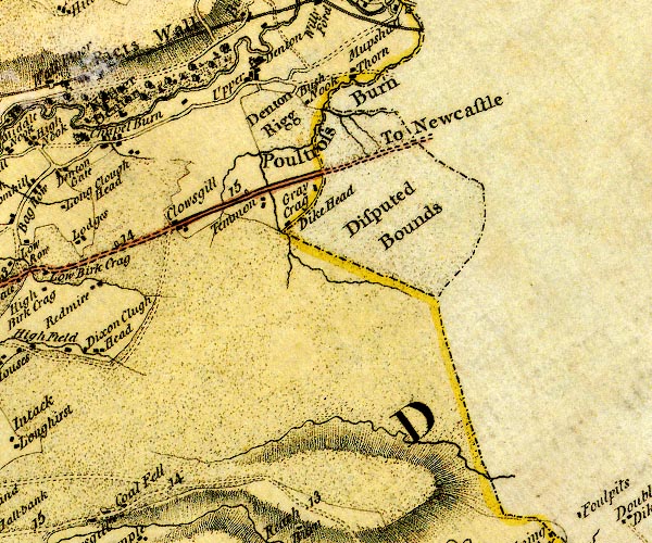 D4NY66SW.jpg "Temmon" block or blocks, labelled in lowercase; a hamlet or just a house item:- Carlisle Library : Map 2 Image © Carlisle Library |
|
|
|
||
| evidence:- | road book:- Cary 1798 (2nd edn 1802) placename:- Temmon |
|
| source data:- | Road book, itineraries, Cary's New Itinerary, by John Cary, 181
Strand, London, 2nd edn 1802. goto source goto source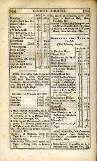 click to enlarge click to enlargeC38699.jpg page 699-700 "Temmon, Cumb." item:- JandMN : 228.2 Image © see bottom of page |
|
|
|
||
| evidence:- | possibly old map:- Laurie and Whittle 1806 placename:- Tammon Inn |
|
| source data:- | Road map, Continuation of the Roads to Glasgow and Edinburgh,
scale about 10 miles to 1 inch, by Nathaniel Coltman? 1806,
published by Robert H Laurie, 53 Fleet Street, London, 1834. click to enlarge click to enlargeLw21.jpg "Tammon Inn" inn; on county boundary item:- private collection : 18.21 Image © see bottom of page |
|
|
|
||
| evidence:- | database:- Listed Buildings 2010 placename:- Temon item:- date stone (1730) |
|
| source data:- | courtesy of English Heritage "TEMON TOGETHER WITH REMAINS OF PELE TOWER / / / UPPER DENTON / CARLISLE / CUMBRIA / II[star] / 78083 / NY6169963825" |
|
|
|
||
| notes:- |
bastle now a barn |
|
| Perriam, D R &Robinson, J: 1998: Medieval Fortified Buildings of Cumbria: CWAAS::
ISBN 1 873124 23 6; plan and illustration |
||
|
|
||
Lakes Guides menu.