Old Cumbria Gazetteer
 |
 |
|
||
| Thirlspot, St John's Castlerigg etc | ||||
| Thirlspot | ||||
| civil parish:- | St John's Castlerigg and Wythburn (formerly Cumberland) | |||
| county:- | Cumbria | |||
| locality type:- | locality | |||
| locality type:- | buildings | |||
| coordinates:- | NY31681776 (etc) | |||
| 1Km square:- | NY3117 | |||
| 10Km square:- | NY31 | |||
|
|
||||
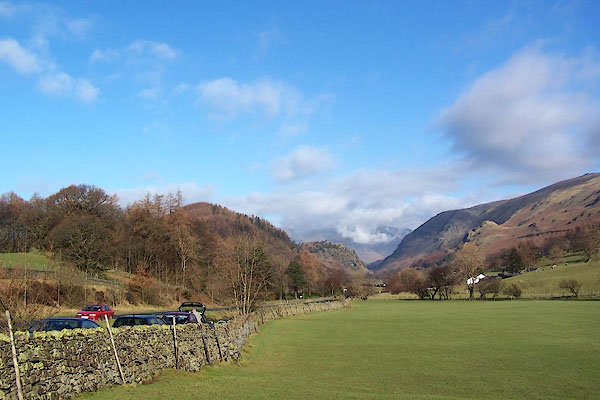 BNE32.jpg Joseph Farington's view from by the 6 mile stone. (taken 17.2.2007) |
||||
|
|
||||
| evidence:- | old map:- OS County Series (Cmd 70 4) placename:- Thirlspot |
|||
| source data:- | Maps, County Series maps of Great Britain, scales 6 and 25
inches to 1 mile, published by the Ordnance Survey, Southampton,
Hampshire, from about 1863 to 1948. |
|||
|
|
||||
| evidence:- | old map:- Ogilby 1675 (plate 96) placename:- Thurlspot |
|||
| source data:- | Road strip map, hand coloured engraving, the Road from Kendal to
Cockermouth, and the Road from Egremond to Carlisle, scale about
1 inch to 1 mile, by John Ogilby, London, 1675.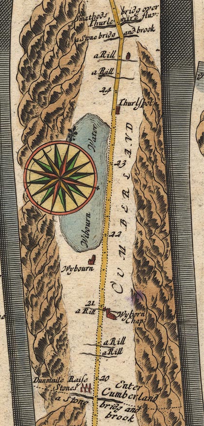 OG96m020.jpg In mile 23, Cumberland. "Thurlspot" houses on the right of the road. item:- JandMN : 22 Image © see bottom of page |
|||
|
|
||||
| evidence:- | old map:- Berry 1679 placename:- Thirlspot |
|||
| source data:- | Road map, diagram, The Grand Roads of England, engraved by John
Rich, made and published by William Berry, at the Sign of the
Globe, London, 1679. "Thirlspot" |
|||
|
|
||||
| evidence:- | old map:- Bowen 1720 (plate 260) placename:- Thurlspot |
|||
| source data:- | Road strip map, uncoloured engraving, pl.260, The Road from
Kendal to Cockermouth, scale about 2 miles to 1 inch, with
sections in Westmorland and Cumberland, published by Emanuel
Bowen, St Katherines, London, 1720.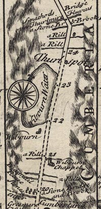 B260m20.jpg At mile 23-24. item:- private collection : 1.260 Image © see bottom of page |
|||
|
|
||||
| evidence:- | old map:- Badeslade 1742 placename:- Thurlspot |
|||
| source data:- | Map, uncoloured engraving, A Map of Cumberland North from
London, scale about 11 miles to 1 inch, with descriptive text,
by Thomas Badeslade, London, engraved and published by William
Henry Toms, Union Court, Holborn, London, 1742. click to enlarge click to enlargeBD10.jpg "Thurlspot" circle, italic lowercase text; village, hamlet or locality item:- JandMN : 115 Image © see bottom of page |
|||
|
|
||||
| evidence:- | old map:- Bowen and Kitchin 1760 placename:- Thurlspot |
|||
| source data:- | Map, hand coloured engraving, A New Map of the Counties of
Cumberland and Westmoreland Divided into their Respective Wards,
scale about 4 miles to 1 inch, by Emanuel Bowen and Thomas
Kitchin et al, published by T Bowles, Robert Sayer, and John
Bowles, London, 1760. BO18NY21.jpg "Thurlspot" circle, tower item:- Armitt Library : 2008.14.10 Image © see bottom of page |
|||
|
|
||||
| evidence:- | old map:- Donald 1774 (Cmd) placename:- Threspat |
|||
| source data:- | Map, hand coloured engraving, 3x2 sheets, The County of Cumberland, scale about 1
inch to 1 mile, by Thomas Donald, engraved and published by Joseph Hodskinson, 29
Arundel Street, Strand, London, 1774. D4NY31NW.jpg "Threspat" block or blocks, labelled in lowercase; a hamlet or just a house item:- Carlisle Library : Map 2 Image © Carlisle Library |
|||
|
|
||||
| evidence:- | old map:- Clarke 1787 map (Ambleside to Keswick) placename:- Trespett |
|||
| source data:- | Map, A Map of the Roads Lakes etc between Keswick and Ambleside,
scale about 2.5 ins to 1 mile, by James Clarke, engraved by S J
Neele, 352 Strand, published by James Clarke, Penrith,
Cumberland and in London etc, 1787. CL9NY31I.jpg "Trespett" item:- private collection : 10.9 Image © see bottom of page |
|||
|
|
||||
| evidence:- | road book:- Cary 1798 (2nd edn 1802) placename:- Thirlspot |
|||
| source data:- | Road book, itineraries, Cary's New Itinerary, by John Cary, 181
Strand, London, 2nd edn 1802. goto source goto source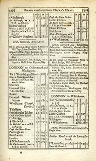 click to enlarge click to enlargeC38317.jpg page 317-318 "Thirlspot" item:- JandMN : 228.1 Image © see bottom of page |
|||
|
|
||||
| evidence:- | old map:- Cooke 1802 placename:- Thurlspot |
|||
| source data:- | Map, Cumberland, scale about 15.5 miles to 1 inch, by George
Cooke, 1802, bound in Gray's New Book of Roads, 1824, published
by Sherwood, Jones and Co, Paternoster Road, London, 1824. click to enlarge click to enlargeGRA1Cd.jpg "Thurlspot" blocks, italic lowercase text, village, hamlet, locality item:- Hampshire Museums : FA2000.62.2 Image © see bottom of page |
|||
|
|
||||
| evidence:- | old map:- Laurie and Whittle 1806 placename:- Thirlspot |
|||
| source data:- | Road map, Completion of the Roads to the Lakes, scale about 10
miles to 1 inch, by Nathaniel Coltman? 1806, published by Robert
H Laurie, 53 Fleet Street, London, 1834. click to enlarge click to enlargeLw18.jpg "Thirlspot 288" village or other place; distance from London item:- private collection : 18.18 Image © see bottom of page |
|||
|
|
||||
| evidence:- | old map:- Wallis 1810 (Cmd) placename:- Thurlspot |
|||
| source data:- | Road map, hand coloured engraving, Cumberland, scale about 16
miles to 1 inch, by James Wallis, 77 Berwick Stree, Soho,
London, 1810. click to enlarge click to enlargeWL13.jpg "Thurlspot" village, hamlet, house, ... item:- Dove Cottage : 2009.81.10 Image © see bottom of page |
|||
|
|
||||
| evidence:- | old map:- Otley 1818 placename:- Thrispot |
|||
| source data:- | Map, uncoloured engraving, The District of the Lakes,
Cumberland, Westmorland, and Lancashire, scale about 4 miles to
1 inch, by Jonathan Otley, 1818, engraved by J and G Menzies,
Edinburgh, Scotland, published by Jonathan Otley, Keswick,
Cumberland, et al, 1833.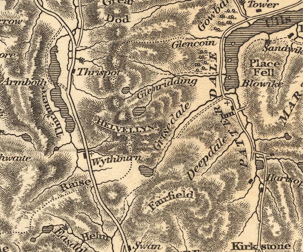 OT02NY31.jpg item:- JandMN : 48.1 Image © see bottom of page |
|||
|
|
||||
| evidence:- | old map:- Garnett 1850s-60s H placename:- Thirlspot |
|||
| source data:- | Map of the English Lakes, in Cumberland, Westmorland and
Lancashire, scale about 3.5 miles to 1 inch, published by John
Garnett, Windermere, Westmorland, 1850s-60s.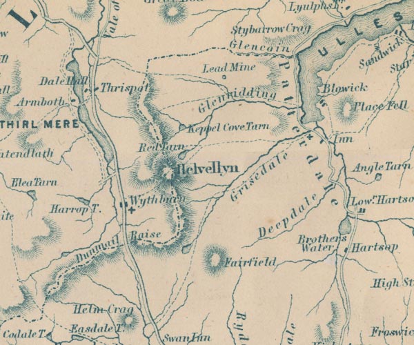 GAR2NY31.jpg "Thirlspot" blocks, settlement item:- JandMN : 82.1 Image © see bottom of page |
|||
|
|
||||
| evidence:- | old map:- Burrow 1920s |
|||
| source data:- | Road book, On the Road, Dunlop Pictorial Road Plans, volume V,
strip maps with parts in Westmorland, Cumberland etc, irregular
scale about 1.5 miles to 1 inch, by E J Burrow and Co,
Cheltenham, Gloucestershire, 1920s.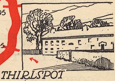 EJB3Vg41.jpg item:- private collection : 17 Image © see bottom of page |
|||
|
|
||||
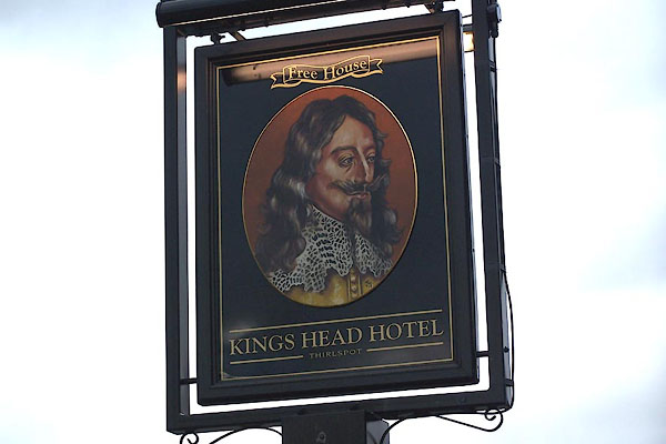
| evidence:- | old print with text:- Farington 1789 (plate 18) |
|||
| source data:- | Print, engraving, View on the Road Leading from Ambleside to Keswick, painted by Joseph
Farington, engraved by W Byrne and J Landseer, published by W Byrne, 79 Titchfield
Street, London, 1789.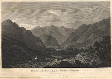 click to enlarge click to enlargeBMZ86.jpg The six milestone from Keswick is just south of the King's Head, Thirlspot, on the left is Castlerigg Fell, and the view looks down St John's in the Vale. Plate 18 from Views of the Lakes, &c, in Cumberland and Westmorland, published 1789; with descriptive text:- "VIEW on the ROAD leading from AMBLESIDE to KESWICK." "THE Road from Ambleside to Keswick affords a Series of romantic and picturesque Views, which cannot fail of impressing the Imagination of the Traveller in an extraordinary Manner. Indeed, it is scarcely possible to find a Succession of Scenes more various and contrasted. After passing the charming Scenery of Rydal, and the wild Environs which surround the Lake of that Name, from the Top of a steep Ascent, the peaceful embossomed Grassmere presents itself. Pursuing the way from this sequestered and beautiful Retreat, by a long ascending Road, a Height is gained which commands the Vale left behind, so as to produce what is termed a Bird's-Eye View. Grassmere becomes a small Feature in this extensive Landscape, and the inclosures of the cultivated Vale are crowded together like the Divisions in a Map." "Though it does not come within the Power of the Pencil to give an ample Idea of such Scenes, yet upon the great Scale of Nature they are always affecting.- Descending on the North Side, Wythburn or Leathes Water, comes into the View, which is of a wild and barren Character. The Road passes a considerable Way on the Margin of that Lake, when it becomes again steep and winding; but the Tediousness of Alpine travelling is compensated by the Scene which opens from the Six Mile Stone, on this Side Keswick.- It is this View which is attempted to be described in the annexed Plate.- Between lofty Mountains on the right, and Rocks of high and rude Forms on the left, passes the narrow green Vale of Legberthwaite, which is divided into small Inclosures, and peopled with a few Cots. The Vale is terminated by the romantick Rock of St. John; behind which rises Saddleback, a Mountain almost vying with Skiddaw for pre-eminence, and forming a sublime Back Ground to the Scene." item:- Dove Cottage : Lowther.49 Image © see bottom of page |
|||
|
|
||||
| places:- |
|
|||
|
||||
|
||||
|
||||
Lakes Guides menu.