 Old Cumbria Gazetteer
 |
 |
|
| Thornship, Shap | ||
| Thornship | ||
| civil parish:- | Shap (formerly Westmorland) | |
| county:- | Cumbria | |
| locality type:- | buildings | |
| coordinates:- | NY55621415 | |
| 1Km square:- | NY5514 | |
| 10Km square:- | NY51 | |
|
|
||
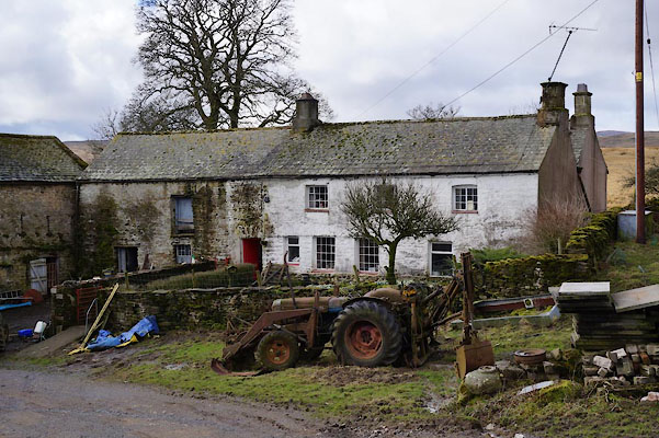 BZZ88.jpg (taken 7.3.2014) |
||
|
|
||
| evidence:- | old map:- OS County Series (Wmd 14 14) placename:- Thornship |
|
| source data:- | Maps, County Series maps of Great Britain, scales 6 and 25
inches to 1 mile, published by the Ordnance Survey, Southampton,
Hampshire, from about 1863 to 1948. |
|
|
|
||
| evidence:- | old map:- Jefferys 1770 (Wmd) placename:- Thornship |
|
| source data:- | Map, 4 sheets, The County of Westmoreland, scale 1 inch to 1
mile, surveyed 1768, and engraved and published by Thomas
Jefferys, London, 1770.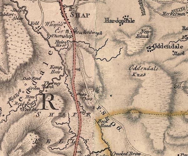 J5NY51SE.jpg "Thornship" circle, labelled in italic lowercase text; settlement, farm, house, or hamlet? item:- National Library of Scotland : EME.s.47 Image © National Library of Scotland |
|
|
|
||
| evidence:- | old map:- Cary 1789 (edn 1805) placename:- Thornship |
|
| source data:- | Map, uncoloured engraving, Westmoreland, scale about 2.5 miles
to 1 inch, by John Cary, London, 1789; edition 1805.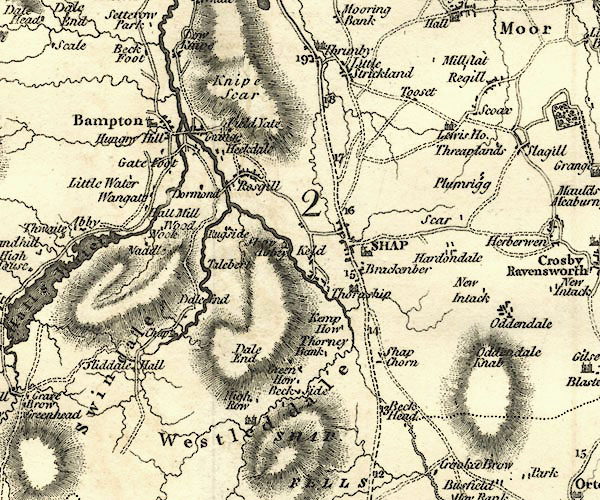 CY24NY51.jpg "Thornship" house symbol; large house item:- JandMN : 129 Image © see bottom of page |
|
|
|
||
| evidence:- | database:- Listed Buildings 2010 placename:- Thornship Farm |
|
| source data:- | courtesy of English Heritage "THORNSHIP FARMHOUSE AND BYRE ADJOINING SOUTH END / / THORNSHIP LANE / SHAP / EDEN / CUMBRIA / II / 74181 / NY5562214152" |
|
|
|
||
| evidence:- | database:- Listed Buildings 2010 |
|
| source data:- | courtesy of English Heritage "BARN TO SOUTH OF THORNSHIP FARMHOUSE / / THORNSHIP LANE / SHAP / EDEN / CUMBRIA / II / 74183 / NY5563714134" |
|
|
|
||
| evidence:- | database:- Listed Buildings 2010 |
|
| source data:- | courtesy of English Heritage "BYRE TO NORTH EAST OF THORNSHIP FARMHOUSE / / THORNSHIP LANE / SHAP / EDEN / CUMBRIA / II / 74182 / NY5563314180" |
|
|
|
||
 Lakes Guides menu.