 Old Cumbria Gazetteer
 |
 |
|
| Thornthwaite Hall, Bampton | ||
| Thornthwaite Hall | ||
| civil parish:- | Bampton (formerly Westmorland) | |
| county:- | Cumbria | |
| locality type:- | buildings | |
| locality type:- | park (?) | |
| coordinates:- | NY51281630 | |
| 1Km square:- | NY5116 | |
| 10Km square:- | NY51 | |
|
|
||
| evidence:- | old map:- OS County Series (Wmd 13 12) placename:- Thornthwaite Hall |
|
| source data:- | Maps, County Series maps of Great Britain, scales 6 and 25
inches to 1 mile, published by the Ordnance Survey, Southampton,
Hampshire, from about 1863 to 1948. |
|
|
|
||
| evidence:- | old map:- Saxton 1579 placename:- Thornthwate |
|
| source data:- | Map, hand coloured engraving, Westmorlandiae et Cumberlandiae Comitatus ie Westmorland
and Cumberland, scale about 5 miles to 1 inch, by Christopher Saxton, London, engraved
by Augustinus Ryther, 1576, published 1579-1645.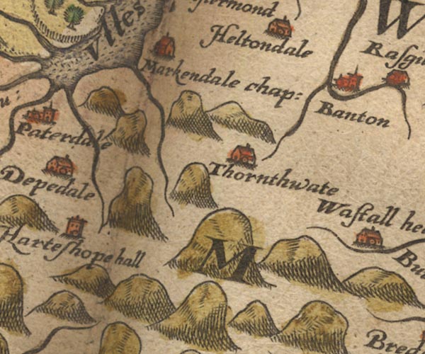 Sax9NY41.jpg Building, symbol for a hamlet, which may or may not have a nucleus. "Thornthwate" item:- private collection : 2 Image © see bottom of page |
|
|
|
||
| evidence:- | old map:- Speed 1611 (Wmd) placename:- Thornthwaite |
|
| source data:- | Map, hand coloured engraving, The Countie Westmorland and
Kendale the Cheif Towne, scale about 2.5 miles to 1 inch, by
John Speed, 1610, published by George Humble, Popes Head Alley,
London, 1611-12. SP14NY41.jpg "Thornthwaite" circle, tower item:- Armitt Library : 2008.14.5 Image © see bottom of page |
|
|
|
||
| evidence:- | old map:- Jansson 1646 placename:- Thornehwate |
|
| source data:- | Map, hand coloured engraving, Cumbria and Westmoria, ie
Cumberland and Westmorland, scale about 3.5 miles to 1 inch, by
John Jansson, Amsterdam, Netherlands, 1646.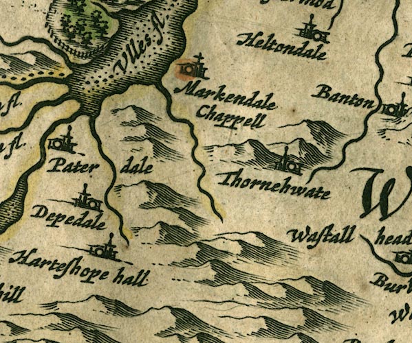 JAN3NY41.jpg "Thornehwate" Buildings and tower. item:- JandMN : 88 Image © see bottom of page |
|
|
|
||
| evidence:- | hearth tax returns:- Hearth Tax 1675 placename:- Thornthwaite hall |
|
| source data:- | Records, hearth tax survey returns, Westmorland, 1674/75. "Thornthwaite hall" in "Bampton Pattricke" |
|
|
|
||
| evidence:- | old map:- Morden 1695 (Wmd) |
|
| source data:- | Map, hand coloured engraving, Westmorland, scale about 2.5 miles to 1 inch, by Robert
Morden, published by Abel Swale, the Unicorn, St Paul's Churchyard, Awnsham, and John
Churchill, the Black Swan, Paternoster Row, London, 1695. MD10NY51.jpg "Thornthwate hall" Circle, tower; just outside a ring of fence palings, trees, with the Haweswater Beck running through. item:- JandMN : 24 Image © see bottom of page |
|
|
|
||
| evidence:- | old map:- Badeslade 1742 placename:- Thornthwait Hall |
|
| source data:- | Map, uncoloured engraving, A Map of Westmorland North from
London, scale about 10 miles to 1 inch, with descriptive text,
by Thomas Badeslade, London, engraved and published by William
Henry Toms, Union Court, Holborn, London, 1742. click to enlarge click to enlargeBD12.jpg "Thornthwait H." circle, italic lowercase text; village, hamlet or locality item:- Dove Cottage : 2007.38.62 Image © see bottom of page |
|
|
|
||
| evidence:- | old map:- Simpson 1746 map (Wmd) placename:- Thorntwate Hall |
|
| source data:- | Map, uncoloured engraving, Westmorland, scale about 8 miles to 1
inch, printed by R Walker, Fleet Lane, London, 1746.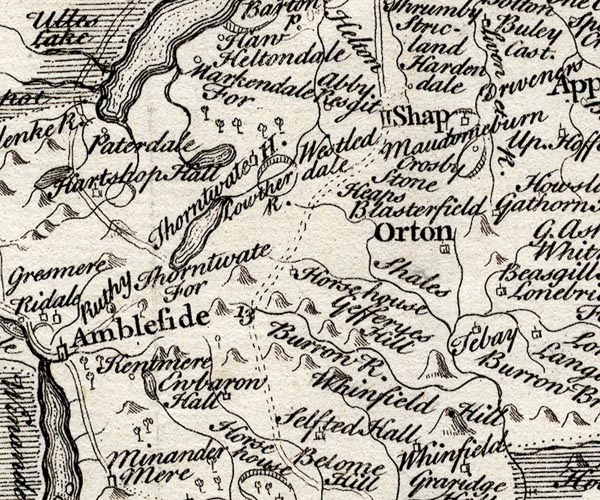 SMP2NYK.jpg "Thorntwate H." Building; and outline of a park. item:- Dove Cottage : 2007.38.59 Image © see bottom of page |
|
|
|
||
| evidence:- | old map:- Bowen and Kitchin 1760 |
|
| source data:- | Map, hand coloured engraving, A New Map of the Counties of
Cumberland and Westmoreland Divided into their Respective Wards,
scale about 4 miles to 1 inch, by Emanuel Bowen and Thomas
Kitchin et al, published by T Bowles, Robert Sayer, and John
Bowles, London, 1760.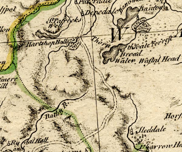 BO18NY30.jpg circle, tower, and outline of fence palings, bushes, with stream through item:- Armitt Library : 2008.14.10 Image © see bottom of page |
|
|
|
||
| evidence:- | old map:- Jefferys 1770 (Wmd) placename:- Thornthwait Hall |
|
| source data:- | Map, 4 sheets, The County of Westmoreland, scale 1 inch to 1
mile, surveyed 1768, and engraved and published by Thomas
Jefferys, London, 1770. J5NY51NW.jpg "Thornthwait Hall" circle; house item:- National Library of Scotland : EME.s.47 Image © National Library of Scotland |
|
|
|
||
| evidence:- | old map:- Cary 1789 (edn 1805) placename:- Hall Mill |
|
| source data:- | Map, uncoloured engraving, Westmoreland, scale about 2.5 miles
to 1 inch, by John Cary, London, 1789; edition 1805. CY24NY51.jpg "Hall Mill" block/s, labelled in italic lowercase; house, or hamlet item:- JandMN : 129 Image © see bottom of page |
|
|
|
||
| evidence:- | old map:- Otley 1818 placename:- Thornthwaite Hall |
|
| source data:- | Map, uncoloured engraving, The District of the Lakes,
Cumberland, Westmorland, and Lancashire, scale about 4 miles to
1 inch, by Jonathan Otley, 1818, engraved by J and G Menzies,
Edinburgh, Scotland, published by Jonathan Otley, Keswick,
Cumberland, et al, 1833.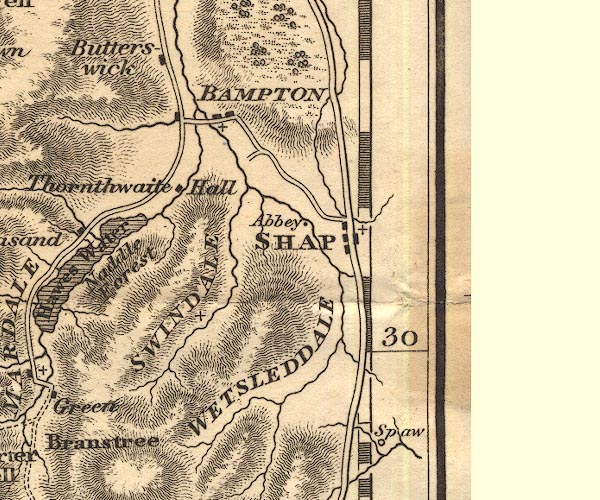 OT02NY51.jpg item:- JandMN : 48.1 Image © see bottom of page |
|
|
|
||
| evidence:- | old map:- Garnett 1850s-60s H placename:- Thornthwaite Hall |
|
| source data:- | Map of the English Lakes, in Cumberland, Westmorland and
Lancashire, scale about 3.5 miles to 1 inch, published by John
Garnett, Windermere, Westmorland, 1850s-60s.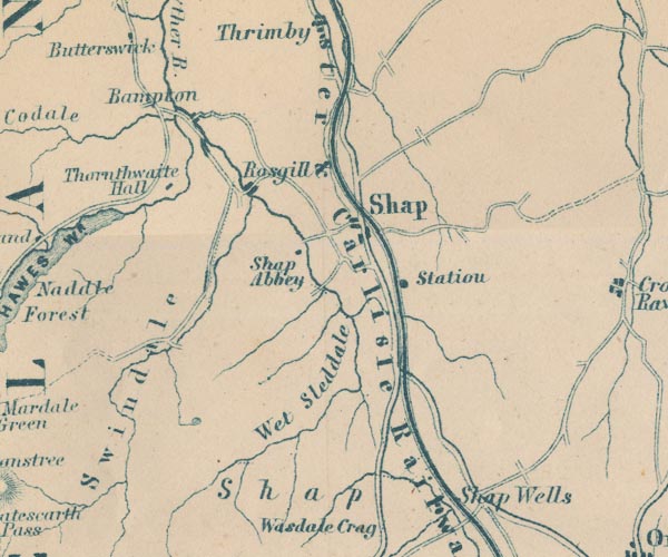 GAR2NY51.jpg "Thornthwaite Hall" block, building item:- JandMN : 82.1 Image © see bottom of page |
|
|
|
||
| evidence:- | probably fiction:- Trollope 1864 placename:- Vavasor Hall |
|
| source data:- |  goto source goto sourcechapter 1 Mr Vavasor and his daughter "... Squire Vavasor of Vavasor Hall, in Westmorland, was a country gentleman, possessing some thousand a year at the outside, and he therefore never came up to London ..." chapter 31 Among the Fells "The whole party went to church on this Christmas morning. ..." "... There were long skirtings of dark pines around a portion of the Squire's property, and at the back of the house there was a thick wood of firs running up to the top of what was there called the Beacon Hill. Through this there was a wild steep walk which came out upon the moorland, and from thence there was a track across the mountain to Hawes Water and Naddale, and on over many miles to the further beauties of Bowness and Windermere. ..." |
|
|
|
||
| evidence:- | old photograph:- Bell 1880s-1940s placename:- Thornthwaite Hall |
|
| source data:- | Photograph, Thornthwaite Hall, Bampton, Westmorland, by Herbert Bell, photographer,
Ambleside, Westmorland, 1897.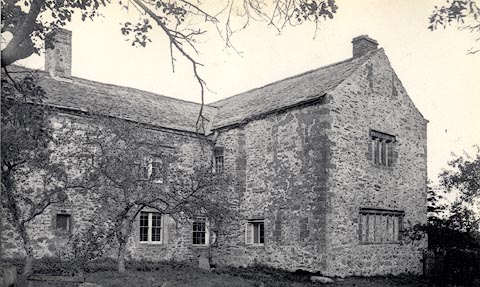 click to enlarge click to enlargeHB0059.jpg Vol.1 no.59 in an album, Examples of Early Domestic and Military Architecture in Westmorland, assembled 1910. ms at bottom:- "59. Thornthwaite Hall. Bampton W." item:- Armitt Library : 1958.3165.59 Image © see bottom of page |
|
|
|
||
| evidence:- | database:- Listed Buildings 2010 placename:- Thornthwaite Hall |
|
| source data:- | courtesy of English Heritage "THORNTHWAITE HALL AND ATTACHED BARN / / / BAMPTON / EDEN / CUMBRIA / II / 74469 / NY5128516298" |
|
|
|
||
| notes:- |
tower and hall |
|
| Perriam, D R &Robinson, J: 1998: Medieval Fortified Buildings of Cumbria: CWAAS::
ISBN 1 873124 23 6; plan and illustration |
||
|
|
||
Lakes Guides menu.