 Old Cumbria Gazetteer
 |
 |
|
| Thrang Crag, Martindale | ||
| Thrang Crag | ||
| locality:- | Martindale Common | |
| civil parish:- | Martindale (formerly Westmorland) | |
| county:- | Cumbria | |
| locality type:- | rocks | |
| coordinates:- | NY434174 | |
| 1Km square:- | NY4317 | |
| 10Km square:- | NY41 | |
|
|
||
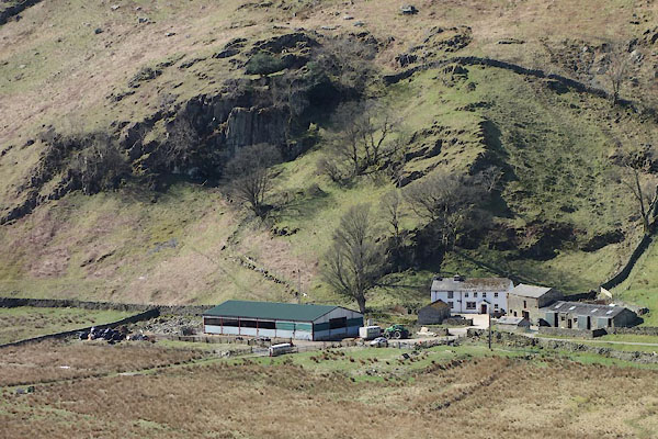 CCU85.jpg (taken 8.4.2015) |
||
|
|
||
| evidence:- | old map:- OS County Series (Wmd 12 8) placename:- Throng Crag |
|
| source data:- | Maps, County Series maps of Great Britain, scales 6 and 25
inches to 1 mile, published by the Ordnance Survey, Southampton,
Hampshire, from about 1863 to 1948. |
|
|
|
||
| evidence:- | old map:- Cary 1789 (edn 1805) placename:- Thrang Cragg |
|
| source data:- | Map, uncoloured engraving, Westmoreland, scale about 2.5 miles
to 1 inch, by John Cary, London, 1789; edition 1805.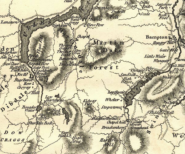 CY24NY41.jpg "Thrang Cragg" block/s, labelled in italic lowercase; house, or hamlet item:- JandMN : 129 Image © see bottom of page |
|
|
|
||
 Lakes Guides menu.