 Old Cumbria Gazetteer
 |
 |
|
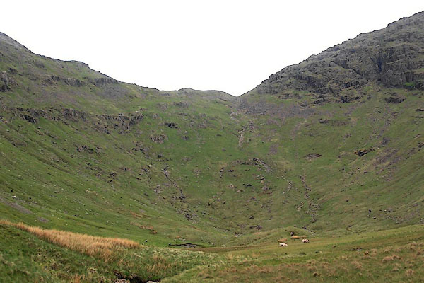
| Threshthwaite Mouth, Patterdale | ||
| Threshthwaite Mouth | ||
| civil parish:- | Patterdale (formerly Westmorland) | |
| civil parish:- | Lakes (formerly Westmorland) | |
| county:- | Cumbria | |
| locality type:- | pass | |
| coordinates:- | NY42641028 | |
| 1Km square:- | NY4210 | |
| 10Km square:- | NY41 | |
|
|
||
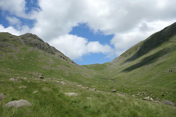 CDO58.jpg (taken 9.7.2015) 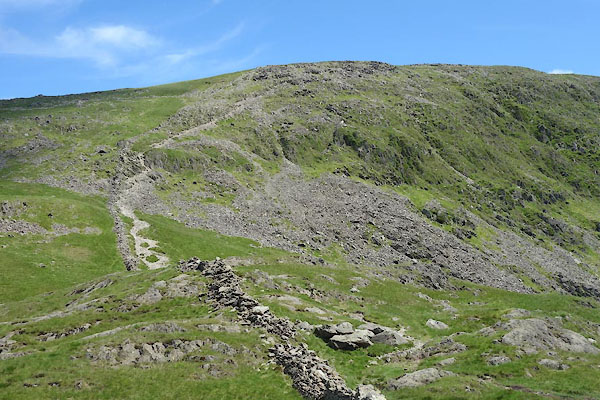 CDO61.jpg (taken 9.7.2015) |
||
|
|
||
| evidence:- | old map:- OS County Series (Wmd 19 12) placename:- Threshthwaite Mouth |
|
| source data:- | Maps, County Series maps of Great Britain, scales 6 and 25
inches to 1 mile, published by the Ordnance Survey, Southampton,
Hampshire, from about 1863 to 1948. |
|
|
|
||
| evidence:- | outline view:- Otley 1823 (8th edn 1849) placename:- Threshthwaite Mouth |
|
| source data:- | Engraving, outline view of mountains, Windermere looking towards the North East from
Bowness, drawn by T Binns, engraved by O Jewitt, opposite p.2 of A Descriptive Guide
of the English Lakes, by Jonathan Otley, 8th edition, 1849.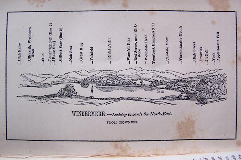 click to enlarge click to enlargeO80E02.jpg With a list of mountains. item:- Armitt Library : A1180.3 Image © see bottom of page |
|
|
|
||
| evidence:- | outline view:- Otley 1823 (5th edn 1834) |
|
| source data:- | Print, woodcut outline view, Mountains North East of Windermere, by Jonathan Otley,
Keswick, Cumberland, 1830.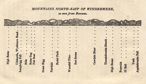 click to enlarge click to enlargeOT2E11.jpg Printed on p.99 of A Concise Description of the English Lakes, by Jonathan Otley, 5th edition, 1834. "MOUNTAINS NORTH-EAST OF WINDERMERE, as seen from Bowness." Mountains are listed:- "High Raise / Ullskarth, Wythburn Head / Loughrigg Fell / Stile / Raise Gap / Nab Scar / Great Rigg / Fairfield / Rydal Park / Wansfell Pike / Red Screes / Cawdale Moor / Threshthwaite Mouth / High Street / Froswick / Ill Bell / Yoak / Applethwaite Fell" item:- JandMN : 48.12 Image © see bottom of page |
|
|
|
||
 BQS99.jpg (taken 9.6.2009) 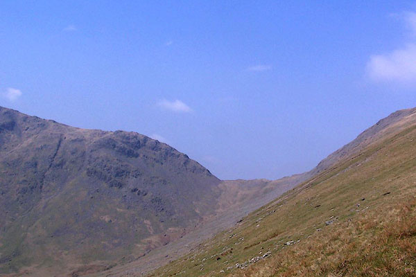 BQK99.jpg (taken 16.4.2009) |
||
|
|
||
 Lakes Guides menu.