 Old Cumbria Gazetteer
 |
 |
|
| Ulverston Canal | ||
| locality:- | Ulverston | |
| civil parish:- | Ulverston (formerly Lancashire) | |
| county:- | Cumbria | |
| locality type:- | canal | |
| coordinates:- | SD29397852 | |
| coordinates:- | SD31317768 | |
| 1Km square:- | SD2978 | |
| 10Km square:- | SD27 | |
| 10Km square:- | SD37 | |
|
|
||
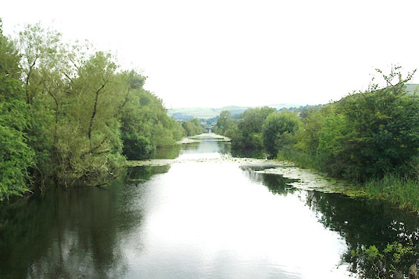 BWV62.jpg (taken 13.7.2012) |
||
|
|
||
| evidence:- | old map:- OS County Series (Lan 16 4) placename:- Ulverston Canal |
|
| source data:- | Maps, County Series maps of Great Britain, scales 6 and 25
inches to 1 mile, published by the Ordnance Survey, Southampton,
Hampshire, from about 1863 to 1948. |
|
|
|
||
| evidence:- | old text:- Capper 1808 |
|
| source data:- | Gazetteer, A Topographical Dictionary of the United Kingdom,
compiled by Benjamin Pitts Capper, published by Richard
Phillips, Bridge Street, Blackfriars, London, 1808; published
1808-29. goto source goto source"[Ulverston] ... By means of a canal, lately cut, vessels of 150 tons can approach the town, carrying on a considerable traffic, in the export of iron ore, limestone, and corn; and in the neighbourhood, are several furnaces and smelting houses. ..." |
|
|
|
||
| evidence:- | old map:- Otley 1818 |
|
| source data:- | Map, uncoloured engraving, The District of the Lakes,
Cumberland, Westmorland, and Lancashire, scale about 4 miles to
1 inch, by Jonathan Otley, 1818, engraved by J and G Menzies,
Edinburgh, Scotland, published by Jonathan Otley, Keswick,
Cumberland, et al, 1833.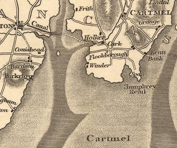 OT02SD37.jpg "Canal" item:- JandMN : 48.1 Image © see bottom of page |
|
|
|
||
| evidence:- | descriptive text:- Otley 1823 (5th edn 1834) |
|
| source data:- | Guide book, A Concise Description of the English Lakes, the
mountains in their vicinity, and the roads by which they may be
visited, with remarks on the mineralogy and geology of the
district, by Jonathan Otley, published by the author, Keswick,
Cumberland now Cumbria, by J Richardson, London, and by Arthur
Foster, Kirkby Lonsdale, Cumbria, 1823; published 1823-49,
latterly as the Descriptive Guide to the English Lakes. goto source Page 95:- "... It [Ulverston] communicates with the channel of the Leven by a canal admitting vessels of considerable burden." |
|
|
|
||
| evidence:- | descriptive text:- Ford 1839 (3rd edn 1843) |
|
| source data:- | Guide book, A Description of Scenery in the Lake District, by
Rev William Ford, published by Charles Thurnam, Carlisle, by W
Edwards, 12 Ave Maria Lane, Charles Tilt, Fleet Street, William
Smith, 113 Fleet Street, London, by Currie and Bowman,
Newcastle, by Bancks and Co, Manchester, by Oliver and Boyd,
Edinburgh, and by Sinclair, Dumfries, 1839. goto source Page 4:- "..." "[Ulverston] ... Being about a mile from the Leven, a canal, cut in 1795, enables vessels of small tonnage to come up to the town. Considerable quantities of iron-ore and wrought-iron are exported to different places. ..." |
|
|
|
||
| evidence:- | old map:- Ford 1839 map |
|
| source data:- | Map, uncoloured engraving, Map of the Lake District of
Cumberland, Westmoreland and Lancashire, scale about 3.5 miles
to 1 inch, published by Charles Thurnam, Carlisle, and by R
Groombridge, 5 Paternoster Row, London, 3rd edn 1843.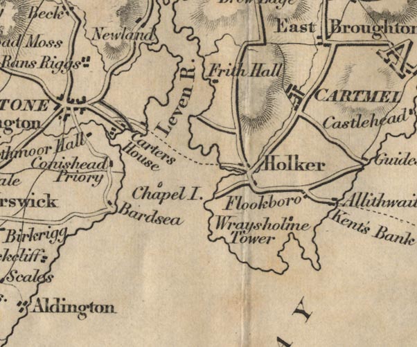 FD02SD37.jpg item:- JandMN : 100.1 Image © see bottom of page |
|
|
|
||
| evidence:- | old map:- Garnett 1850s-60s H |
|
| source data:- | Map of the English Lakes, in Cumberland, Westmorland and
Lancashire, scale about 3.5 miles to 1 inch, published by John
Garnett, Windermere, Westmorland, 1850s-60s.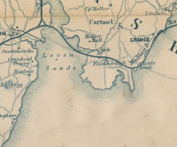 GAR2SD37.jpg bold line item:- JandMN : 82.1 Image © see bottom of page |
|
|
|
||
| evidence:- | old print:- Barber 1873 |
|
| source data:- | Print, ?colour lithograph, Hill of Hoad, published by The
Graphotyping Co, 7 Garrick Street and Simpkin, Marshall and Co,
Stationers' Hall Court, London, and by J Atkinson, King Street,
Ulverston, Cumberland, about 1873.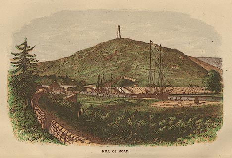 click to enlarge click to enlargeBB1E05.jpg Seen from beside the Ulverston Canal, on which there are ships; Sir John Barrow Monument on Hoad Hill; railway bridge in the background. "HILL OF HOAD" item:- JandMN : 69.6 Image © see bottom of page |
|
|
|
||
| evidence:- | old text:- Admiralty 1933 |
|
| source data:- | goto source Page 375:- "Ulverston ... It is connected to Ulverston channel by a canal available for vessels of 8 1/2-foot (2m6) draught, and not more than 95 feet (29m0) in length or 21 feet (6m4) in beam." |
|
|
|
||
| hearsay:- |
The first sod was cut in 1793. The canal opened in 1796 enabling an increase in the
export of iron ore, bar iron, slate, bobbins, malt etc. Coal was imported from Lancashire,
and timber from Scandinavia. It was the 'shortest, straightest, and deepest canal
in England; one mile, 65 feet wide, 15 feet deep. |
|
| Ships were built in Ulverston. The Argo of 300 toons, built 1799, was sunk by a french
privateer at Madiera, on her maiden voyage to Jamaica. The Bessie Whinneray, built
1865, held the record for the vastest voyage from the River Clyde to St Petersburg,
sailing to collect timber from the Baltic. |
||
| Commercial traffic ended in 1916. The last ship to pass through the lock was the Nahula,
1949. Then the gates were concreted. |
||
|
|
||
| person:- | canal engineer : Rennie, John |
|
| date:- | 1796 |
|
|
|
||
Lakes Guides menu.