 Old Cumbria Gazetteer
 |
 |
|
| Ulverston Sands, Morecambe Bay | ||
| Ulverston Sands | ||
| locality:- | Morecambe Bay | |
| civil parish:- | Urswick (formerly Lancashire) | |
| county:- | Cumbria | |
| locality type:- | sands | |
| coordinates:- | SD30737411 (etc etc) | |
| 1Km square:- | SD3074 | |
| 10Km square:- | SD37 | |
|
|
||
| evidence:- | old map:- OS County Series (Lan 16 8) placename:- Ulverston Sands |
|
| source data:- | Maps, County Series maps of Great Britain, scales 6 and 25
inches to 1 mile, published by the Ordnance Survey, Southampton,
Hampshire, from about 1863 to 1948. OS County Series (Lan 16 12) OS County Series (Lan 16 16) |
|
|
|
||
| evidence:- | old map:- Saxton 1579 |
|
| source data:- | Map, hand coloured engraving, Westmorlandiae et Cumberlandiae Comitatus ie Westmorland
and Cumberland, scale about 5 miles to 1 inch, by Christopher Saxton, London, engraved
by Augustinus Ryther, 1576, published 1579-1645.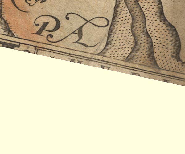 Sax9SD27.jpg item:- private collection : 2 Image © see bottom of page |
|
|
|
||
| evidence:- | old map:- Speed 1611 (Wmd) placename:- Ken Sandes |
|
| source data:- | Map, hand coloured engraving, The Countie Westmorland and
Kendale the Cheif Towne, scale about 2.5 miles to 1 inch, by
John Speed, 1610, published by George Humble, Popes Head Alley,
London, 1611-12.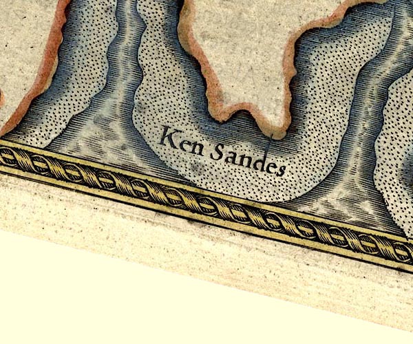 SP14SD37.jpg "Ken Sandes" sands item:- Armitt Library : 2008.14.5 Image © see bottom of page |
|
|
|
||
| evidence:- | poem:- Drayton 1612/1622 text placename:- Levin Sands item:- placename, Leven Sands |
|
| source data:- | Poem, Poly Olbion, by Michael Drayton, published by published by
John Marriott, John Grismand and Thomas Dewe, and others?
London, part 1 1612, part 2 1622. goto source goto sourcepage 136:- "... Levin from the Fells, Besides her naturall source, with the abundance swells," goto sourcepage 137:- "... Till comming to the Sands, even almost at her fall, On them her ancient Style shee liberally bestowes." |
|
|
|
||
| evidence:- | old map:- Morden 1695 (Wmd) |
|
| source data:- | Map, hand coloured engraving, Westmorland, scale about 2.5 miles to 1 inch, by Robert
Morden, published by Abel Swale, the Unicorn, St Paul's Churchyard, Awnsham, and John
Churchill, the Black Swan, Paternoster Row, London, 1695.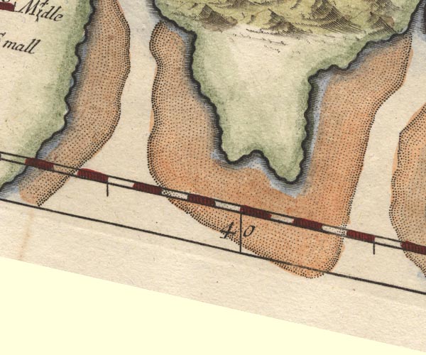 MD10SD37.jpg item:- JandMN : 24 Image © see bottom of page |
|
|
|
||
| evidence:- | descriptive text:- West 1778 (11th edn 1821) |
|
| source data:- | Guide book, A Guide to the Lakes, by Thomas West, published by
William Pennington, Kendal, Cumbria once Westmorland, and in
London, 1778 to 1821. goto source Page 35:- "In crossing Leven-sands, to Ulverston, you have on the right, a grand view of Alpine scenery. A rocky hill patched with wood and heath, rising immediately from the" goto sourcePage 36:- "coast, directs the eye to an immense chain of lofty mountains, apparently increased in magnitude and height since they were seen from Hest-bank. On a fine morning this is a pleasant ride, when the mountains are strongly illuminated by the sun-beams, and patched with shadows of intervening clouds that sail along their sides; or when they drag their watery skirts over the summits, and, admitting the streaming beams, adorn their rocky heads with silver, and variegate their olive-coloured sides with stripes of gold and green. This fairy scene soon shifting, all is concealed in a mantle of azure mist. At the Eau, or ford of the river Leven, another carter conducts you over. On the dissolution of the priory of Conishead, King Henry VIII. charged himself and his successors with the payment of the salary, fifteen marks per annum, which the guide received from the priory." |
|
|
|
||
| evidence:- | old map:- West 1784 map placename:- Leven Sands placename:- Ulverston Sands |
|
| source data:- | Map, hand coloured engraving, A Map of the Lakes in Cumberland,
Westmorland and Lancashire, scale about 3.5 miles to 1 inch,
engraved by Paas, 53 Holborn, London, about 1784. "Leven and Ulverston Sands" 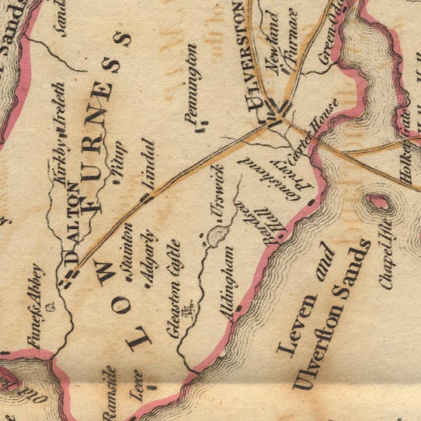 Ws02SD27.jpg 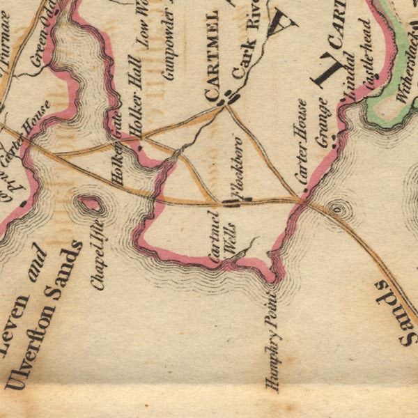 Ws02SD37.jpg item:- Armitt Library : A1221.1 Image © see bottom of page |
|
|
|
||
| evidence:- | old text:- Camden 1789 placename:- Levensand |
|
| source data:- | Book, Britannia, or A Chorographical Description of the Flourishing Kingdoms of England,
Scotland, and Ireland, by William Camden, 1586, translated from the 1607 Latin edition
by Richard Gough, published London, 1789. goto source Page 131:- "... Forness ... the shore here running out a great way to the west, the sea, as if enraged at it, lashes it more furiously, and, in high tides. has even devoured the shore, and made three large bays, viz. Kentsand, into which the river Ken empties itself, Levensand and Duddensand, between which the land projects ..." |
|
|
|
||
| evidence:- | old map:- Laurie and Whittle 1806 placename:- Leven Sands |
|
| source data:- | Road map, Completion of the Roads to the Lakes, scale about 10
miles to 1 inch, by Nathaniel Coltman? 1806, published by Robert
H Laurie, 53 Fleet Street, London, 1834. click to enlarge click to enlargeLw18.jpg "Leven Sands" sands in estuary item:- private collection : 18.18 Image © see bottom of page |
|
|
|
||
| evidence:- | old print:- Robertson 1911 placename:- Ulverston Sands |
|
| source data:- | Print, lithograph? Ulverston Sands, from a watercolour by Arthur Tucker, published
by Chatto and Windus, London, 1911.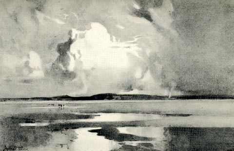 click to enlarge click to enlargeRSN132.jpg Tipped in opposite p.178 of Wordsworthshire by Eric Robertson. printed at bottom:- "ULVERSTON SANDS" signed at painting lower left:- "Arthur Tucker" item:- JandMN : 197.33 Image © see bottom of page |
|
|
|
||
Lakes Guides menu.