 Old Cumbria Gazetteer
 |
 |
|
| Underhill Wood, Longsleddale | ||
| Underhill Wood | ||
| civil parish:- | Longsleddale (formerly Westmorland) | |
| county:- | Cumbria | |
| locality type:- | wood | |
| coordinates:- | NY48840420 (etc) | |
| 1Km square:- | NY4804 | |
| 10Km square:- | NY40 | |
|
|
||
| evidence:- | old map:- OS County Series (Wmd 27 7) placename:- Underhill Wood |
|
| source data:- | Maps, County Series maps of Great Britain, scales 6 and 25
inches to 1 mile, published by the Ordnance Survey, Southampton,
Hampshire, from about 1863 to 1948. OS County Series (Wmd 27 11) Parcels 154 13.274 acres, and perhaps parcels 153 0.744 acres, 182 3.114 acres, 183 7.094 acres? |
|
|
|
||
| evidence:- | old map:- OS 1881-82 New Series (outline edition) placename:- Underhill Wood |
|
| source data:- | Map, engraving, area north of Kendal, Westmorland, New Series
one inch map, outline edition, sheet 39, scale 1 inch to 1 mile,
published by the Ordnance Survey, Southampton, Hampshire,
1881-82.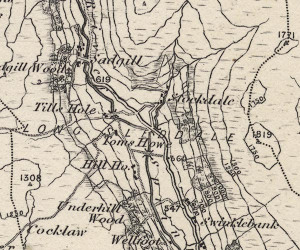 O21NY40X.jpg , "Underhill Wood" item:- JandMN : 61 Image © see bottom of page |
|
|
|
||
| evidence:- | map:- OS Six Inch (1956) placename:- Underhill Wood |
|
| source data:- | Map series, various editions with the national grid, scale about
6 inches to 1 mile, published by the Ordnance Survey,
Southampton, Hampshire, scale 1 to 10560 from 1950s to 1960s,
then 1 to 10000 from 1960s to 2000s, superseded by print on
demand from digital data.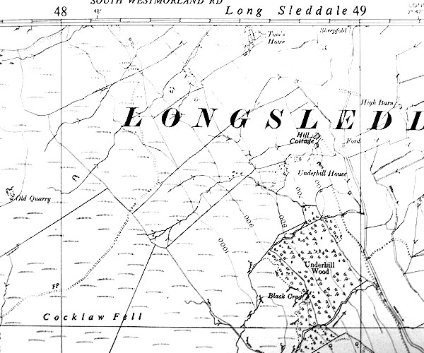 SINY4804.jpg "Underhill Wood" |
|
|
|
||
 Lakes Guides menu.