 Old Cumbria Gazetteer
 |
 |
|
| Wall End, Great Langdale | ||
| Wall End | ||
| locality:- | Great Langdale | |
| civil parish:- | Lakes (formerly Westmorland) | |
| county:- | Cumbria | |
| locality type:- | buildings | |
| coordinates:- | NY28300553 | |
| 1Km square:- | NY2805 | |
| 10Km square:- | NY20 | |
|
|
||
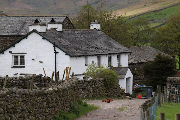 CAO10.jpg (taken 2.5.2014) 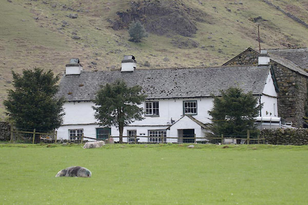 CAO09.jpg (taken 2.5.2014) |
||
|
|
||
| evidence:- | old map:- OS County Series (Wmd 25 6) placename:- Wall End |
|
| source data:- | Maps, County Series maps of Great Britain, scales 6 and 25
inches to 1 mile, published by the Ordnance Survey, Southampton,
Hampshire, from about 1863 to 1948. |
|
|
|
||
| evidence:- | hearth tax returns:- Hearth Tax 1675 placename:- Wallend |
|
| source data:- | Records, hearth tax survey returns, Westmorland, 1674/75. "Wallend" in "Langdale" |
|
|
|
||
| evidence:- | old map:- Jefferys 1770 (Wmd) placename:- Wall End |
|
| source data:- | Map, 4 sheets, The County of Westmoreland, scale 1 inch to 1
mile, surveyed 1768, and engraved and published by Thomas
Jefferys, London, 1770.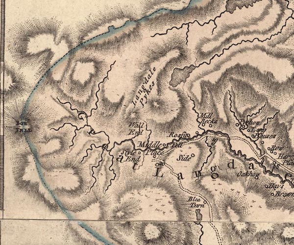 J5NY20NE.jpg "Wall End" no symbol item:- National Library of Scotland : EME.s.47 Image © National Library of Scotland |
|
|
|
||
| evidence:- | old map:- Cary 1789 (edn 1805) placename:- Wall End |
|
| source data:- | Map, uncoloured engraving, Westmoreland, scale about 2.5 miles
to 1 inch, by John Cary, London, 1789; edition 1805.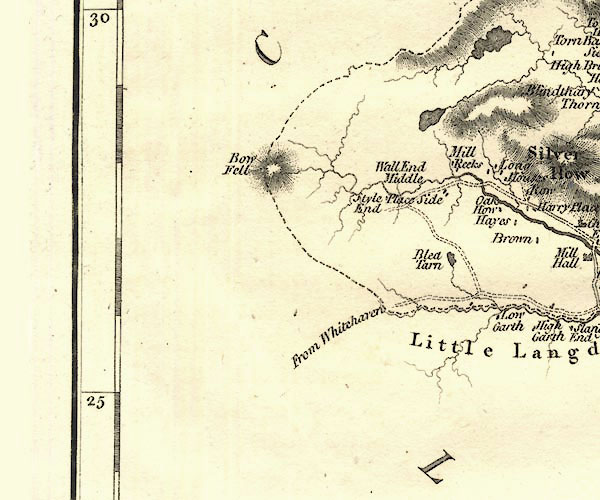 CY24NY20.jpg "Wall End" no symbol item:- JandMN : 129 Image © see bottom of page |
|
|
|
||
| evidence:- | old text:- Green 1810 placename:- Well End |
|
| source data:- | Set of prints, soft ground etchings, Sixty Studies from Nature,
by William Green, Ambleside, Westmorland, drawn 1808-10,
published 1810. goto source goto sourcepage 104:- "... descend to Well End, the highest house on that side of the valley, and from thence ..." |
|
|
|
||
| evidence:- | old map:- Otley 1818 placename:- Wall End |
|
| source data:- | Map, uncoloured engraving, The District of the Lakes,
Cumberland, Westmorland, and Lancashire, scale about 4 miles to
1 inch, by Jonathan Otley, 1818, engraved by J and G Menzies,
Edinburgh, Scotland, published by Jonathan Otley, Keswick,
Cumberland, et al, 1833.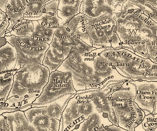 OT02NY20.jpg "Wall end" item:- JandMN : 48.1 Image © see bottom of page |
|
|
|
||
| evidence:- | old map:- Garnett 1850s-60s H placename:- Wallend |
|
| source data:- | Map of the English Lakes, in Cumberland, Westmorland and
Lancashire, scale about 3.5 miles to 1 inch, published by John
Garnett, Windermere, Westmorland, 1850s-60s.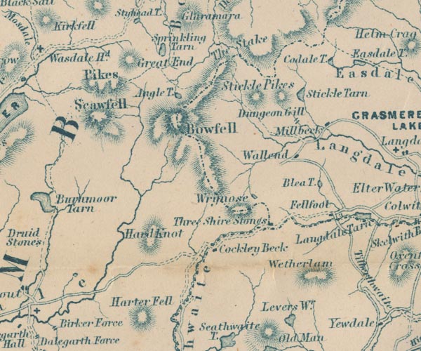 GAR2NY20.jpg "Wallend" block, building item:- JandMN : 82.1 Image © see bottom of page |
|
|
|
||
| evidence:- | database:- Listed Buildings 2010 placename:- Wall End Farm |
|
| source data:- | courtesy of English Heritage "WALL END FARMHOUSE WITH BARNS TO SOUTH EAST AND NORTH / / / LAKES / SOUTH LAKELAND / CUMBRIA / II / 452280 / NY2830405534" |
|
|
|
||
Lakes Guides menu.