 Old Cumbria Gazetteer
 |
 |
|
| Warcop Old Bridge, Warcop | ||
| Warcop Old Bridge | ||
| site name:- | Eden, River | |
| locality:- | Warcop | |
| civil parish:- | Warcop (formerly Westmorland) | |
| county:- | Cumbria | |
| locality type:- | bridge | |
| coordinates:- | NY74331510 | |
| 1Km square:- | NY7415 | |
| 10Km square:- | NY71 | |
|
|
||
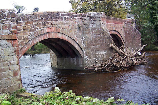 BJY88.jpg Three ribbed arches, sandstone. (taken 28.10.2005) 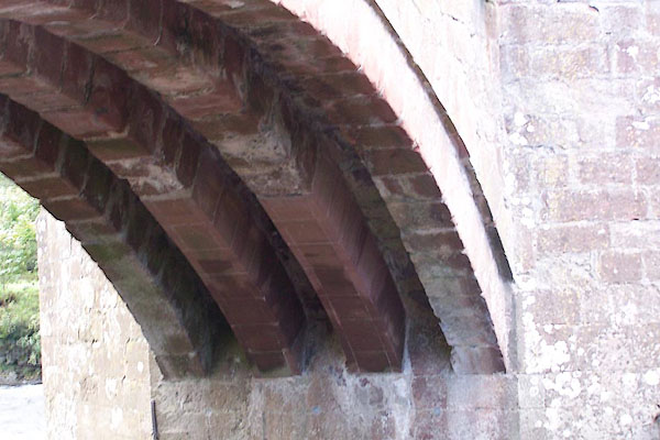 BJY89.jpg Three ribbed arches, sandstone. (taken 28.10.2005) |
||
|
|
||
| evidence:- | old map:- Saxton 1579 |
|
| source data:- | Map, hand coloured engraving, Westmorlandiae et Cumberlandiae Comitatus ie Westmorland
and Cumberland, scale about 5 miles to 1 inch, by Christopher Saxton, London, engraved
by Augustinus Ryther, 1576, published 1579-1645.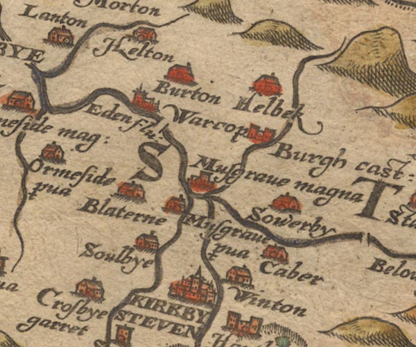 SAX9NY71.jpg Double line over a stream, over the Eden. item:- private collection : 2 Image © see bottom of page |
|
|
|
||
| evidence:- | old map:- Jansson 1646 |
|
| source data:- | Map, hand coloured engraving, Cumbria and Westmoria, ie
Cumberland and Westmorland, scale about 3.5 miles to 1 inch, by
John Jansson, Amsterdam, Netherlands, 1646.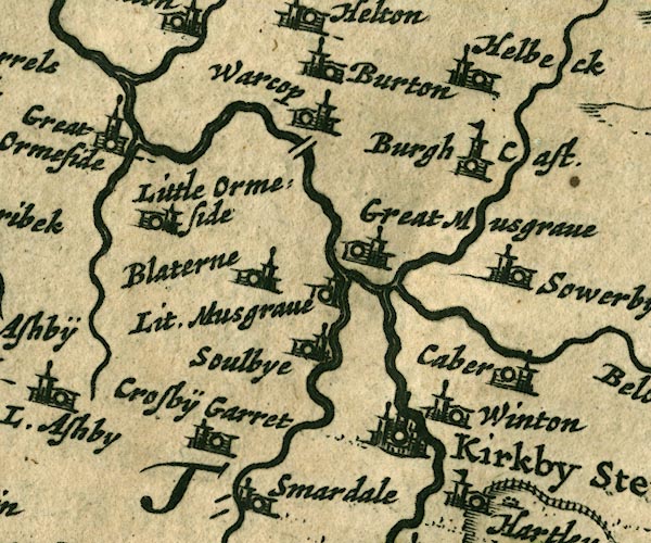 JAN3NY71.jpg Double line crossing the stream. item:- JandMN : 88 Image © see bottom of page |
|
|
|
||
| evidence:- | old map:- Seller 1694 (Wmd) |
|
| source data:- | Map, hand coloured engraving, Westmorland, scale about 8 miles
to 1 inch, by John Seller, 1694. click to enlarge click to enlargeSEL7.jpg two lines cross a stream; bridge item:- Dove Cottage : 2007.38.87 Image © see bottom of page |
|
|
|
||
| evidence:- | old map:- Morden 1695 (Wmd) |
|
| source data:- | Map, hand coloured engraving, Westmorland, scale about 2.5 miles to 1 inch, by Robert
Morden, published by Abel Swale, the Unicorn, St Paul's Churchyard, Awnsham, and John
Churchill, the Black Swan, Paternoster Row, London, 1695.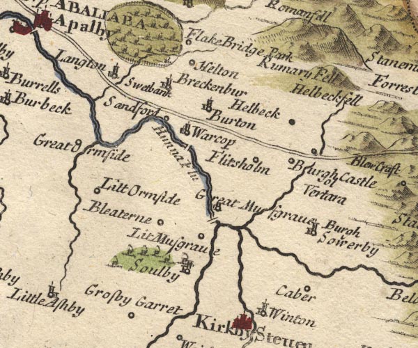 MD10NY71.jpg Double line over a stream, over the Eden. item:- JandMN : 24 Image © see bottom of page |
|
|
|
||
| evidence:- | old map:- Jefferys 1770 (Wmd) |
|
| source data:- | Map, 4 sheets, The County of Westmoreland, scale 1 inch to 1
mile, surveyed 1768, and engraved and published by Thomas
Jefferys, London, 1770.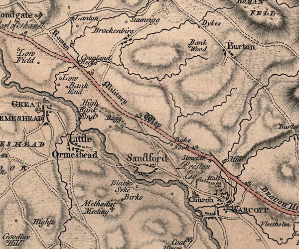 J5NY71NW.jpg double line, road, across a stream; bridge item:- National Library of Scotland : EME.s.47 Image © National Library of Scotland |
|
|
|
||
| evidence:- | old map:- Cary 1789 (edn 1805) |
|
| source data:- | Map, uncoloured engraving, Westmoreland, scale about 2.5 miles
to 1 inch, by John Cary, London, 1789; edition 1805.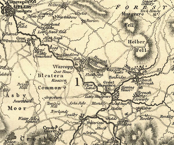 CY24NY71.jpg road across a stream; bridge over the Eden at Warcop item:- JandMN : 129 Image © see bottom of page |
|
|
|
||
| evidence:- | database:- Listed Buildings 2010 placename:- Warcop Old Bridge |
|
| source data:- | courtesy of English Heritage "WARCOP OLD BRIDGE OVER RIVER EDEN TO SOUTH-WEST OF EDEN GATE / / / WARCOP / EDEN / CUMBRIA / II[star] / 73412 / NY7432215095" |
|
| source data:- | courtesy of English Heritage "Roadbridge, probably C16 (R.C.H.M.). Coursed, squared rubble. Splayed cutwaters separating 3 segmental arches, each spanning c25 ft; 4 square-section ribs to soffit of each arch. Roadway clO ft wide with polygonal refuges over cutwaters. Parapets c4 ft high with segmental copings. Scheduled Ancient Monument." |
|
|
|
||
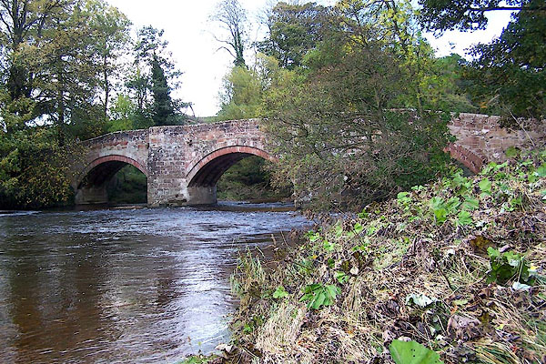
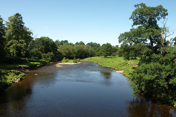 BVA80.jpg View of river. (taken 24.7.2011) |
||
|
|
||
 BJY90.jpg Four ribbed arches, sandstone. (taken 28.10.2005) |
||
|
|
||
 Lakes Guides menu.