 Old Cumbria Gazetteer
 |
 |
|
| Wath Sutton, Preston Patrick | ||
| Wath Sutton | ||
| civil parish:- | Preston Patrick (formerly Westmorland) | |
| county:- | Cumbria | |
| locality type:- | buildings | |
| coordinates:- | SD52978265 | |
| 1Km square:- | SD5282 | |
| 10Km square:- | SD58 | |
|
|
||
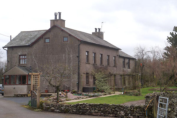 CCP88.jpg (taken 13.3.2015) |
||
|
|
||
| evidence:- | old map:- OS County Series (Wmd 43 13) placename:- Wath Sutton |
|
| source data:- | Maps, County Series maps of Great Britain, scales 6 and 25
inches to 1 mile, published by the Ordnance Survey, Southampton,
Hampshire, from about 1863 to 1948. |
|
|
|
||
| evidence:- | old map:- Jefferys 1770 (Wmd) placename:- Want Suddon |
|
| source data:- | Map, 4 sheets, The County of Westmoreland, scale 1 inch to 1
mile, surveyed 1768, and engraved and published by Thomas
Jefferys, London, 1770.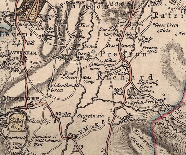 J5SD58SW.jpg "Want / Suddon" circle, labelled in italic lowercase text; settlement, farm, house, or hamlet?, two separate labels item:- National Library of Scotland : EME.s.47 Image © National Library of Scotland |
|
|
|
||
| evidence:- | probably old map:- Cary 1789 (edn 1805) placename:- Suddon |
|
| source data:- | Map, uncoloured engraving, Westmoreland, scale about 2.5 miles
to 1 inch, by John Cary, London, 1789; edition 1805.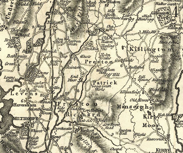 CY24SD58.jpg "Suddon" block/s, labelled in italic lowercase; house, or hamlet item:- JandMN : 129 Image © see bottom of page |
|
|
|
||
| evidence:- | database:- Listed Buildings 2010 placename:- Wath Sutton Farm |
|
| source data:- | courtesy of English Heritage "WATH SUTTON FARMHOUSE / / / PRESTON PATRICK / SOUTH LAKELAND / CUMBRIA / II / 76610 / SD5296982656" |
|
|
|
||
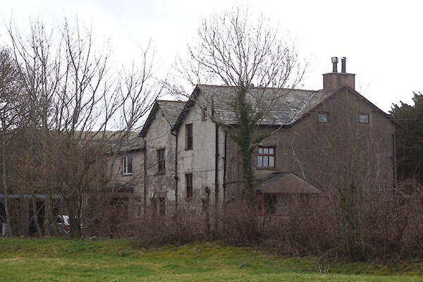 CCP89.jpg (taken 13.3.2015) |
||
|
|
||
 Lakes Guides menu.