 Old Cumbria Gazetteer
 |
 |
|
| Wellknowe, Lower Allithwaite | ||
| Wellknowe House | ||
| Wellknowe Farmhouse | ||
| Well Knowe | ||
| civil parish:- | Lower Allithwaite (formerly Lancashire) | |
| county:- | Cumbria | |
| locality type:- | buildings | |
| coordinates:- | SD37267923 | |
| 1Km square:- | SD3779 | |
| 10Km square:- | SD37 | |
|
|
||
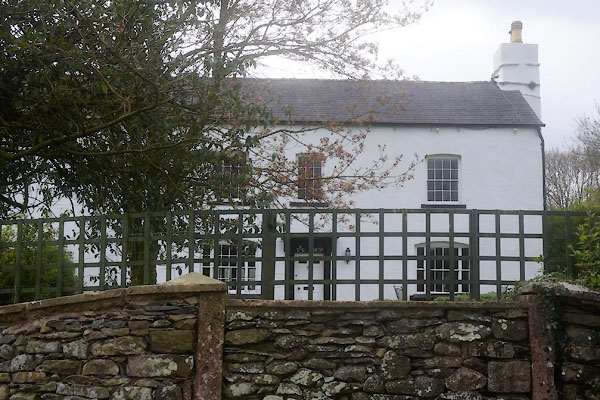 CFY89.jpg Wellknowe House. (taken 21.4.2017) 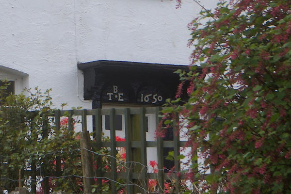 CFY90.jpg Wellknowe House, date stone "B / T . E 1650" (taken 21.4.2017) |
||
|
|
||
| evidence:- | old map:- OS County Series (Lan 12 15) placename:- Well Know |
|
| source data:- | Maps, County Series maps of Great Britain, scales 6 and 25
inches to 1 mile, published by the Ordnance Survey, Southampton,
Hampshire, from about 1863 to 1948. |
|
|
|
||
| evidence:- | database:- Listed Buildings 2010 placename:- Well Knowe House item:- date stone (1650) |
|
| source data:- | courtesy of English Heritage "WELL KNOWE HOUSE / / / LOWER ALLITHWAITE / SOUTH LAKELAND / CUMBRIA / II / 76931 / SD3726779233" |
|
|
|
||
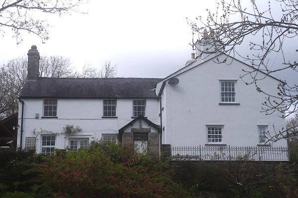 CFY84.jpg Wellknowe Farmhouse. (taken 21.4.2017) |
||
|
|
||
 Lakes Guides menu.