Old Cumbria Gazetteer
 |
 |
|
||
| Measand Beck | ||||
| runs into:- |  Hawes Water Hawes Water |
|||
|
|
||||
| Fordingdale Beck | ||||
| locality:- | Bampton Common | |||
| civil parish:- | Bampton (formerly Westmorland) | |||
| county:- | Cumbria | |||
| locality type:- | river | |||
| 1Km square:- | NY4815 (etc) | |||
| 10Km square:- | NY41 | |||
|
|
||||
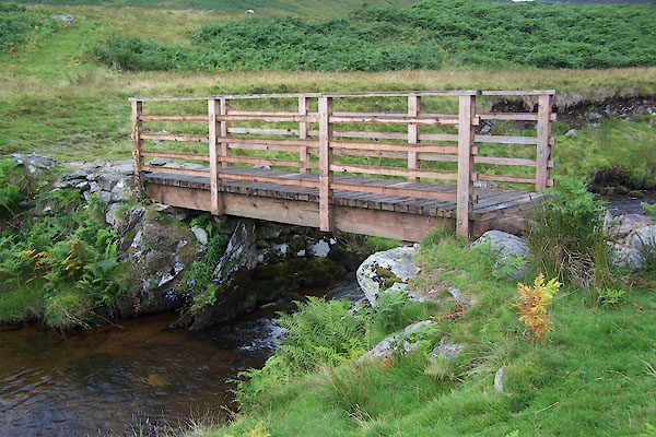
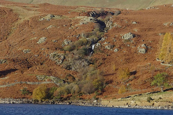
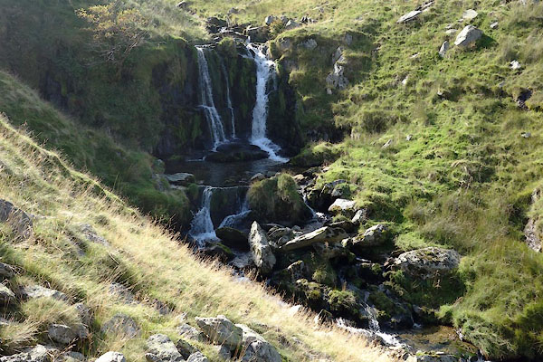
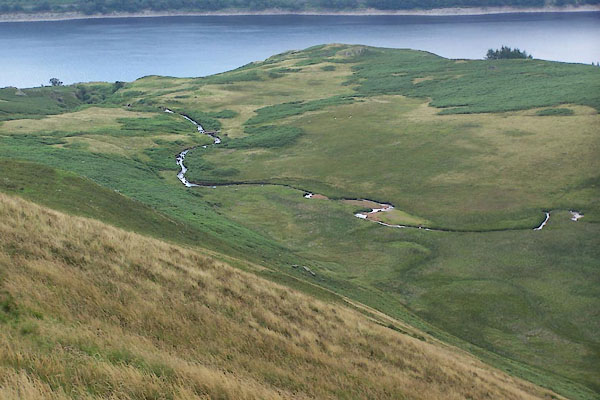 BTH98.jpg (taken 11.8.2010) 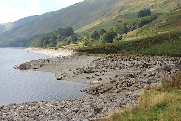 BZK29.jpg Mouth of beck, after a dryish period. (taken 29.9.2013) |
||||
|
|
||||
| evidence:- | old map:- OS County Series (Wmd 13 10) placename:- Measand Beck |
|||
| source data:- | Maps, County Series maps of Great Britain, scales 6 and 25
inches to 1 mile, published by the Ordnance Survey, Southampton,
Hampshire, from about 1863 to 1948. |
|||
|
|
||||
| evidence:- | old map:- Jefferys 1770 (Wmd) |
|||
| source data:- | Map, 4 sheets, The County of Westmoreland, scale 1 inch to 1
mile, surveyed 1768, and engraved and published by Thomas
Jefferys, London, 1770.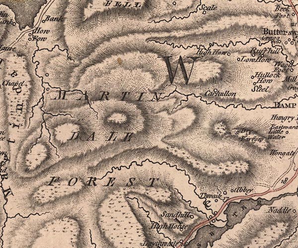 J5NY41NE.jpg single or double wiggly line; river item:- National Library of Scotland : EME.s.47 Image © National Library of Scotland |
|||
|
|
||||
| evidence:- | old map:- Cary 1789 (edn 1805) |
|||
| source data:- | Map, uncoloured engraving, Westmoreland, scale about 2.5 miles
to 1 inch, by John Cary, London, 1789; edition 1805.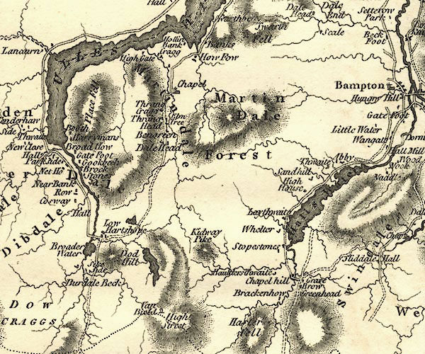 CY24NY41.jpg river running into Hawes Water item:- JandMN : 129 Image © see bottom of page |
|||
|
|
||||
| evidence:- | old text:- Green 1814 placename:- Fordingdale Beck |
|||
| source data:- | Set of prints, soft ground etchings, Sixty Small Prints, with
text, A Description of a Series of Sixty Small Prints, by
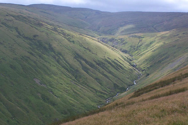
William Green, Ambleside, Westmorland, 1814. goto source page 34:- "... this promontory [Killands]; on the side of which rushes, in wild impetuosity, Fordingdale Beck, a stream abounding in picturesque waterfalls." |
|||
|
|
||||
| evidence:- | descriptive text:- Ford 1839 (3rd edn 1843) placename:- Fordingdale Beck |
|||
| source data:- | Guide book, A Description of Scenery in the Lake District, by
Rev William Ford, published by Charles Thurnam, Carlisle, by W
Edwards, 12 Ave Maria Lane, Charles Tilt, Fleet Street, William
Smith, 113 Fleet Street, London, by Currie and Bowman,
Newcastle, by Bancks and Co, Manchester, by Oliver and Boyd,
Edinburgh, and by Sinclair, Dumfries, 1839. goto source Page 138:- "... A richly-wooded promontory, that stretches from the west side of the lake, appears to cut it into two: a little beyond is Fordingdale Beck, presenting some beautiful cascades, ..." |
|||
|
|
||||
| evidence:- | old print:- Green 1809 placename:- Fordingdale Beck item:- waterfall |
|||
| source data:- | Print, soft ground etching, Fordingdale Beck, Measand, Bampton, Westmorland, by William
Green, published by William Green, Ambleside, Westmorland, and Longman, Hurst, Rees
and Orme, Paternoster Row, London, 1809.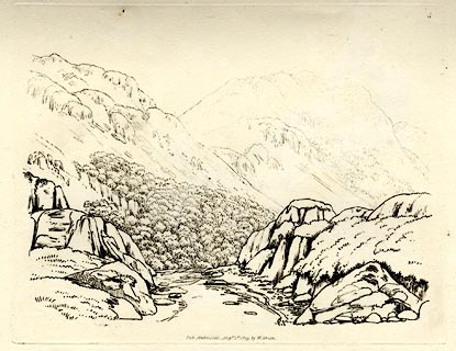 click to enlarge click to enlargeGN0303.jpg Plate 4 in Seventy Eight Studies from Nature. printed in introductory pages to set of prints:- "Number 4. Fordingdale Beck is an impetuous mountain torrent, which runs into Haws Water, near Measand School. There is a succession of pretty water-falls upon this beck: the one given here is simple in its accompaniments, and not difficult of imitation." printed at bottom:- "FORDINGDALE BECK / Pub. Ambleside Augst. 1st. 1809, by W. Green." item:- Armitt Library : A6637.4 Image © see bottom of page |
|||
|
|
||||
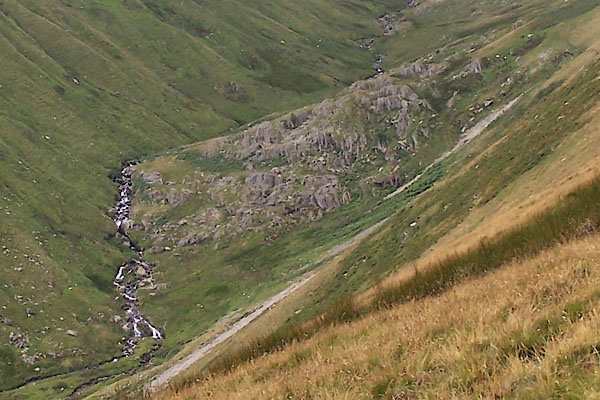
 BTH96.jpg (taken 11.8.2010) 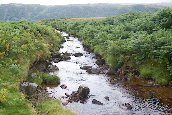 BTI02.jpg (taken 11.8.2010) |
||||
|
|
||||
| places:- |
|
|||
|
||||
|
||||
|
||||
|
||||
Lakes Guides menu.